MyTopo
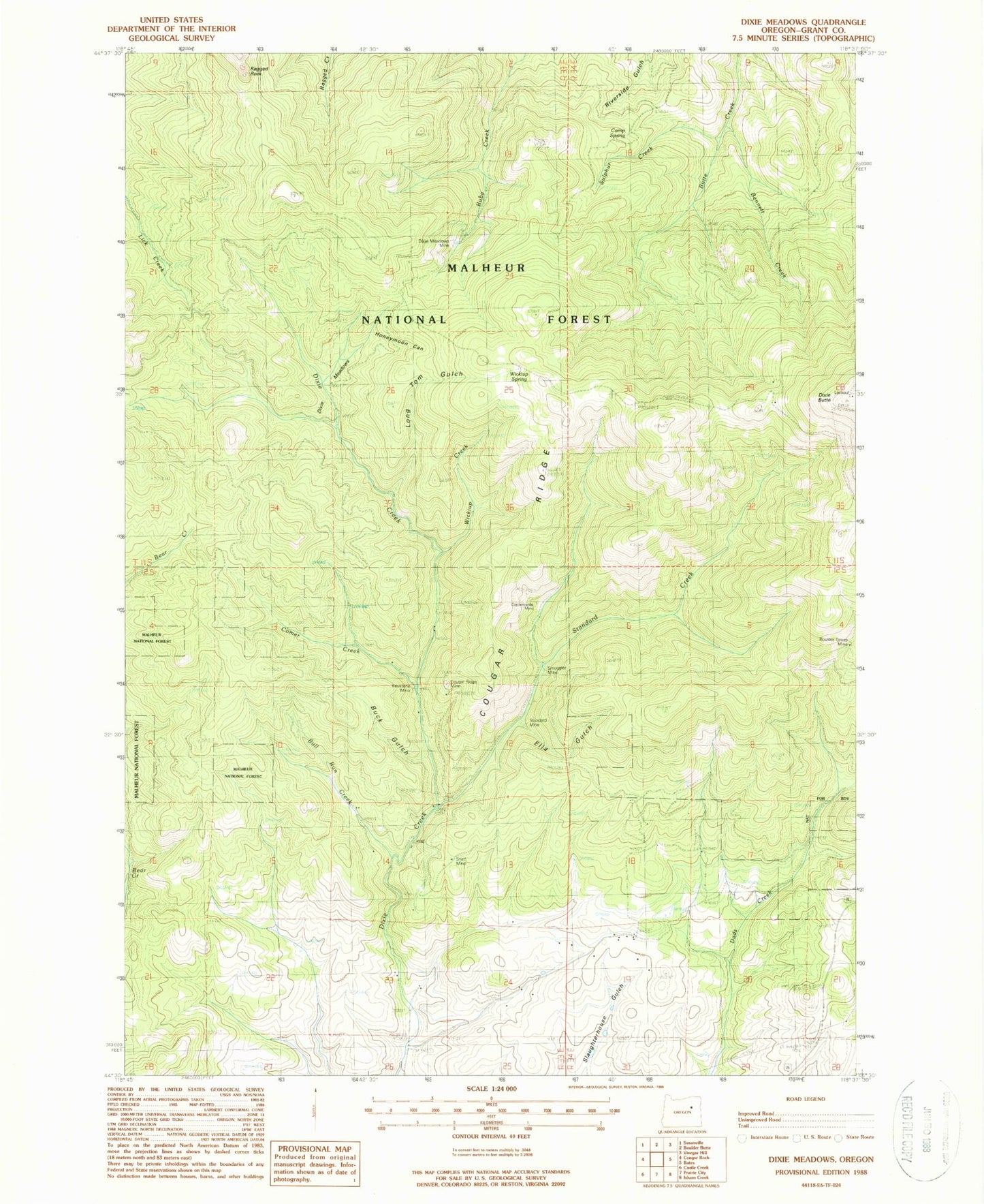
Classic USGS Dixie Meadows Oregon 7.5'x7.5' Topo Map
Couldn't load pickup availability
Historical USGS topographic quad map of Dixie Meadows in the state of Oregon. Map scale may vary for some years, but is generally around 1:24,000. Print size is approximately 24" x 27"
This quadrangle is in the following counties: Grant.
The map contains contour lines, roads, rivers, towns, and lakes. Printed on high-quality waterproof paper with UV fade-resistant inks, and shipped rolled.
Contains the following named places: Bennett Creek, Boulder Group Mine, Buck Gulch, Bull Run Creek, Camp Spring, Comer, Comer Creek, Comer Post Office, Copperopolis Mine, Cougar Ridge, Cougar Ridge Mine, Dixie Butte, Dixie Butte Fire Lookout Tower, Dixie Meadows, Dixie Meadows Mine, Ella Gulch, Honeymoon Canyon, Keystone Mine, Lick Creek Trail, Long Tom Gulch, Ragged Rocks Trail, Shatt Mine, Smuggler Mine, Standard Creek, Standard Mine, Sulphur Creek, Wickiup Creek, Wickiup Spring