MyTopo
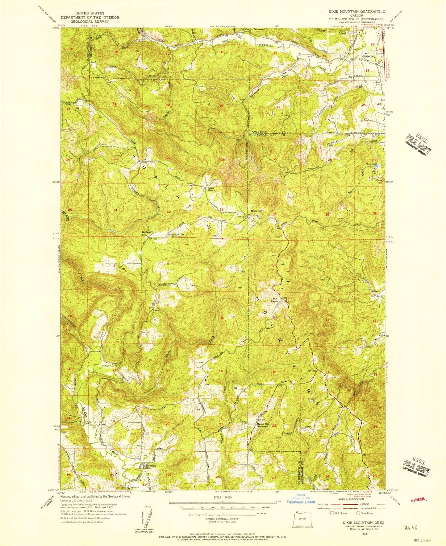
Classic USGS Dixie Mountain Oregon 7.5'x7.5' Topo Map
Couldn't load pickup availability
Historical USGS topographic quad map of Dixie Mountain in the state of Oregon. Map scale may vary for some years, but is generally around 1:24,000. Print size is approximately 24" x 27"
This quadrangle is in the following counties: Columbia, Multnomah, Washington.
The map contains contour lines, roads, rivers, towns, and lakes. Printed on high-quality waterproof paper with UV fade-resistant inks, and shipped rolled.
Contains the following named places: Brunswick Canyon, Coal Creek, Crabapple Creek, Dixie Mountain, Dixie Ranch, Dutch Canyon, East Fork McKay Creek, Fairview Cemetery, Gourlay Creek, Grace Lutheran Church, Howard Schmidt Dam, Howard Schmidt Reservoir, John Place Reservoir, Johnson Crossing, Kay Dam, Kay Reservoir, Lazy Creek, Mason Hill Park, Mountain View Cemetery, Mud Creek, Neil Creek, Nitchman Reservoir, North Plains Division, Patterson Creek, Raymond Creek, Saint Wenceslaus Catholic Church, Saint Wenceslaus Cemetery, Salt Creek, Scappoose Rural Fire District Holbrook Station, Shadybrook, Shadybrook Cemetery, Sky Ranch, South Scappoose, Tualatin Mountains, Van Raden Dam, Van Raden Reservoir, Wallace School, Wolf Creek