MyTopo
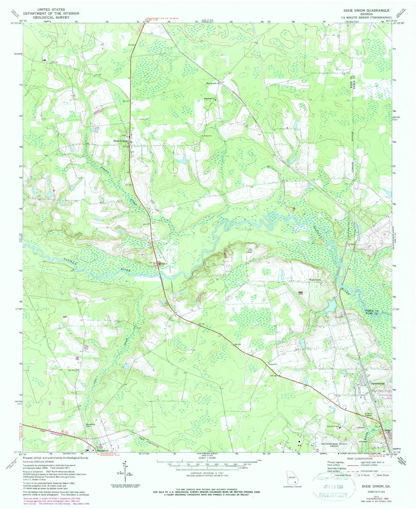
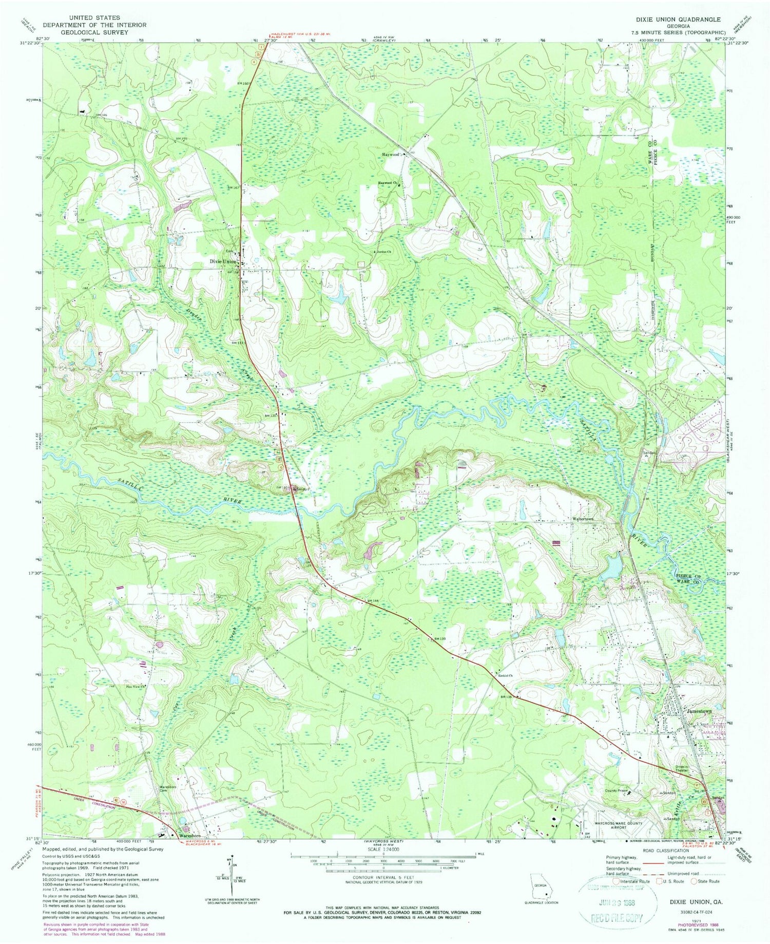
Classic USGS Dixie Union Georgia 7.5'x7.5' Topo Map
Couldn't load pickup availability
Historical USGS topographic quad map of Dixie Union in the state of Georgia. Map scale may vary for some years, but is generally around 1:24,000. Print size is approximately 24" x 27"
This quadrangle is in the following counties: Pierce, Ware.
The map contains contour lines, roads, rivers, towns, and lakes. Printed on high-quality waterproof paper with UV fade-resistant inks, and shipped rolled.
Contains the following named places: Cox Creek, Dixie Union, Dixie Union Census Designated Place, Dixie Union Church, Dryden Creek, Ezekiel Church, Haywood, Haywood Church, Jamestown, Jamestown Baptist Church, Jamestown United Methodist Church, Jordan Church, Pebble Hill Church, Pine View Church, Rome Primitive Baptist Church Cemetery, Salem Church, Shriners Club Lake, Shriners Club Lake Dam, Waltertown, Ware County Fire Rescue Station 1 Industrial Park, Ware County Fire Rescue Station 6 Dixie Union, Ware County Fire Rescue Station 8 Pebble Hill, Ware County Fire Rescue Station 9 Waresboro, Ware County Jail, Ware County Sheriff's Office, Ware State Prison, Waresboro Cemetery