MyTopo
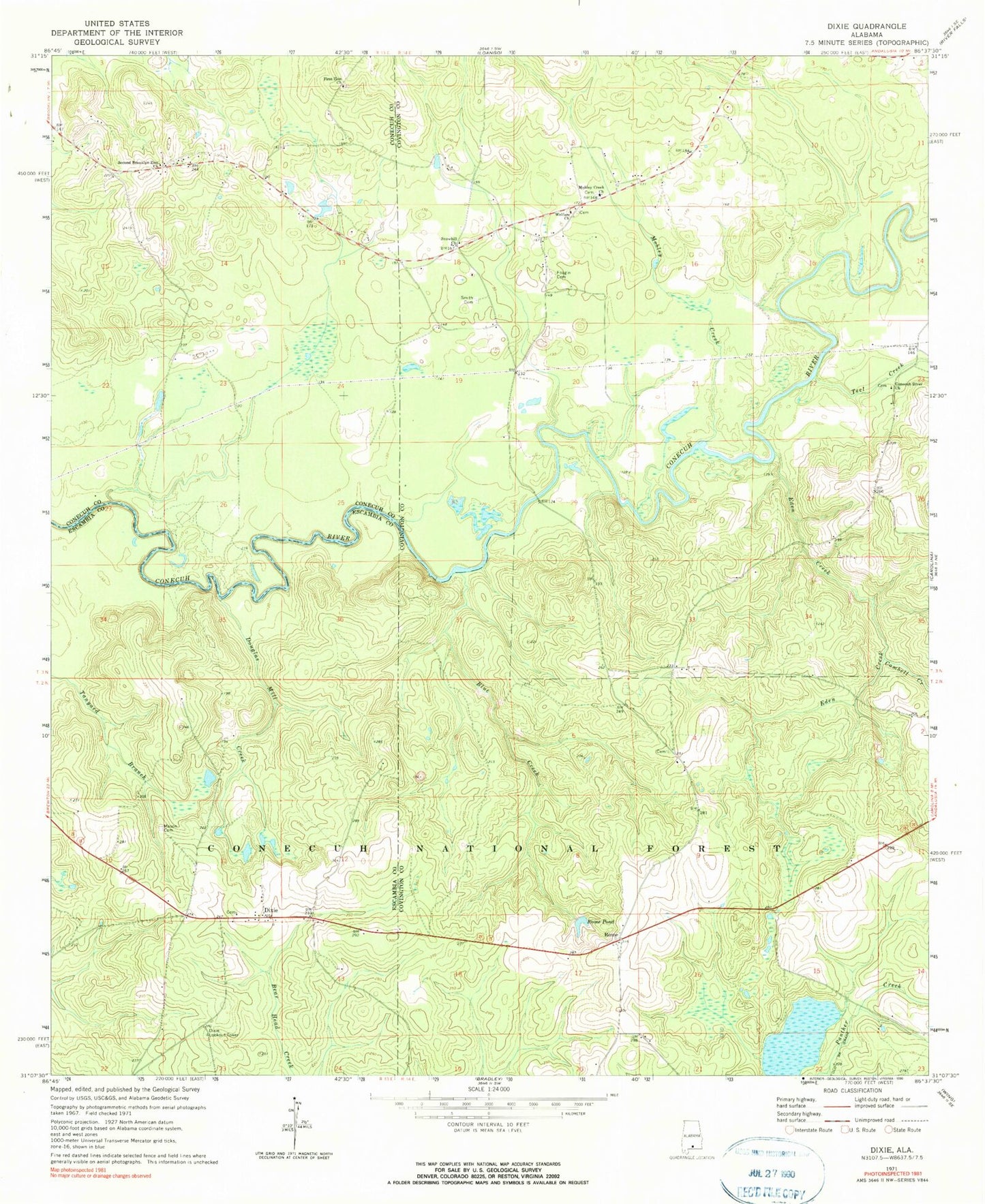
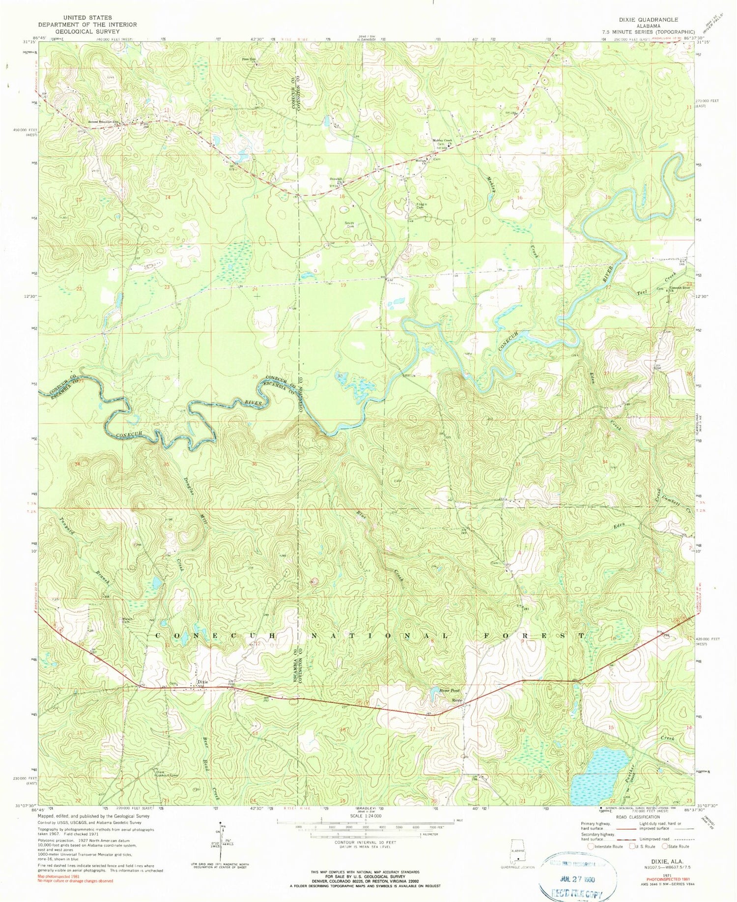
Classic USGS Dixie Alabama 7.5'x7.5' Topo Map
Couldn't load pickup availability
Historical USGS topographic quad map of Dixie in the state of Alabama. Typical map scale is 1:24,000, but may vary for certain years, if available. Print size: 24" x 27"
This quadrangle is in the following counties: Conecuh, Covington, Escambia.
The map contains contour lines, roads, rivers, towns, and lakes. Printed on high-quality waterproof paper with UV fade-resistant inks, and shipped rolled.
Contains the following named places: Eden Creek, Blue Creek, Conecuh River Missionary Baptist Church, Douglas Mill Creek, First Zion Church, Mason Cemetery, Mobley Creek, Mobley Creek Baptist Church, Rome, Rome Pond, Second Brooklyn Zion Church, Smith Cemetery, Snowhill Church, Teel Creek, Welfare Church, Brooklyn Zion School (historical), Georgiaville School (historical), Florala Church, Dixie, Dixie Methodist Church, Mason (historical), Floral School (historical), Georgiaville, Mill Creek, Mount Olive Church, Feagin Cemetery, Dixie Lookout Tower, Dixon Forestry Center, Dixie Volunteer Fire Department