MyTopo
Classic USGS Dixie Arkansas 7.5'x7.5' Topo Map
Couldn't load pickup availability
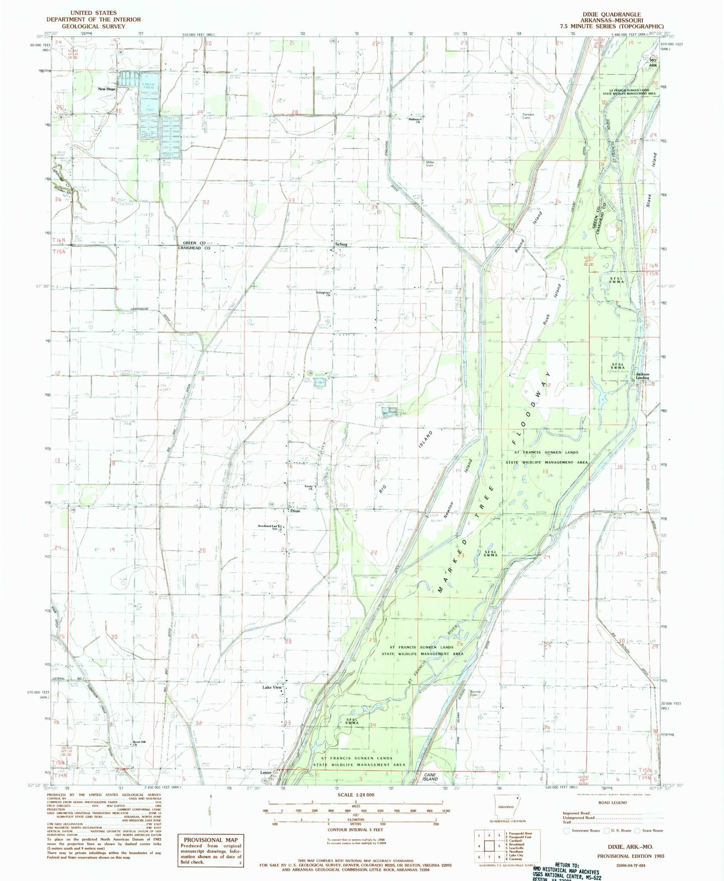
Historical USGS topographic quad map of Dixie in the state of Arkansas. Map scale may vary for some years, but is generally around 1:24,000. Print size is approximately 24" x 27"
This quadrangle is in the following counties: Craighead, Dunklin, Greene.
The map contains contour lines, roads, rivers, towns, and lakes. Printed on high-quality waterproof paper with UV fade-resistant inks, and shipped rolled.
Contains the following named places: Bagwell Slough, Beech Grove Church, Big Cypress Swamp, Big Island, Brookland East School, Burnt Hill Church, Burrow Cemetery, Caney Slough, Crockett Cemetery, Deasons Lake, Decent Lake School, Ditch Number 2, Ditch Number 3, Dixie, Dixie Baptist Church, Jackson Landing, Lake City Fire Protection District Dixie Station, Lake View, Lake View School, Lake View United Methodist Church, Lester, Lighthouse Creek, Lighthouse Ditch, Maysville, Miller, Millers Store, Mitchell Point, Mulberry Church, New 24 Liberty Church, New Hope, New Hope Baptist Church, New Hope School, Newton Island, Parsons Cemetery, Rooker Creek, Round Island, Rush Island, Saint Paul School, Schug, Schugtown United Methodist Church, Stave Island, Township of Collier, Township of Lester, Trinity Church, Upper Poplar Ridge, Upper Poplar Ridge School, White Oak Point