MyTopo
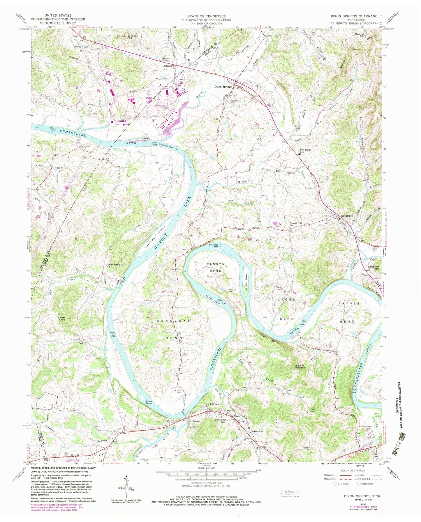
Classic USGS Dixon Springs Tennessee 7.5'x7.5' Topo Map
Couldn't load pickup availability
Historical USGS topographic quad map of Dixon Springs in the state of Tennessee. Map scale may vary for some years, but is generally around 1:24,000. Print size is approximately 24" x 27"
This quadrangle is in the following counties: Smith, Trousdale, Wilson.
The map contains contour lines, roads, rivers, towns, and lakes. Printed on high-quality waterproof paper with UV fade-resistant inks, and shipped rolled.
Contains the following named places: Adams Chapel, Alexander Cemetery, Alexander Island, Bartletts Bar, Beasleys Bend, Blind Island, Boston Hollow, Bowman Branch, Bradleys Cemetery, Bridgewaters Landing, Brimm Hollow, Cage Cemetery, Cages Bend, Cato Cemetery, Cedar Knob, Chapel Hill Church, Commissioner District 2, Corley Branch, Cotton Bar, Cox-Davis School, Davis Branch, Davis Cemetery, Dixon Creek, Dixon Island, Dixon Springs, Dixon Springs Cemetery, Dixon Springs Post Office, Dry Branch, Dry Fork Branch, Duke Branch, Fall Creek, Glasgow Branch, Harper Cemetery, Hartsville Nuclear Power Plant, Haynie Pinnacle, Johnson Hill, Johntown, Kennys Bend, Kennys Cemetery, Kirby Cemetery, Knob Spring Church, Lick Creek, Litchford Cemetery, Lost Creek, Lovells Island, Maces Hill, Maceys Hill Cemetery, Manning-Denton Cemetery, Mount Olivet Church, New Fairview Church, Old Lock and Dam Number Seven, Parkers Island, Paynes Bend, Peyton Creek, Piper-Hughes Cemetery, Plunkett Creek, Plunketts Creek Church, Porter Cemetery, Rawls Creek, Riddleton, Riddleton Baptist Church, Riddleton Dixon Springs Volunteer Fire Department District 5, Riddleton Post Office, Rock City, Rock City / Rome Fire Department, Rock House, Rome, Rome Access Area, Rome Baptist Church, Rome Church of Christ, Rome Ferry, Rome Island, Round Lick Creek, Rowlands Towhead, Saltpeter Hill, Scraunchers Rock Bluff, Stowe Cemetery, Sulphur Branch, Taylors Branch, Union Heights Elementary School, Upton Bluff, Violet Cemetery, Ward Creek, White Branch, Whites Mill, Wilburn Creek, Wilburn Hollow, Young Branch, ZIP Code: 37151