MyTopo
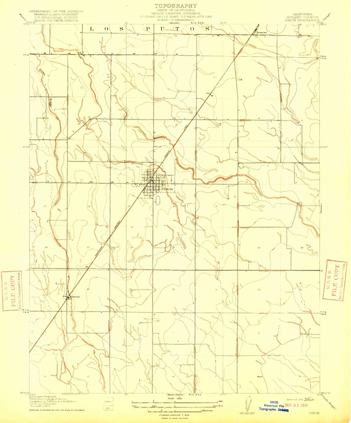
Classic USGS Dixon California 7.5'x7.5' Topo Map
Couldn't load pickup availability
Historical USGS topographic quad map of Dixon in the state of California. Map scale may vary for some years, but is generally around 1:24,000. Print size is approximately 24" x 27"
This quadrangle is in the following counties: Solano.
The map contains contour lines, roads, rivers, towns, and lakes. Printed on high-quality waterproof paper with UV fade-resistant inks, and shipped rolled.
Contains the following named places: Anderson Elementary School, Batavia, C A Jacobs Middle School, City of Dixon, Cornerstone Baptist Church, Dickson Creek, Dixon, Dixon City Hall, Dixon Community Church, Dixon Division, Dixon Fire Department, Dixon High School, Dixon May Fairgrounds, Dixon Methodist Church, Dixon Neighborhood Church, Dixon Police Department, Dixon Post Office, Dixon Public Library, Dixon Ridge, Eatwell Farm, Family Christian Center, Freese Farms, Gibson Canyon Creek, Hall Memorial Park, KLCQ-FM (Davis), Maine Prairie Airport, Neighborhood Christian School, Northwest Park, Redeille Farms, Sacramento Valley National Cemetery, Saint Peters Catholic Church, Silveyville Cemetery, Silveyville Primary School, Sucro, The Church of Jesus Christ of Latter Day Saints, Tremont School, Veterans Memorial Hall, Westside Park, Womens Improvement Club Park, ZIP Code: 95620