MyTopo
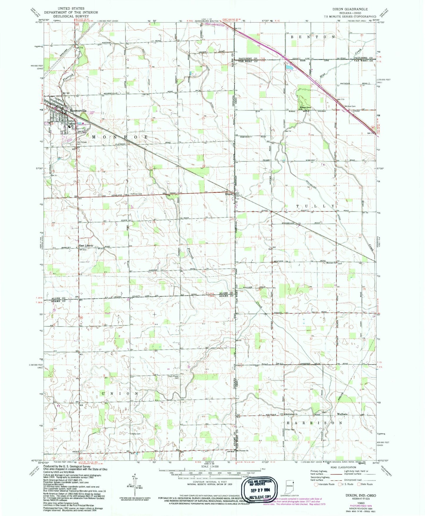
Classic USGS Dixon Indiana 7.5'x7.5' Topo Map
Couldn't load pickup availability
Historical USGS topographic quad map of Dixon in the states of Indiana, Ohio. Map scale may vary for some years, but is generally around 1:24,000. Print size is approximately 24" x 27"
This quadrangle is in the following counties: Adams, Allen, Paulding, Van Wert.
The map contains contour lines, roads, rivers, towns, and lakes. Printed on high-quality waterproof paper with UV fade-resistant inks, and shipped rolled.
Contains the following named places: Bethel Cemetery, Bethlehem Church, Clark Chapel Cemetery, Dealey Farms, Dixon, Dixon Post Office, East Liberty, Fralick Farm, Freck School, Greyhound School, Harting Farms, Hoffman Cemetery, Kings Cemetery, Kings School, McNeal Cemetery, Mentzer Church, Metzer Cemetery, Monroeville, Monroeville Emergency Medical Services, Monroeville Fire Department, Monroeville Memorial Cemetery, Monroeville Police Department, Monroeville Post Office, Mount Victory Church, Olsthoom Dairy, Railroad School, Rose Lane Farm, Scott Ditch, Spall's Mobile Home Village, Sponseller Ditch, Town of Monroeville, Township of Monroe, Township of Union, Walnut Grove Church, Walnut Grove Grange, Wolfcale, Wolfcale Post Office