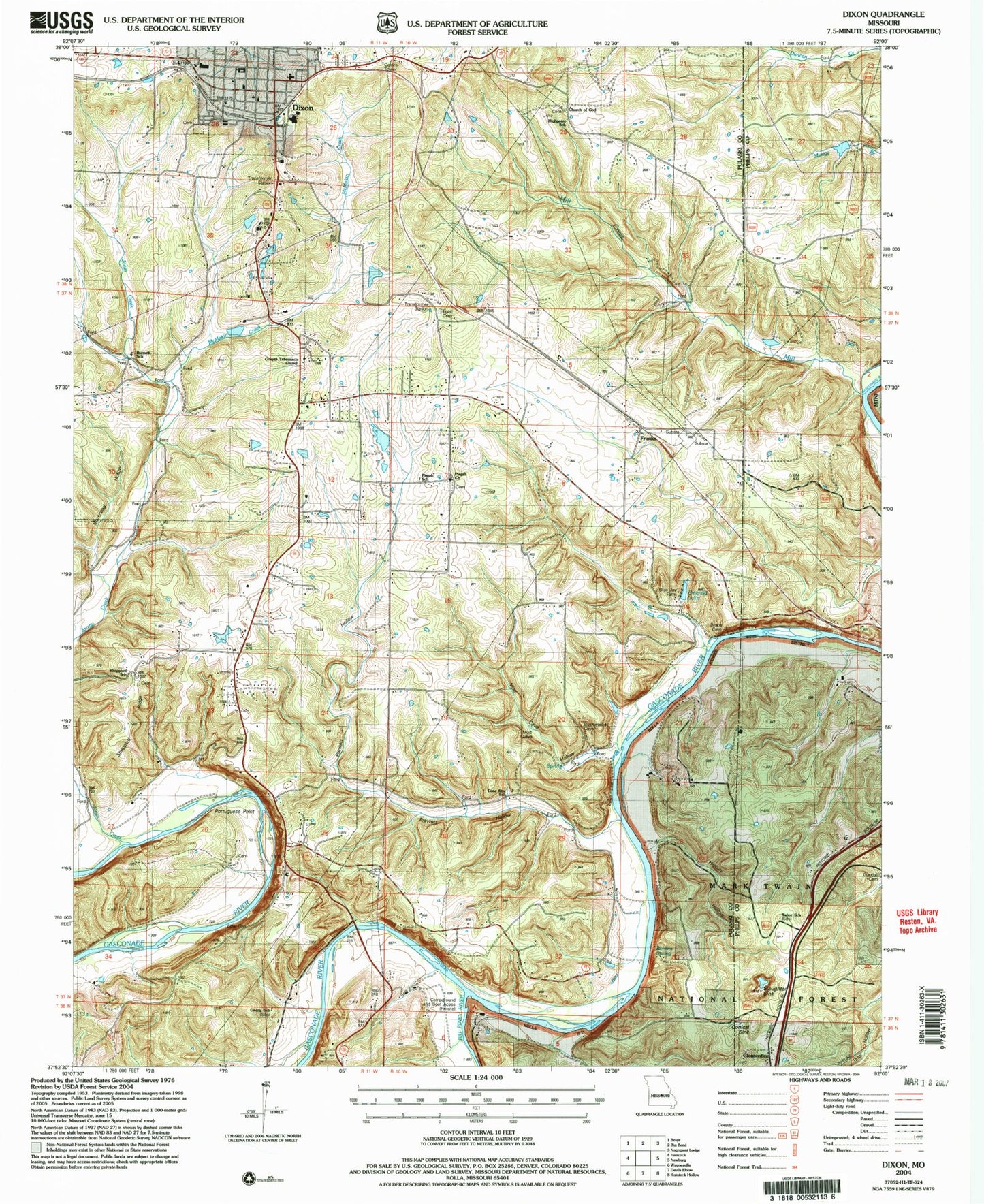
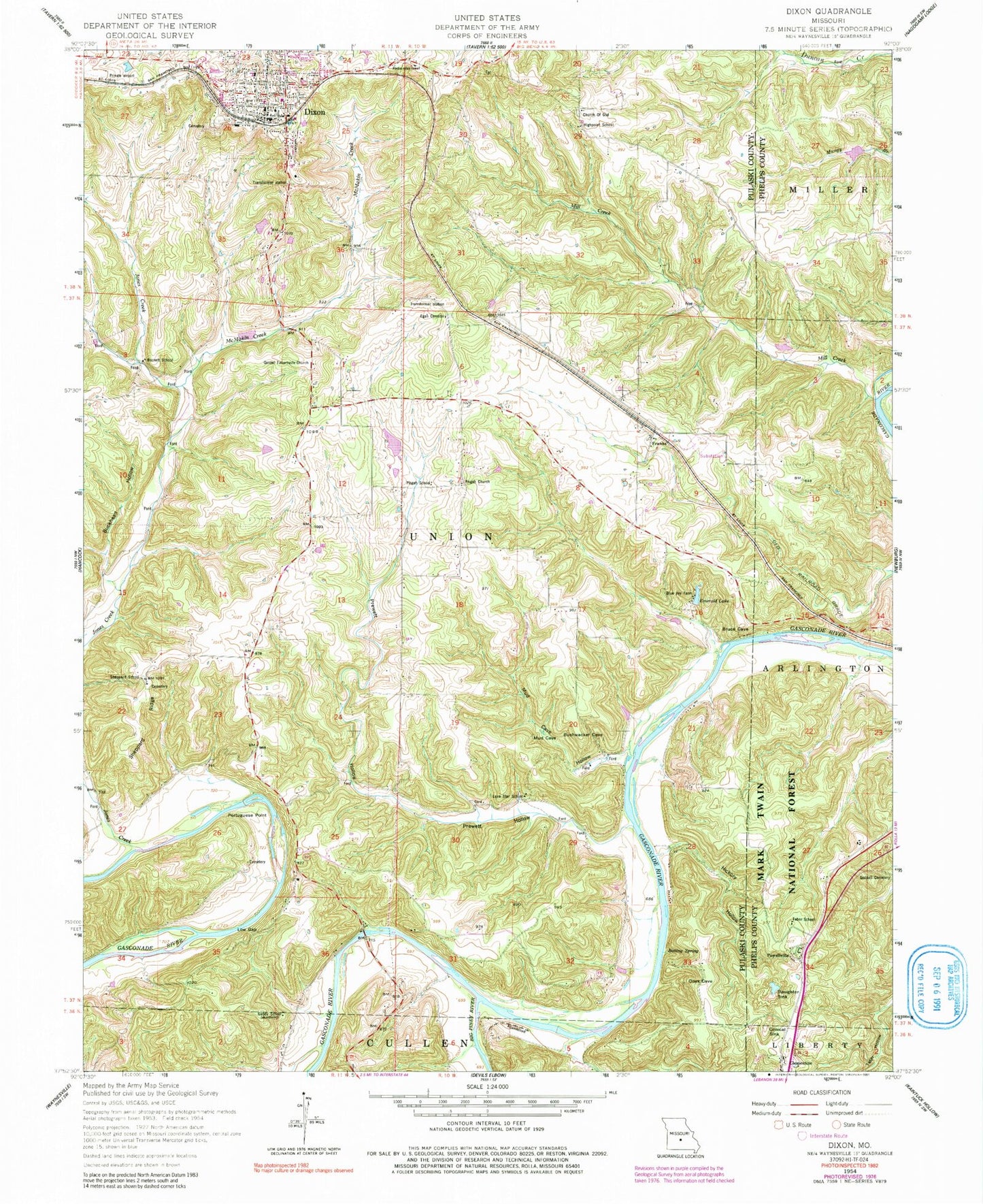
MyTopo
Classic USGS Dixon Missouri 7.5'x7.5' Topo Map
Couldn't load pickup availability
Historical USGS topographic quad map of Dixon in the state of Missouri. Map scale may vary for some years, but is generally around 1:24,000. Print size is approximately 24" x 27"
This quadrangle is in the following counties: Phelps, Pulaski.
The map contains contour lines, roads, rivers, towns, and lakes. Printed on high-quality waterproof paper with UV fade-resistant inks, and shipped rolled.
Contains the following named places: Big Piney River, Blue Jay Farm, Boiling Spring, Bryant Bluff, Buckhead Hollow, Burnett School, Cardin Lake, Cardin Lake Dam, City of Dixon, Clementine, Conical Sink, Dennis Lake, Dennis Lake Dam, Dixon, Dixon Police Department, Dixon Post Office, Dixon Rural Fire Protection District, Egan Cemetery, Emerald Lake, Franks, Gaddy School, Goodall Cemetery, Gospel Tabernacle Church, Hickory Hollow, Highpoint School, Idumea Baptist Church, Jones Creek, Lone Star School, Lone Star Tract State Forest, Low Gap, Mazzaville Resort, McMakin Creek, Mill Creek, Mud Cave Hollow, Piney End Resort, Pisgah Church, Pisgah School, Portuguese Point, Powellville, Prewett Hollow, Sheppard Church, Sheppard Ridge, Sheppard School, Slaughter Sink, Tabor School, Three Island Resort, Township of Union