MyTopo
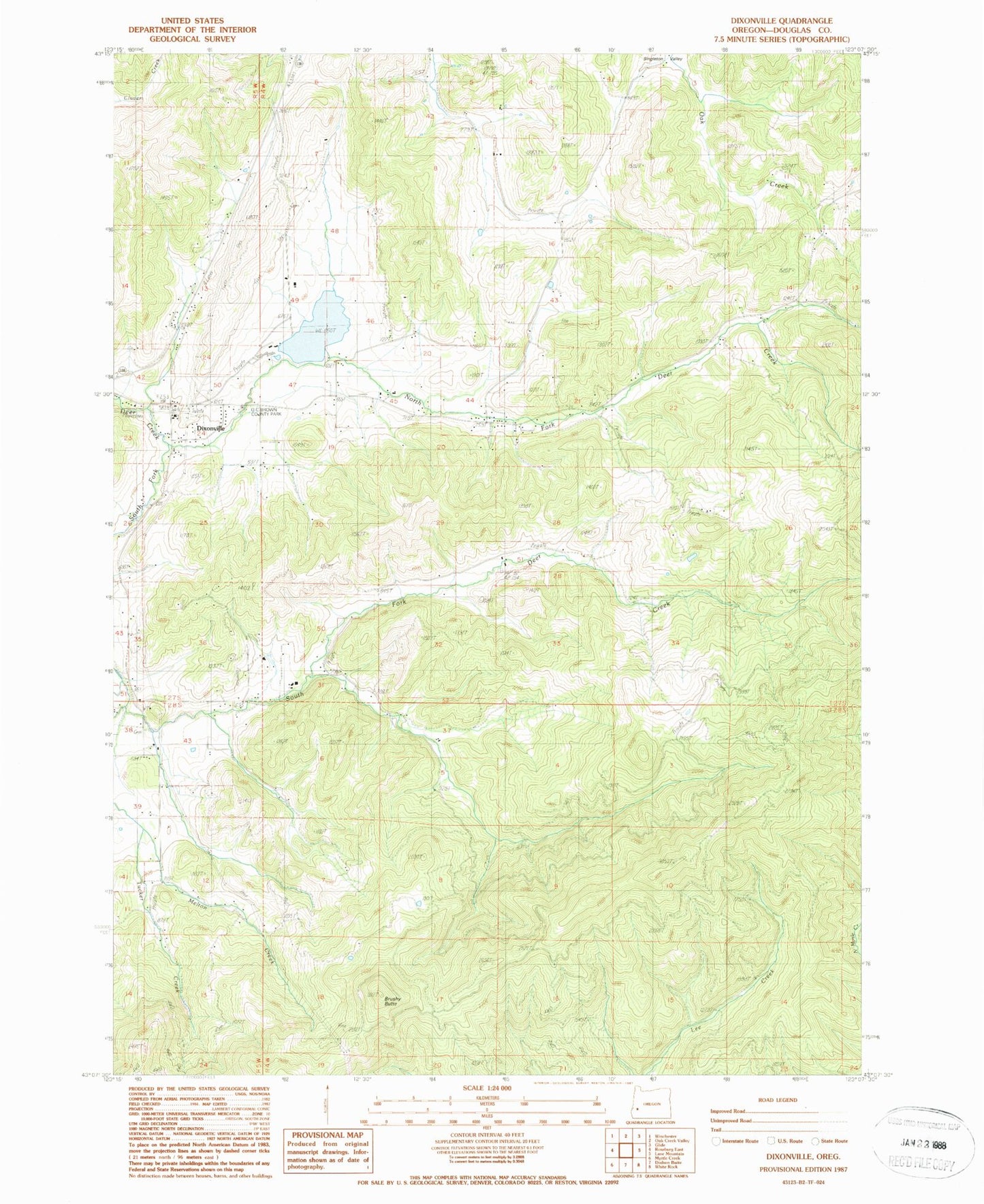
Classic USGS Dixonville Oregon 7.5'x7.5' Topo Map
Couldn't load pickup availability
Historical USGS topographic quad map of Dixonville in the state of Oregon. Map scale may vary for some years, but is generally around 1:24,000. Print size is approximately 24" x 27"
This quadrangle is in the following counties: Douglas.
The map contains contour lines, roads, rivers, towns, and lakes. Printed on high-quality waterproof paper with UV fade-resistant inks, and shipped rolled.
Contains the following named places: Black Mud Summit, Boggess Cemetery, Brushy Butte, Dixonville, Dixonville Log Pond, Dixonville Log Pond Dam, Dixonville Post Office, East Fork High Prairie Creek, Hatfield, High Prairie Creek, Johnston Log Pond, Krogel Bridge, Livingston Cemetery, Livingston Creek, Lurley Post Office, Melton Creek, Middle Fork of South Fork Deer Creek, North Fork Deer Creek, O C Brown County Park, Rose Creek, South Deer Creek Grange, South Fork Deer Creek, Tucker Creek, West Fork High Prairie Creek