
MyTopo
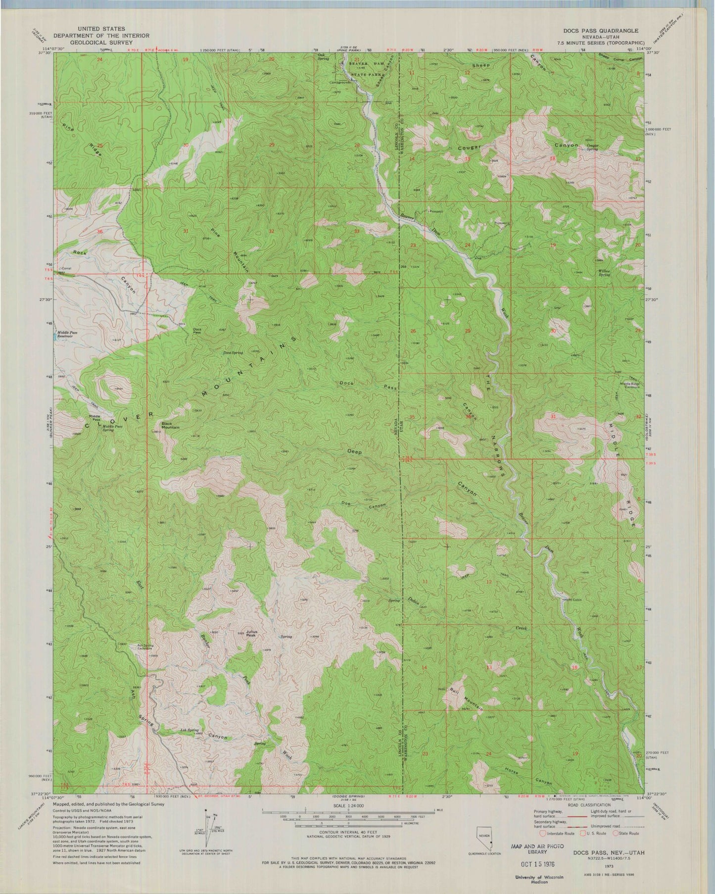
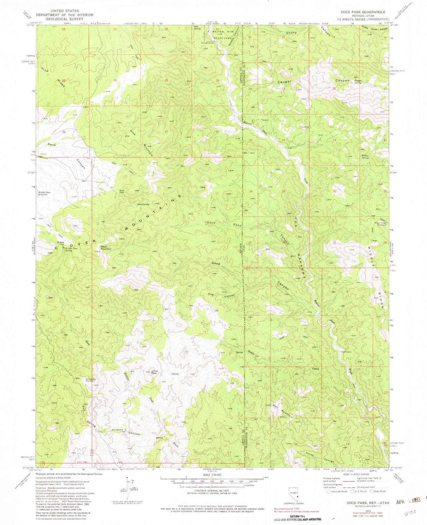
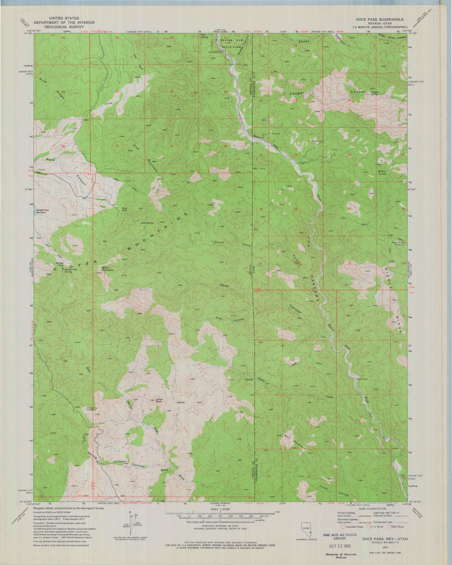
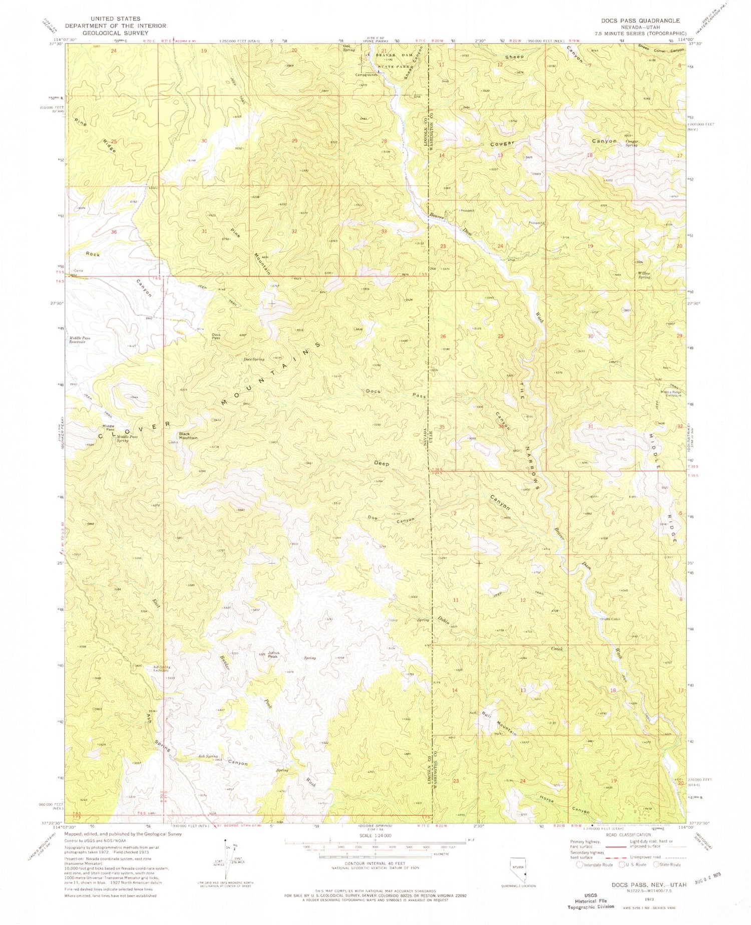
Classic USGS Docs Pass Nevada 7.5'x7.5' Topo Map
Couldn't load pickup availability
Historical USGS topographic quad map of Docs Pass in the states of Nevada, Utah. Map scale may vary for some years, but is generally around 1:24,000. Print size is approximately 24" x 27"
This quadrangle is in the following counties: Lincoln, Washington.
The map contains contour lines, roads, rivers, towns, and lakes. Printed on high-quality waterproof paper with UV fade-resistant inks, and shipped rolled.
Contains the following named places: Ash Spring, Ash Spring Canyon, Ash Spring Exclosure, Black Mountain, Bull Mountain, Cattle Pass, Cougar Canyon, Cougar Canyon Wilderness, Cougar Spring, Deep Canyon, Dobin Creek, Docs Pass, Docs Pass Canyon, Doc's Pass Wilderness, Docs Spring, Doe Canyon, Holts Cabin, Julius Peak, Middle Pass, Middle Pass Spring, Middle Ridge, Middle Ridge Exclosure, Oak Spring, Pine Mountain, Pine Ridge, Sheep Canyon, Slaughter Creek, The Narrows, Water and Ice Falls, Willow Spring