
MyTopo
Classic USGS Doctortown Georgia 7.5'x7.5' Topo Map
Couldn't load pickup availability
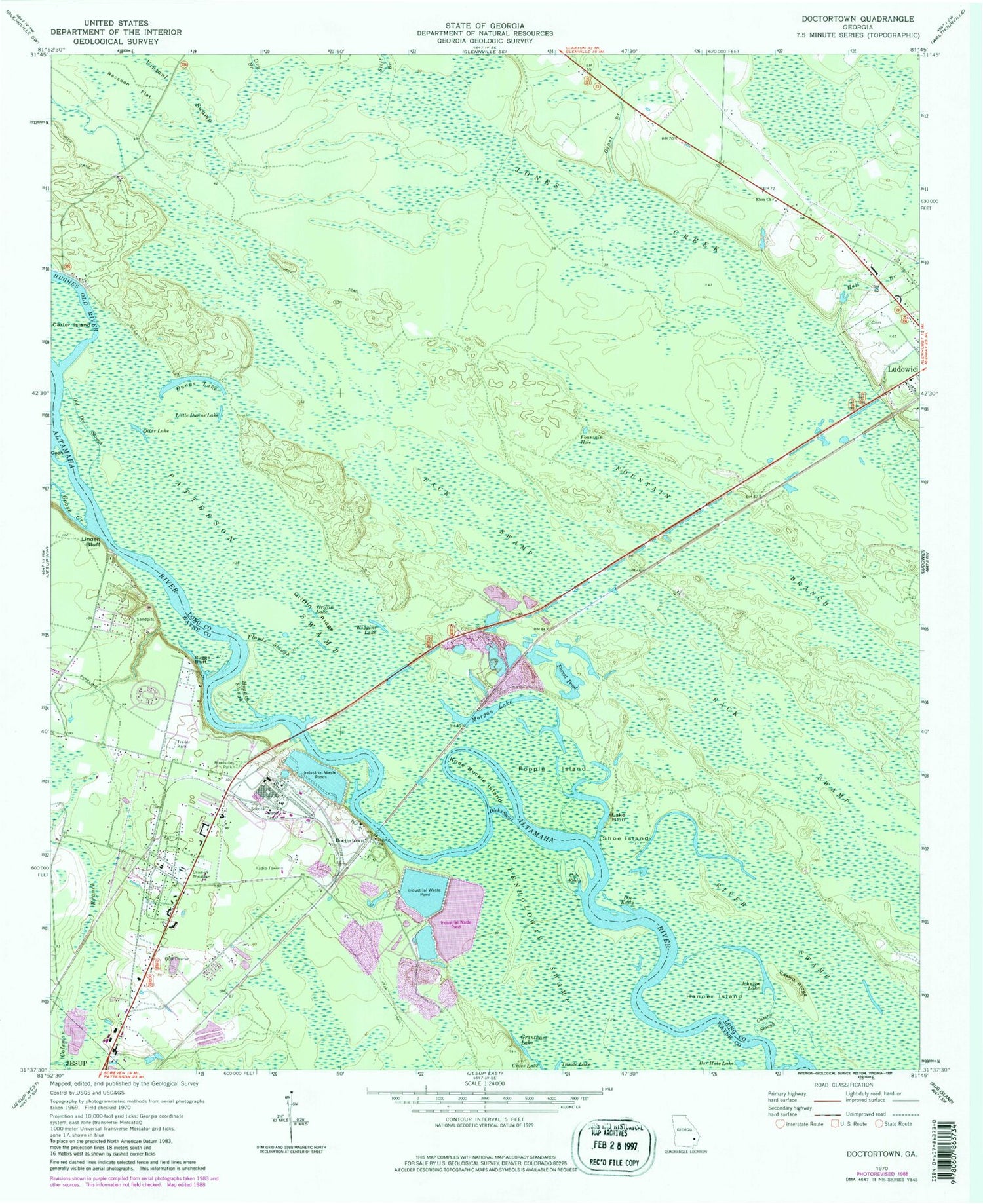
Historical USGS topographic quad map of Doctortown in the state of Georgia. Typical map scale is 1:24,000, but may vary for certain years, if available. Print size: 24" x 27"
This quadrangle is in the following counties: Long, Wayne.
The map contains contour lines, roads, rivers, towns, and lakes. Printed on high-quality waterproof paper with UV fade-resistant inks, and shipped rolled.
Contains the following named places: Back Swamp, Bar Hole Lake, Buggs Bluff, Casino Ridge, Casino Slough, Cole Eddy, Coon Island, Cross Lake, Dicks Swift, Doe Eddy, Dry Branch, Fountain Hole, Grant Branch, Grantham Lake, Griffin Lake, Griffin Ridge, Hall Branch, Hanner Island, Hogpen Slough, Johnson Lake, Knee Buckle Island, Lake Bluff, Linden Bluff, Little Dunns Lake, Morgan Lake, Old Doc Slough, Otter Lake, Patterson Swamp, Popple Island, Raccoon Flat, Shoe Island, Wiggins Lake, Still Branch, Rayonier Lake Dam North, Rayonier Lake North, Rayonier Lake Dam, Rayonier Lake, Rayonier Lake Dam South, Rayonier Lake South, Negro Island, J Alvin Leaphart Senior Memorial Bridge, WLPT-FM (Jesup), WGCO-FM (Jesup), Doctortown, Dunns Lake, Elem Church, Floyds Slough, Forest Pond, Goose Creek, Anderson Drive Baptist Church, Piney Grove Mobile Home Park


