MyTopo
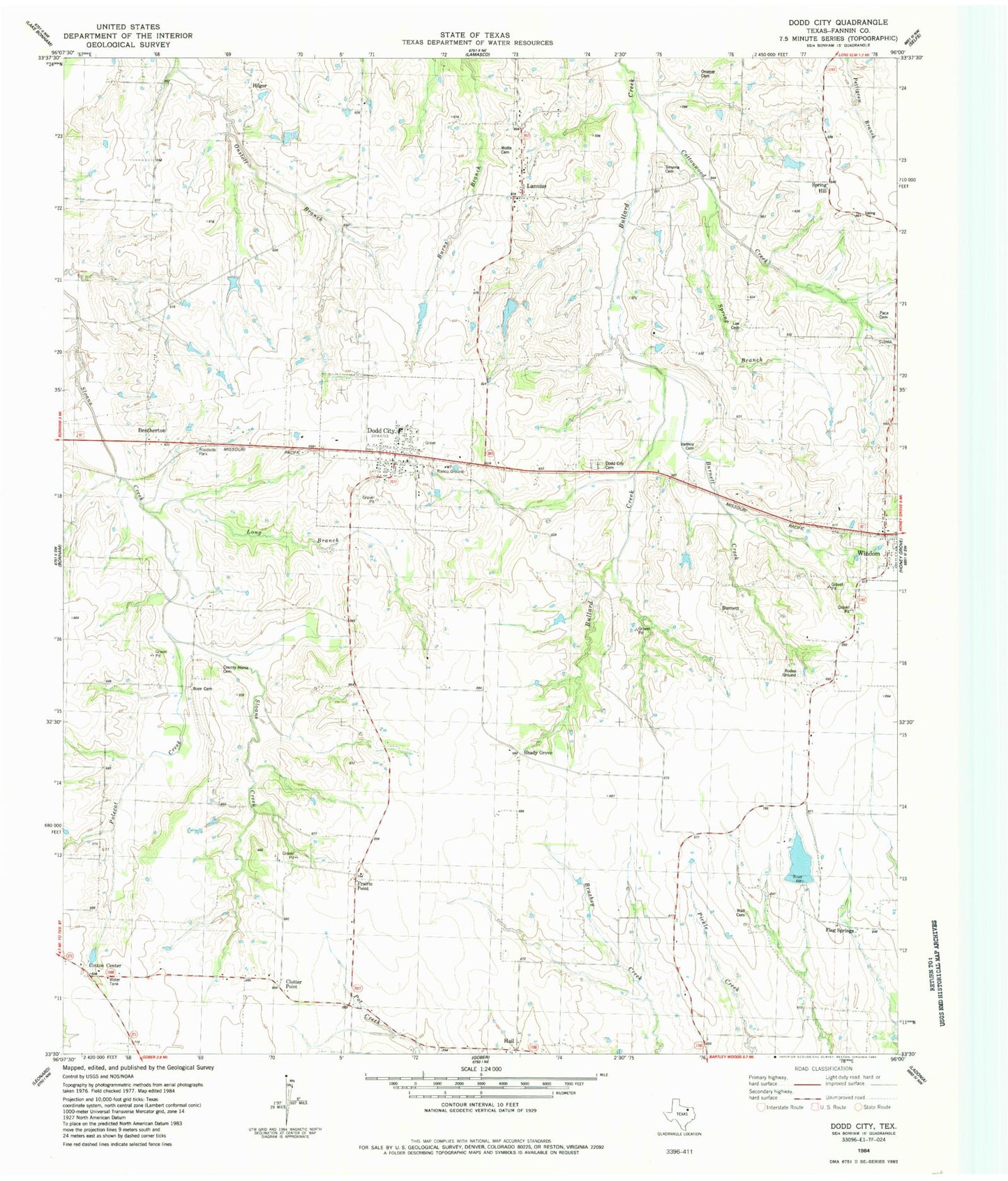
Classic USGS Dodd City Texas 7.5'x7.5' Topo Map
Couldn't load pickup availability
Historical USGS topographic quad map of Dodd City in the state of Texas. Map scale may vary for some years, but is generally around 1:24,000. Print size is approximately 24" x 27"
This quadrangle is in the following counties: Fannin.
The map contains contour lines, roads, rivers, towns, and lakes. Printed on high-quality waterproof paper with UV fade-resistant inks, and shipped rolled.
Contains the following named places: Altick Lake, Altick Lake Dam, Beasley Vault Cemetery, Boze Cemetery, Brotherton, Bullard Creek, Burnett, Burnett Cemetery, Burnett Creek, Chesson Family Cemetery, Clutter Point, Cobb - Vannoy Cemetery, Cotton Center, Cottonwood Creek, County Home Cemetery, Dodd City, Dodd City Cemetery, Dodd City Division, Dodd City Fire Department - First Responders, Dodd City Hall, Dodd City Post Office, Dodd City School, Fannin County, Flag Springs, Fort Inglish, Hail, Happy J Ranch Lake, Happy J Ranch Lake Dam, Hilger, Lannius, Lee Cemetery, Long Branch, Onstott Cemetery, Pace Cemetery, Polecat Creek, Prairie Point, Saint Mark Church, Shady Grove, Shilo Cemetery, Smyrna Cemetery, Spring Branch, Spring Hill, Town of Dodd City, Wall Cemetery, Williams Lake, Williams Lake Dam, Windom Cemetery, Wolfe and Carlisle Cemetery, Wood Cemetery, ZIP Code: 75438