MyTopo
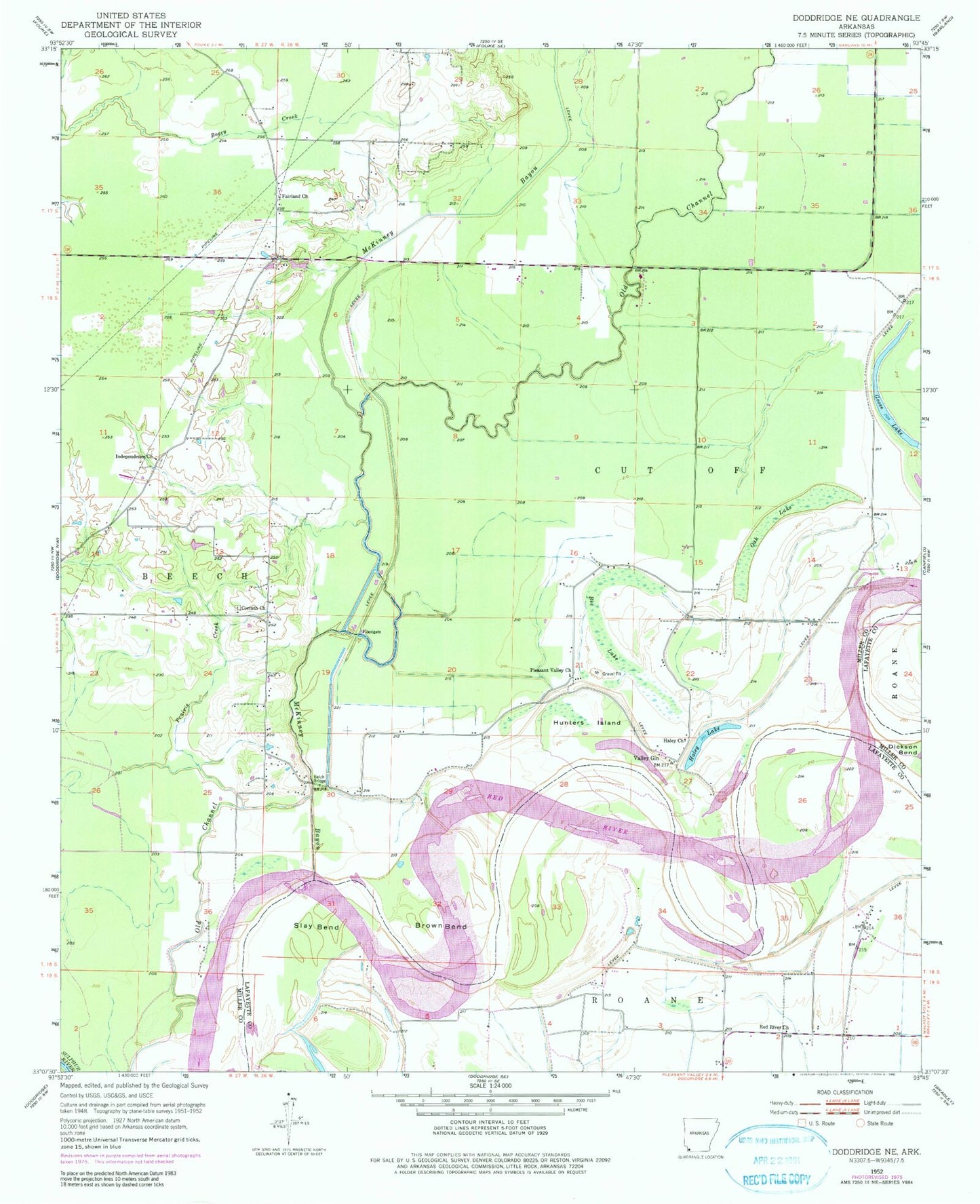
Classic USGS Doddridge NE Arkansas 7.5'x7.5' Topo Map
Couldn't load pickup availability
Historical USGS topographic quad map of Doddridge NE in the state of Arkansas. Map scale may vary for some years, but is generally around 1:24,000. Print size is approximately 24" x 27"
This quadrangle is in the following counties: Lafayette, Miller.
The map contains contour lines, roads, rivers, towns, and lakes. Printed on high-quality waterproof paper with UV fade-resistant inks, and shipped rolled.
Contains the following named places: Bee Lake, Beloh Bridge, Brown Bend, Corinth Church, Fairland, Fairland Church, Goose Lake, Haley Church, Haley Lake, Hunters Island, Independence Church, McKinney Bayou, Oak Lake, Pleasant Valley Church, Prairie Creek, Red River Church, River Bend Volunteer Fire Department, Slay Bend, Township of Cut Off, Valley Gin