
MyTopo
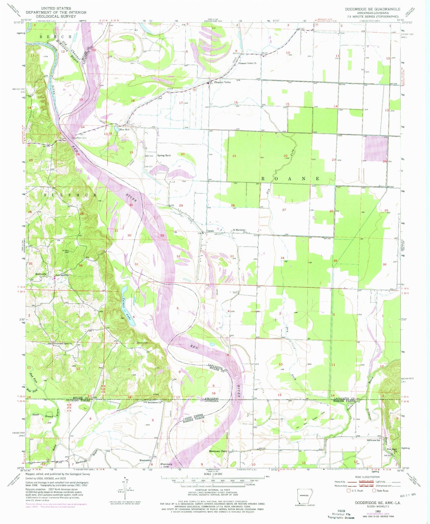
Classic USGS Doddridge SE Arkansas 7.5'x7.5' Topo Map
Couldn't load pickup availability
Historical USGS topographic quad map of Doddridge SE in the states of Arkansas, Louisiana. Map scale may vary for some years, but is generally around 1:24,000. Print size is approximately 24" x 27"
This quadrangle is in the following counties: Bossier, Caddo, Lafayette, Miller.
The map contains contour lines, roads, rivers, towns, and lakes. Printed on high-quality waterproof paper with UV fade-resistant inks, and shipped rolled.
Contains the following named places: Bardstown Bayou, Bethlehem Church, Blanton Cemetery, Blue Hole, Canale, Dry Fork, East Fork Kelly Bayou, Kiblah Oil and Gas Field, Missionary, Missionary Ferry, Missionary Lake, Nance Branch, New Hope Church, New Light Church, Old Bed Rotten Lake, Old Channel McKinney Bayou, Palmer Lake, Pleasant Valley, Pleasant Valley Church, Promised Land Church, Saint Matthews Church, Smithville, Spring Bank, Spring Bank Ferry, Stillhouse Bayou, Stillhouse School, Sulphur River, West Fork Kelly Bayou


