MyTopo
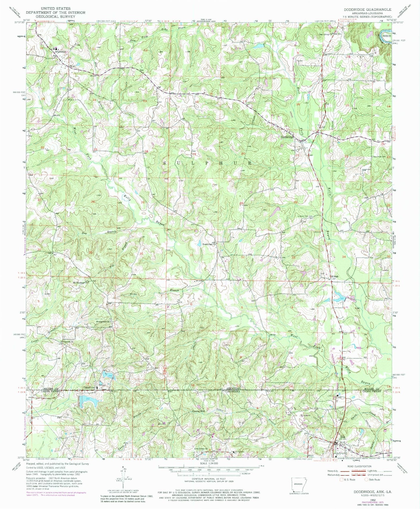
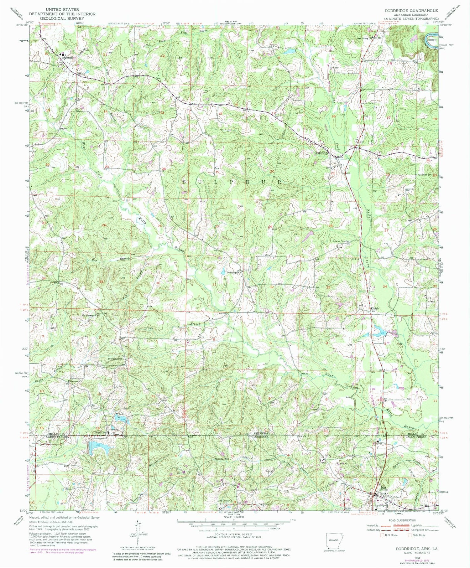
Classic USGS Doddridge Arkansas 7.5'x7.5' Topo Map
Couldn't load pickup availability
Historical USGS topographic quad map of Doddridge in the states of Arkansas, Louisiana. Map scale may vary for some years, but is generally around 1:24,000. Print size is approximately 24" x 27"
This quadrangle is in the following counties: Caddo, Miller.
The map contains contour lines, roads, rivers, towns, and lakes. Printed on high-quality waterproof paper with UV fade-resistant inks, and shipped rolled.
Contains the following named places: Arkla Lake, Arkla Lake Dam, Arla Pond Dam, Bright Star Elementary School, Bright Star High School, Bright Star Volunteer Fire Department, Brightstar, Capps City, Concord Church, Day Branch, Doddridge, Doddridge Church, Doddridge Post Office, Doddridge Volunteer Fire Department, Eason Lake, Eason Lake Dam, Era, Evergreen Church, Hicks Branch, Ida, Ida Lake Dam, Ida Post Office, Jones Lake, Kiblah, Line Creek Church, May Branch, Mount Pleasant Church, New Hope Cemetery, Oak Grove Church, Pill Branch, R Jones Lake Dam, Rodessa Oil and Gas Field, Smith Creek, Sulphur Fork Cemetery, Township of Sulphur, Village of Ida, Westmoreland Lake, Westmoreland Lake Dam, ZIP Code: 71834