
MyTopo
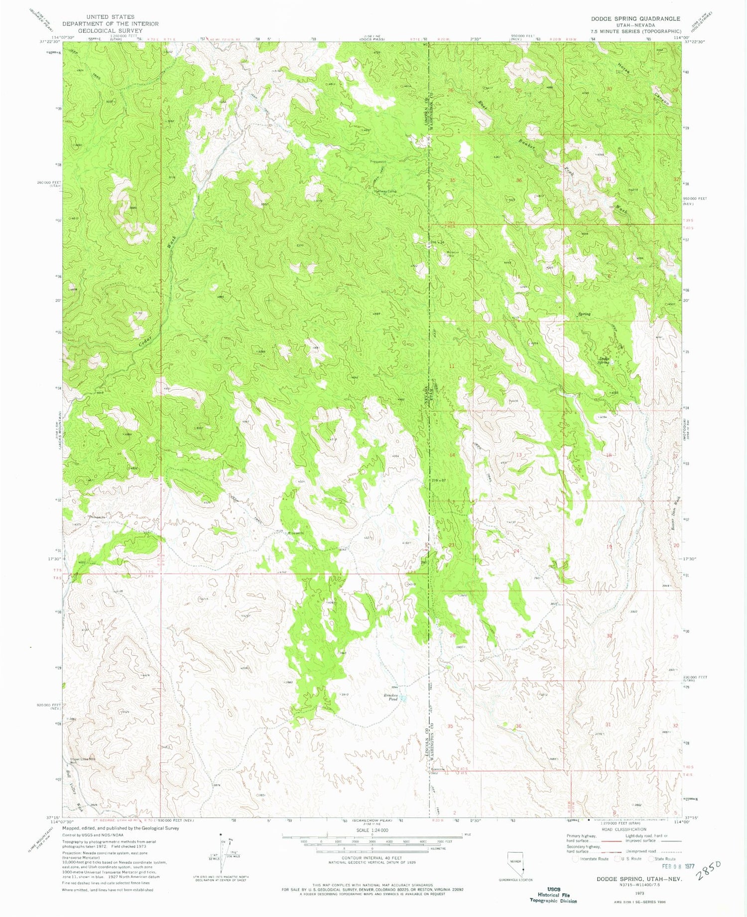
Classic USGS Dodge Spring Utah 7.5'x7.5' Topo Map
Regular price
$16.95
Regular price
Sale price
$16.95
Unit price
per
Couldn't load pickup availability
Historical USGS topographic quad map of Dodge Spring in the states of Utah, Nevada. Typical map scale is 1:24,000, but may vary for certain years, if available. Print size: 24" x 27"
This quadrangle is in the following counties: Lincoln, Washington.
The map contains contour lines, roads, rivers, towns, and lakes. Printed on high-quality waterproof paper with UV fade-resistant inks, and shipped rolled.
Contains the following named places: Dodge Spring, Bracken Pond, Halfway Camp, Upper Lime Mountain Well, Ooze Flat Reservoir, Betsy Spring, Rueben Spring


