MyTopo
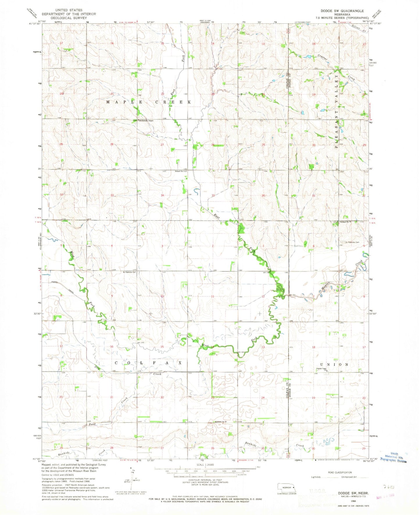
Classic USGS Dodge SW Nebraska 7.5'x7.5' Topo Map
Couldn't load pickup availability
Historical USGS topographic quad map of Dodge SW in the state of Nebraska. Map scale may vary for some years, but is generally around 1:24,000. Print size is approximately 24" x 27"
This quadrangle is in the following counties: Colfax, Dodge.
The map contains contour lines, roads, rivers, towns, and lakes. Printed on high-quality waterproof paper with UV fade-resistant inks, and shipped rolled.
Contains the following named places: Bethlehem Chapel, Colfax Election Precinct, Dry Creek, East Fork Maple Creek, East Nadrchals Minnow Creek, Maple Creek Election Precinct, Middle Nadrchals Minnow Creek, Nadrchals Minnow Creek, Pond Creek, Purple Cane Church, Saint Patricks Cemetery, Saint Patricks Church, School Number 11, School Number 18, School Number 79, Township of Colfax, Township of Maple Creek, West Fork Maple Creek, West Nadrchals Minnow Creek, ZIP Code: 68659