MyTopo
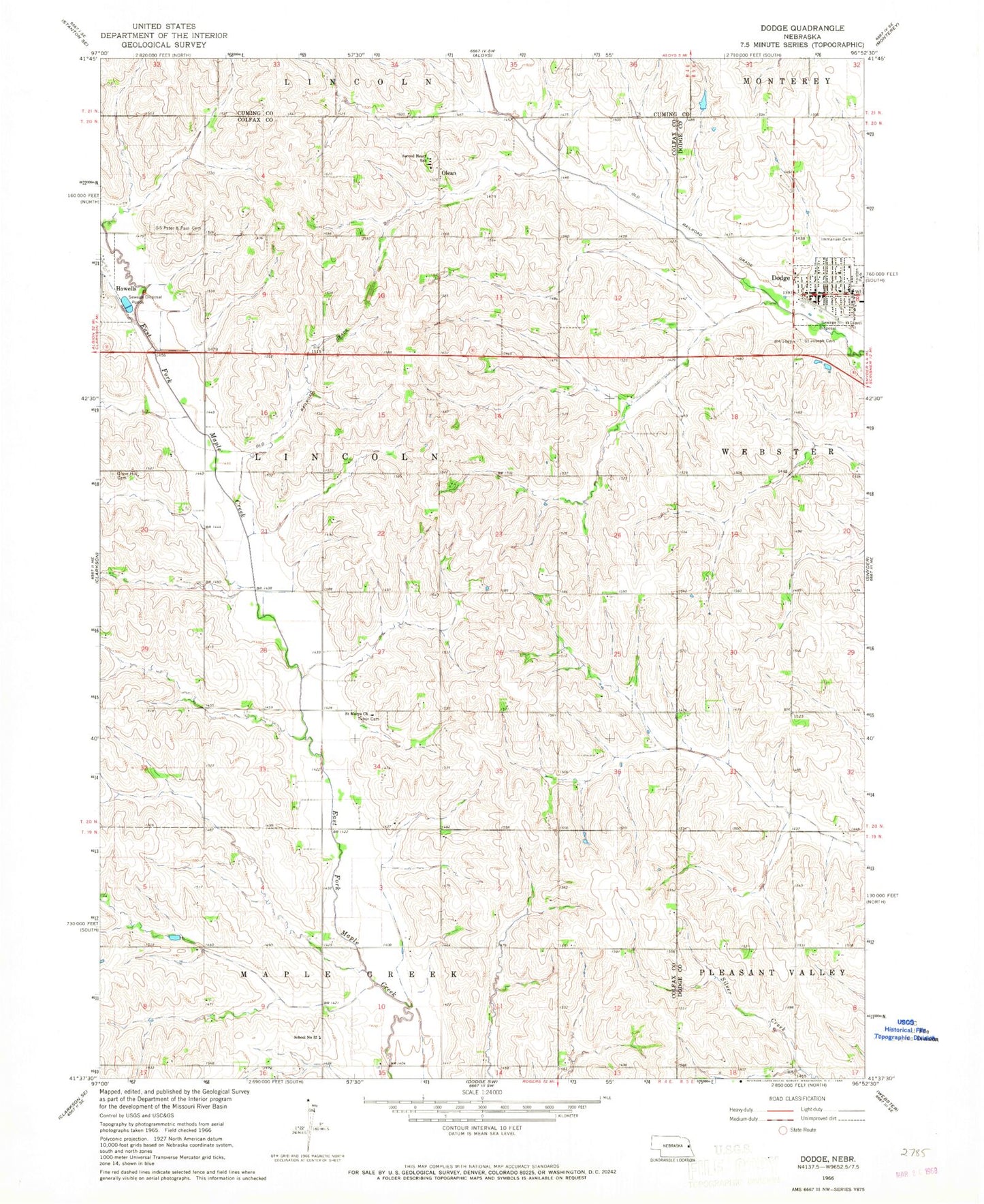
Classic USGS Dodge Nebraska 7.5'x7.5' Topo Map
Couldn't load pickup availability
Historical USGS topographic quad map of Dodge in the state of Nebraska. Map scale may vary for some years, but is generally around 1:24,000. Print size is approximately 24" x 27"
This quadrangle is in the following counties: Colfax, Cuming, Dodge.
The map contains contour lines, roads, rivers, towns, and lakes. Printed on high-quality waterproof paper with UV fade-resistant inks, and shipped rolled.
Contains the following named places: Dodge, Dodge Dental Office, Dodge Library, Dodge Medical Clinic, Dodge Police Station, Dodge Post Office, Dodge Public Schools, Dodge Rescue Unit, Dodge Volunteer Fire Department, Dostal-Bradley Airport, Grove Hill Cemetery, Holsten Park, Immanuel Cemetery, Immanuel Lutheran Church, Lincoln Election Precinct, Olean, Olean Post Office, Parkview Home Incorporated, Sacred Heart Church, Sacred Heart School, Saint Joseph Cemetery, Saint Marys Church, Saint Wenceslaus Church, Saint Wenceslaus Elementary School, Saints Peter and Paul Cemetery, School Number 32, Tabor Cemetery, Township of Lincoln, Village of Dodge, ZIP Code: 68633