
MyTopo
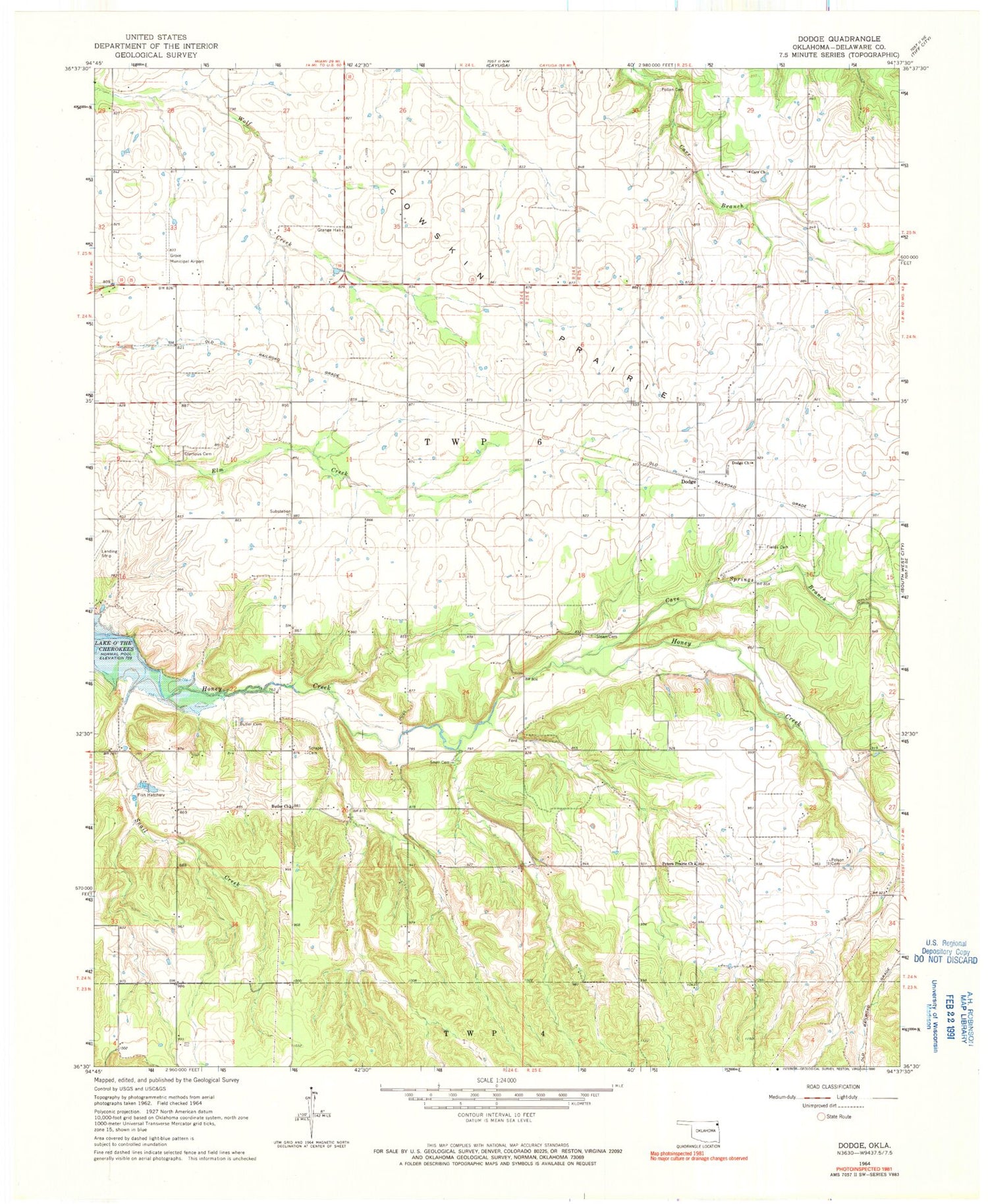
Classic USGS Dodge Oklahoma 7.5'x7.5' Topo Map
Couldn't load pickup availability
Historical USGS topographic quad map of Dodge in the state of Oklahoma. Map scale may vary for some years, but is generally around 1:24,000. Print size is approximately 24" x 27"
This quadrangle is in the following counties: Delaware.
The map contains contour lines, roads, rivers, towns, and lakes. Printed on high-quality waterproof paper with UV fade-resistant inks, and shipped rolled.
Contains the following named places: Butler, Butler Cemetery, Butler Census Designated Place, Butler Church, Butler Volunteer Fire Department, Carr Church, Cave Springs Branch, Cayuga, Cowskin Rural Fire District Station 2, Dodge, Dodge Census Designated Place, Dodge Church, Fields Cemetery, Grove High School, Grove Municipal Airport, Honey Creek, Olympus Cemetery, Peters Prairie Church, Pollan Cemetery, Polson Cemetery, Scraper Cemetery, Sloan Cemetery, Snail Creek, Snell Cemetery, Township 6, White Water, White Water Census Designated Place, ZIP Code: 74344


