MyTopo
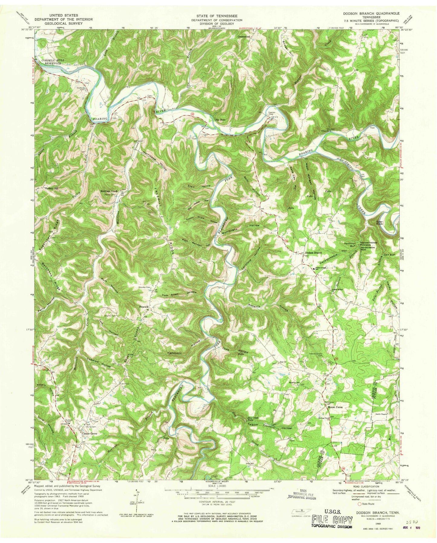
Classic USGS Dodson Branch Tennessee 7.5'x7.5' Topo Map
Couldn't load pickup availability
Historical USGS topographic quad map of Dodson Branch in the state of Tennessee. Map scale may vary for some years, but is generally around 1:24,000. Print size is approximately 24" x 27"
This quadrangle is in the following counties: Jackson, Putnam.
The map contains contour lines, roads, rivers, towns, and lakes. Printed on high-quality waterproof paper with UV fade-resistant inks, and shipped rolled.
Contains the following named places: Aaron Branch, Arbor Church, Arbor School, Backbone Ridge, Big Jessie Hollow, Birdwell Cemetery, Blackburn Fork, Blackburn Fork State Scenic River, Booger Hill, Bowman Branch, Burroughs Hollow, Cedar Grove School, Center Grove, Center Grove School, Chaffin Cemetery, Chaney Cemetery, Commissioner District 3, Commissioner District 4, Cubelow Hollow, Cummins Mill, Dave Bluff, Dodson Branch, Dodson Branch Census Designated Place, Dodson Branch Church, Dodson Branch School, Dodson Branch Volunteer Fire Department, Dodson Branch Volunteer Fire Department Station 2, Dry Creek, Dry Creek Falls, Engia Hollow, Freewill, Freewill Church, Freewill Ridge, Freewill School, Gainesboro Division, Gaw Branch, Gentry Cemetery, Gentry School, Hammock Hollow, Hardscrabble Bluff, Hardscrabble Hollow, Hardscrabble Pinnacle, Hardy Hollow, Hensley Cemetery, Hopper Creek, Hurricane Hollow, Judd Hollow, Lankford Hollow, Long Branch, Lynn School, Maberry School, Martin Ridge, Masters Mill, Mayfield, Morrison Creek, Morrison Creek School, Mount Union, Mount Union Church, Nancy Miles Hollow, Overton Cemetery, Pacific, Peaks Mill, Pendleton Bluff, Petty Hollow, Pine Hill School, Poke Mansell Hollow, Pole Bridge Branch, Roaring River Mill, Roaring River State Scenic River, Roberts Hollow, Ruff Hollow, Sara Lee Hollow, Scott Hollow, Seth Hollow, Seven Knobs, Smith Chapel, South Side Volunteer Fire Department, Spring Creek, Spring Creek Church, Stafford Cemetery, Steprock Hill, Stony Point School, Sugartown Ridge, Talley Creek, Talley Hollow, Tater Knob, The Boils, Tom Allen Hollow, Tom Hollow, Twelve Corners Cemetery, Twelve Corners Church, Twelve Corners Hollow, Wash Morgan Hollow, Whiteacres Mill, Whitehall School, Woodrow School, Young Cemetery, Zion Church