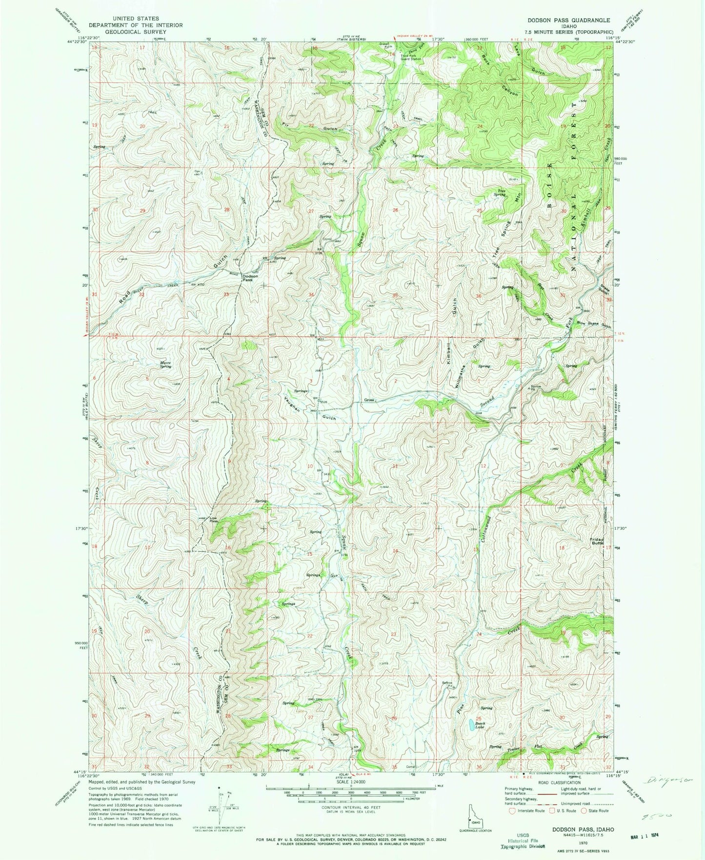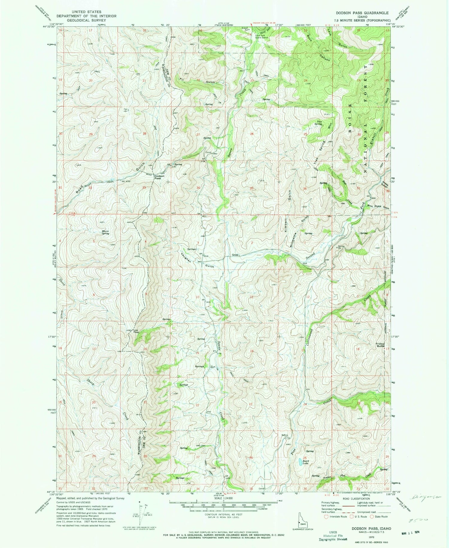
MyTopo
Classic USGS Dodson Pass Idaho 7.5'x7.5' Topo Map
Couldn't load pickup availability
Historical USGS topographic quad map of Dodson Pass in the state of Idaho. Map scale may vary for some years, but is generally around 1:24,000. Print size is approximately 24" x 27"
This quadrangle is in the following counties: Gem, Washington.
The map contains contour lines, roads, rivers, towns, and lakes. Printed on high-quality waterproof paper with UV fade-resistant inks, and shipped rolled.
Contains the following named places: Beech Lake, Bent Creek, Blow Snake Gulch, Cottonwood Creek, Dodson Pass, Fir Gulch, Friday Butte, Gross, Kimball Creek, Kimball Gulch, Low Pass, Moore Spring, Second Fork Squaw Creek, Shake Gulch, Third Fork Guard Station, Third Fork Squaw Creek, Tree Spring, Tree Spring Mountain, Vaughan Gulch, Walker Mill, Willmathe Gulch