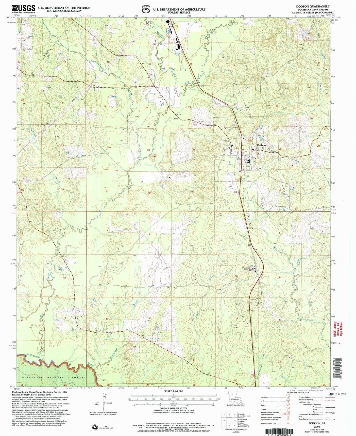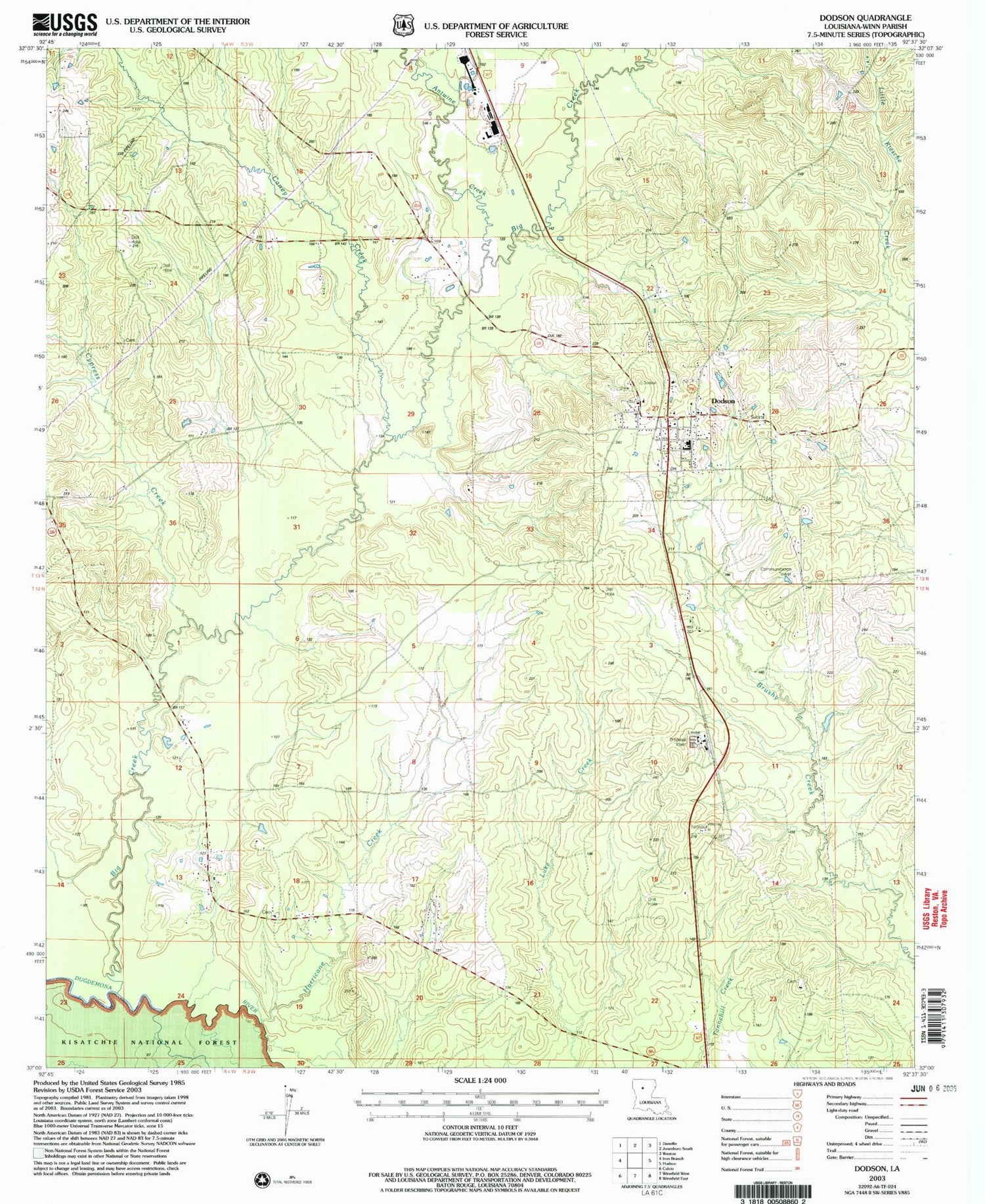
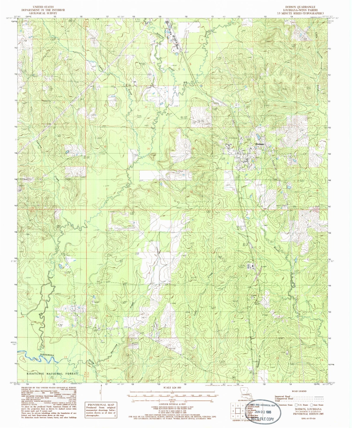
MyTopo
Classic USGS Dodson Louisiana 7.5'x7.5' Topo Map
Couldn't load pickup availability
Historical USGS topographic quad map of Dodson in the state of Louisiana. Map scale may vary for some years, but is generally around 1:24,000. Print size is approximately 24" x 27"
This quadrangle is in the following counties: Winn.
The map contains contour lines, roads, rivers, towns, and lakes. Printed on high-quality waterproof paper with UV fade-resistant inks, and shipped rolled.
Contains the following named places: Antwine Creek, Big Creek, Caney Creek, Chembond Spur, Cypress Creek, Dodson, Dodson Gas Field, Dodson High School, Dodson Post Office, Gansville Gas Field, Hargiss Slough, Hurricane Creek, Hurricane Creek Church, Milams, Parish Governing Authority District 10, Village of Dodson, Ward Four, Ward Seven, Winona, Winona Lookout Tower, Zion Hill, Zion Hill Church, ZIP Code: 71422