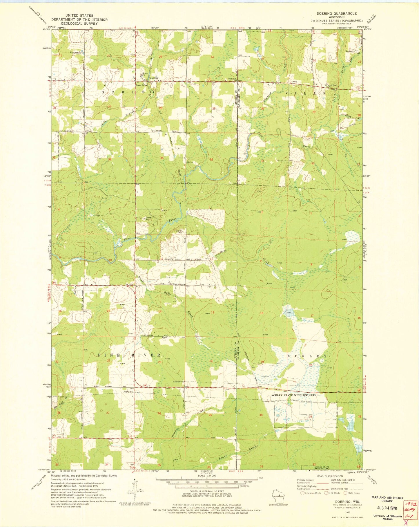
MyTopo
Classic USGS Doering Wisconsin 7.5'x7.5' Topo Map
Couldn't load pickup availability
Historical USGS topographic quad map of Doering in the state of Wisconsin. Map scale may vary for some years, but is generally around 1:24,000. Print size is approximately 24" x 27"
This quadrangle is in the following counties: Langlade, Lincoln.
The map contains contour lines, roads, rivers, towns, and lakes. Printed on high-quality waterproof paper with UV fade-resistant inks, and shipped rolled.
Contains the following named places: Ackley Lookout Tower, Ackley State Wildlife Areas, Doering, Doering School, East Branch Pratt Creek, Forest View Cemetery, Forest View Church, Forest View School, Gleason Flowage 2, Little Oxbo Creek, Lloyd Creek, McCloud Creek, Oxbo Creek, Pratt Creek, Prospect School, Saint Matthews Church, Skunk Creek D12.185 Dam, Spring Brook School, Wildwood Church