MyTopo
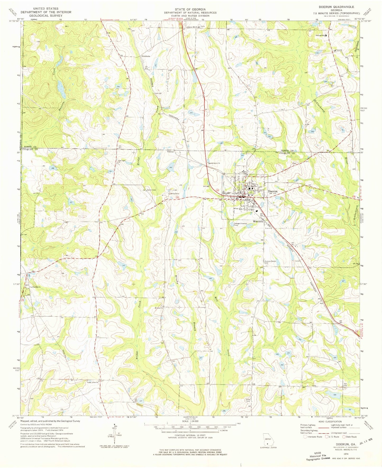
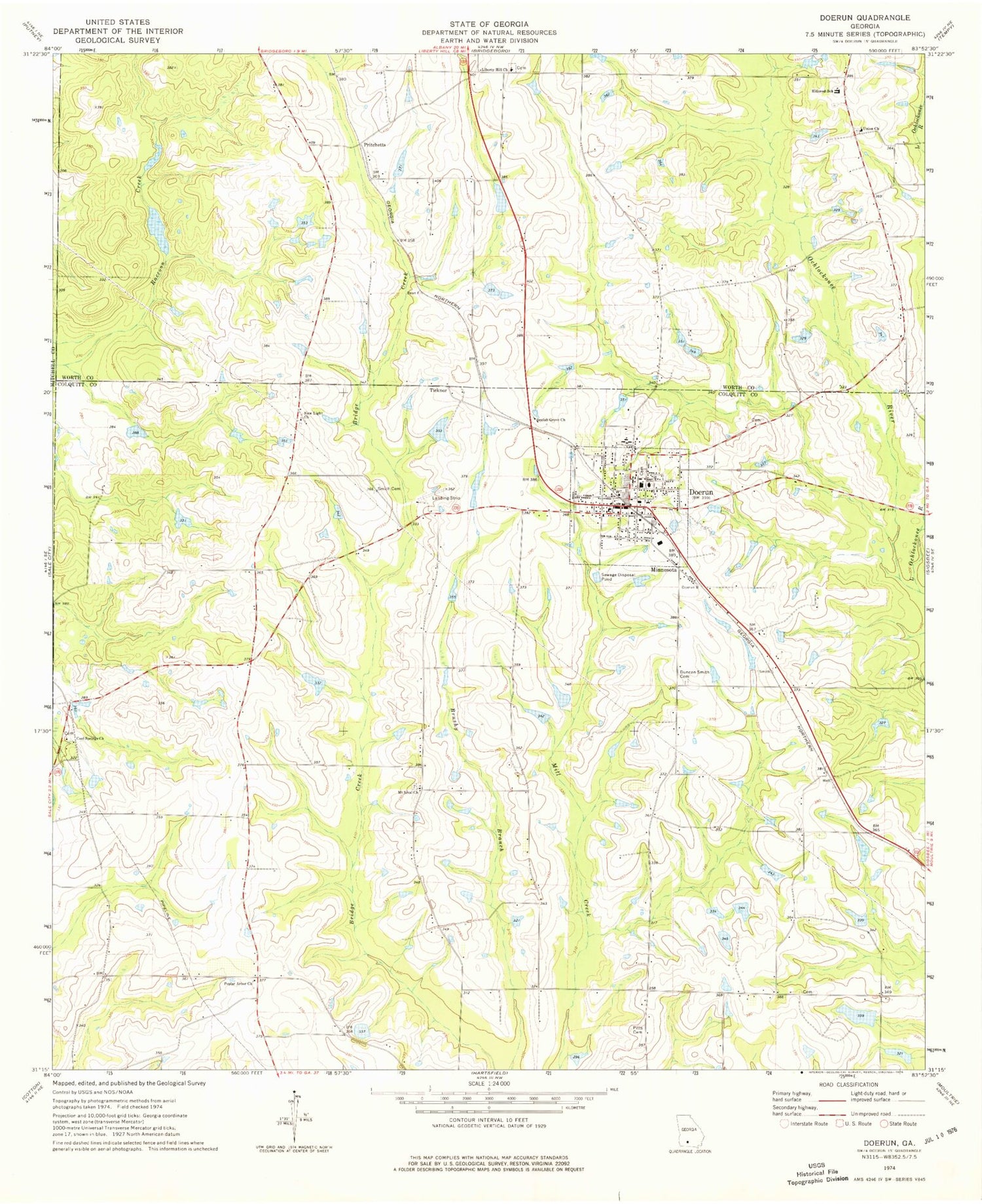
Classic USGS Doerun Georgia 7.5'x7.5' Topo Map
Couldn't load pickup availability
Historical USGS topographic quad map of Doerun in the state of Georgia. Map scale may vary for some years, but is generally around 1:24,000. Print size is approximately 24" x 27"
This quadrangle is in the following counties: Colquitt, Mitchell, Worth.
The map contains contour lines, roads, rivers, towns, and lakes. Printed on high-quality waterproof paper with UV fade-resistant inks, and shipped rolled.
Contains the following named places: Bailey Chapel African Methodist Episcopal Church, Beulah Grove Church, City of Doerun, Coleman School, Colquitt County Volunteer Firefighters Association Fire Station 62 Doerun, Cool Springs Baptist Church Cemetery, Cool Springs Church, Doerun, Doerun Baptist Church, Doerun City Cemetery, Doerun Division, Doerun Elementary School, Doerun High School, Doerun Police Dept, Doerun Post Office, Doerun Public School, Duncan Smith Cemetery, First Methodist Church, Grace Church, Herring School, Hillcrest School, Liberty Hill Baptist Church, Liberty Hill Cemetery, Little Ochlockonee River, Minnesota, Mitchell Grove Church, Mitchell Grove School, Mount Sinai Cemetery, Mount Sinai Church, New Light Church, Pitts Cemetery, Poplar Arbor Church, Pritchetts, Sanders Lake, Sanders Lake Dam, Sells Lake, Sells Lake Dam, Smith Cemetery, Terrace, Ticknor, Union Cemetery, Union Church, ZIP Code: 31744