MyTopo
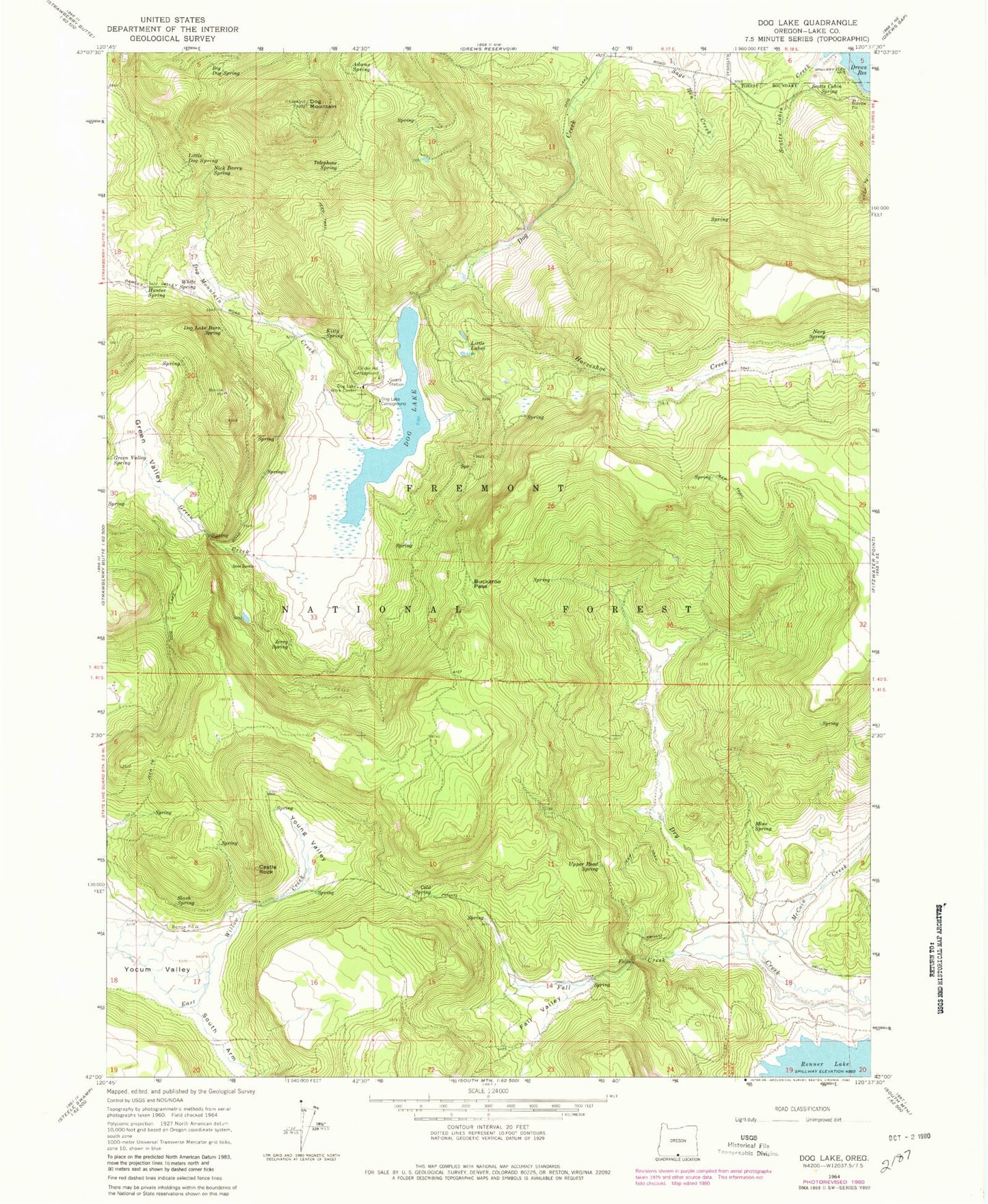
Classic USGS Dog Lake Oregon 7.5'x7.5' Topo Map
Couldn't load pickup availability
Historical USGS topographic quad map of Dog Lake in the state of Oregon. Map scale may vary for some years, but is generally around 1:24,000. Print size is approximately 24" x 27"
This quadrangle is in the following counties: Lake.
The map contains contour lines, roads, rivers, towns, and lakes. Printed on high-quality waterproof paper with UV fade-resistant inks, and shipped rolled.
Contains the following named places: Adams Spring, Big Dog Spring, Buckaroo Pass, Campground Number One, Campground Number Two, Castle Rock, Cold Spring, Dog Lake, Dog Lake Burn Spring, Dog Lake Campground Boat Ramp, Dog Lake Guard Station, Dog Lake Recreation Site, Dog Lake Spring, Dog Lake Work Center, Dog Mountain, Dog Mountain Creek, Fall Creek, Fall Valley, Fred Ross, Green Creek, Green Valley, Horseshoe Creek, Hunter Spring, Jerry Spring, Kitty Spring, Little Dog Spring, Little Lakes, McCoin Creek, Mine Spring, Navy Spring, Nick Barry Spring, Ross Ranch, Scotts Cabin Creek, Scotts Cabin Spring, Slash Spring, South Arm Yokum Valley, Telephone Spring, Upper Road Spring, White Spring, Young Valley