MyTopo
Classic USGS Dog Valley Peak Utah 7.5'x7.5' Topo Map
Regular price
$16.95
Regular price
Sale price
$16.95
Unit price
per
Couldn't load pickup availability
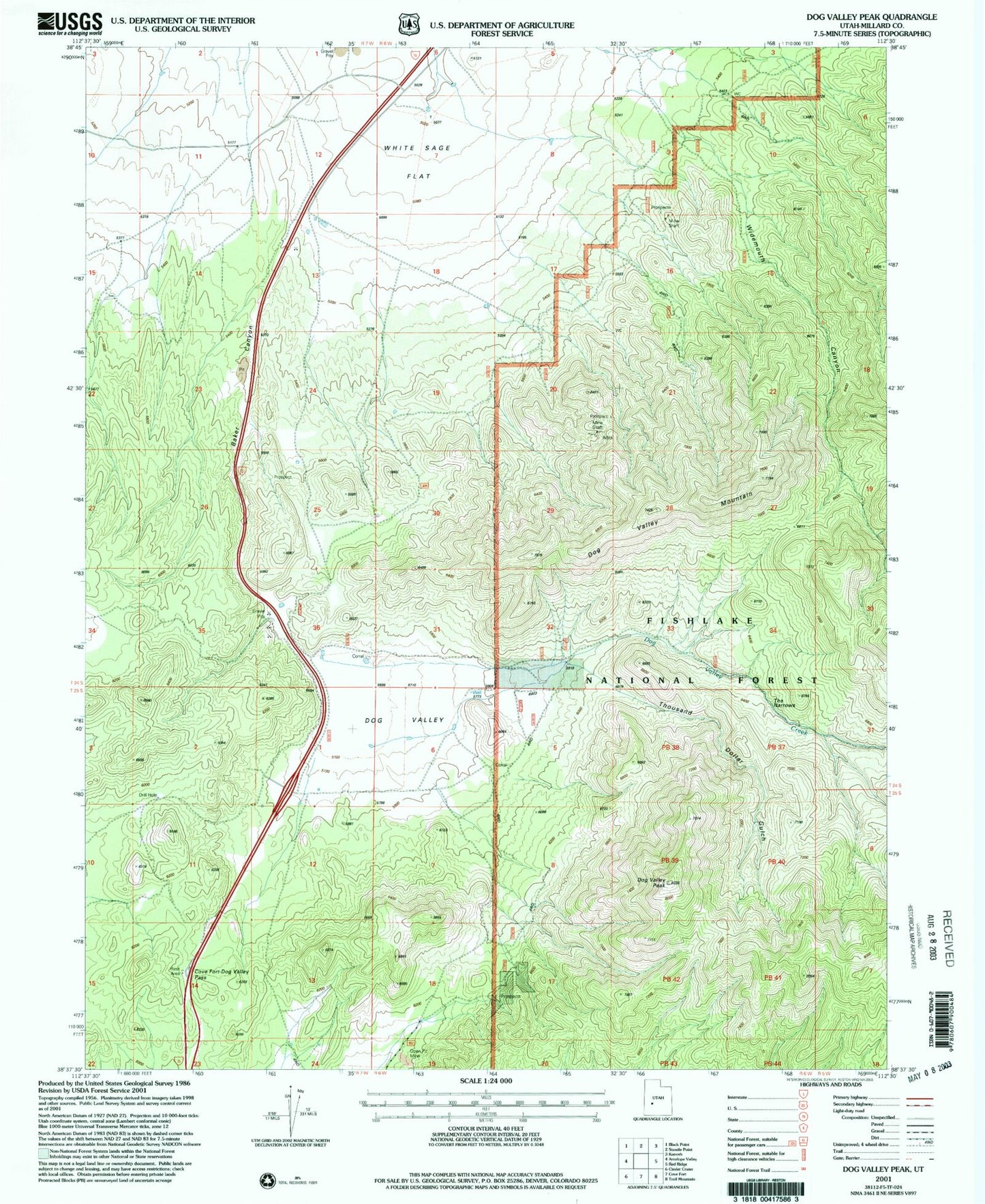
Historical USGS topographic quad map of Dog Valley Peak in the state of Utah. Map scale may vary for some years, but is generally around 1:24,000. Print size is approximately 24" x 27"
This quadrangle is in the following counties: Millard.
The map contains contour lines, roads, rivers, towns, and lakes. Printed on high-quality waterproof paper with UV fade-resistant inks, and shipped rolled.
Contains the following named places: Baker Canyon, Cove Fort Dog Valley Pass, Dog Valley, Dog Valley Creek, Dog Valley Mountain, Dog Valley Peak, Jewkes Mine, Purple Sage Mine, The Narrows, Thousand Dollar Gulch, White Sage Flat, Widemouth Canyon, ZIP Code: 84637