
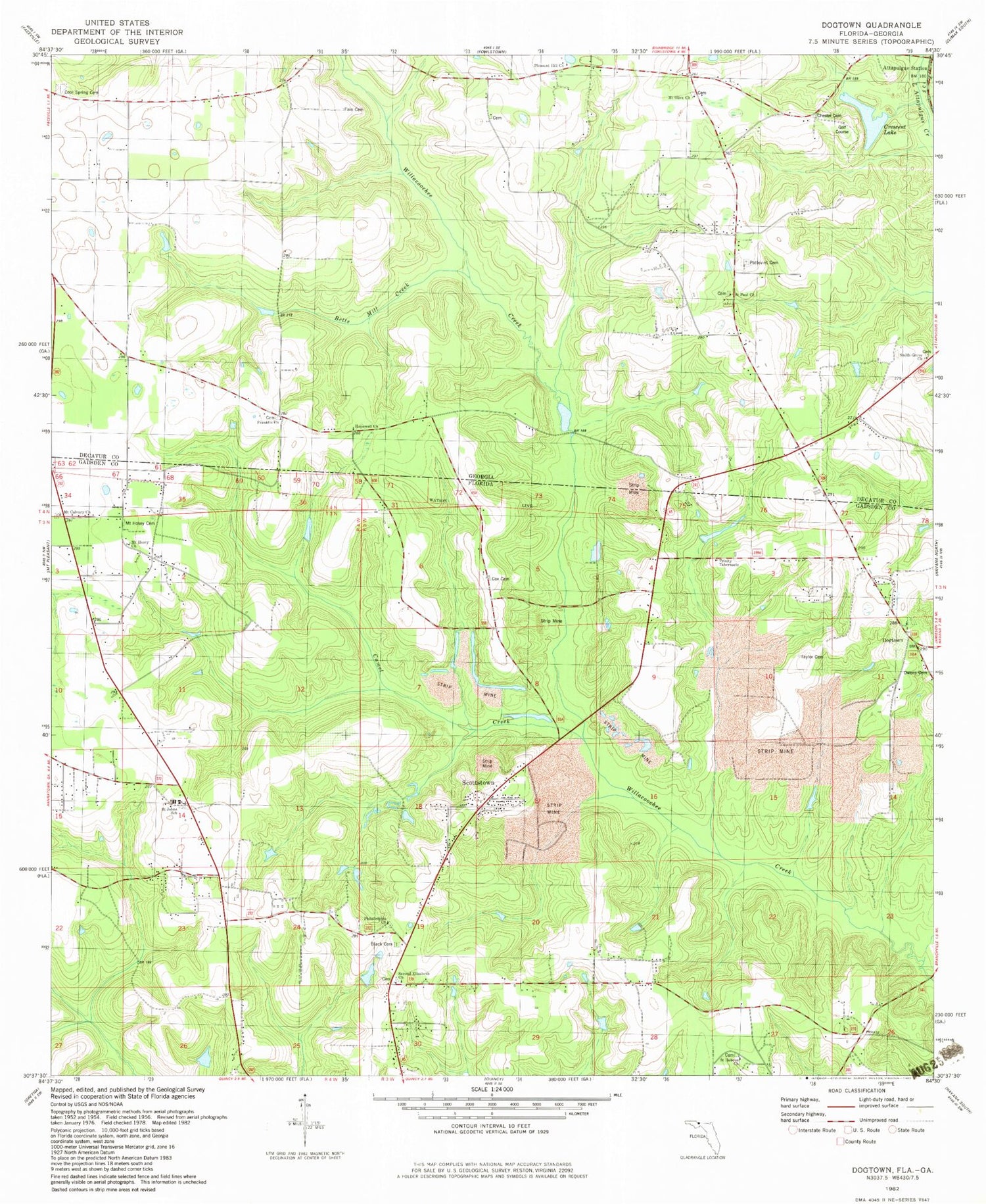
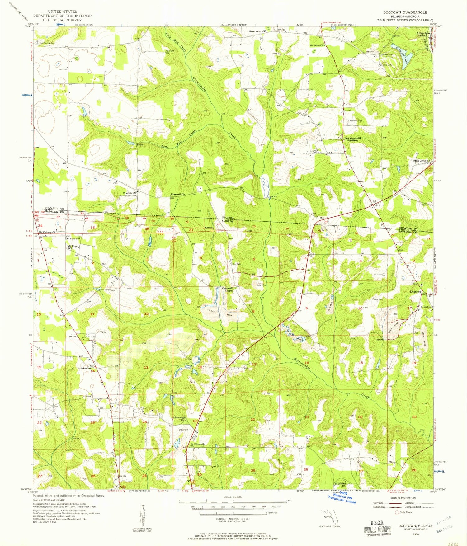
MyTopo
Classic USGS Dogtown Florida 7.5'x7.5' Topo Map
Couldn't load pickup availability
Historical USGS topographic quad map of Dogtown in the states of Florida, Georgia. Map scale may vary for some years, but is generally around 1:24,000. Print size is approximately 24" x 27"
This quadrangle is in the following counties: Decatur, Gadsden.
The map contains contour lines, roads, rivers, towns, and lakes. Printed on high-quality waterproof paper with UV fade-resistant inks, and shipped rolled.
Contains the following named places: Attapulgus, Betts Mill Creek, Campbell Chapel, Chester Cemetery, Cool Spring Cemetery, Cool Spring Church, Crescent Lake, Dogtown, Englehart Decatur Mine, Fain Cemetery, Franklin Church, Gunn Farm Mine, Hopewell Church, Lewis Cemetery, Mount Calvary Cemetery, Mount Calvary Church, Mount Hosea Missionary Baptist Church Cemetery, Mount Hosey Church, Mount Olive Church, Mount Olive Church Cemetery, Oak Grove School, Old Philadelphia Church Cemetery, Owens Cemetery, Philadelphia Church, Pottevint Cemetery, Robertsville Volunteer Fire Department, Saint Elizabeth Church, Saint Hebron Cemetery, Saint Hebron Church, Saint Johns School, Smith Grove Church, Sweetwater Church, Taylor Cemetery, Viola Farm Airport, ZIP Code: 32352


