
MyTopo
Classic USGS Dogwood Creek Alabama 7.5'x7.5' Topo Map
Regular price
$16.95
Regular price
Sale price
$16.95
Unit price
per
Couldn't load pickup availability
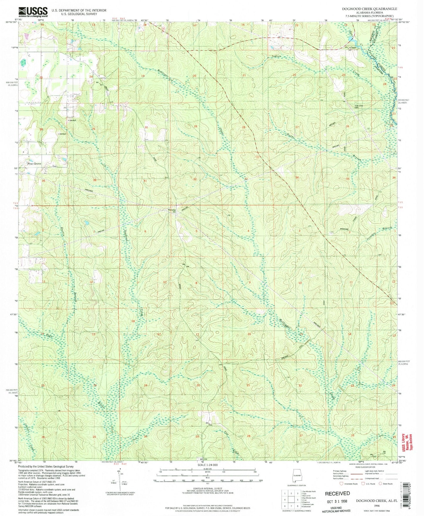
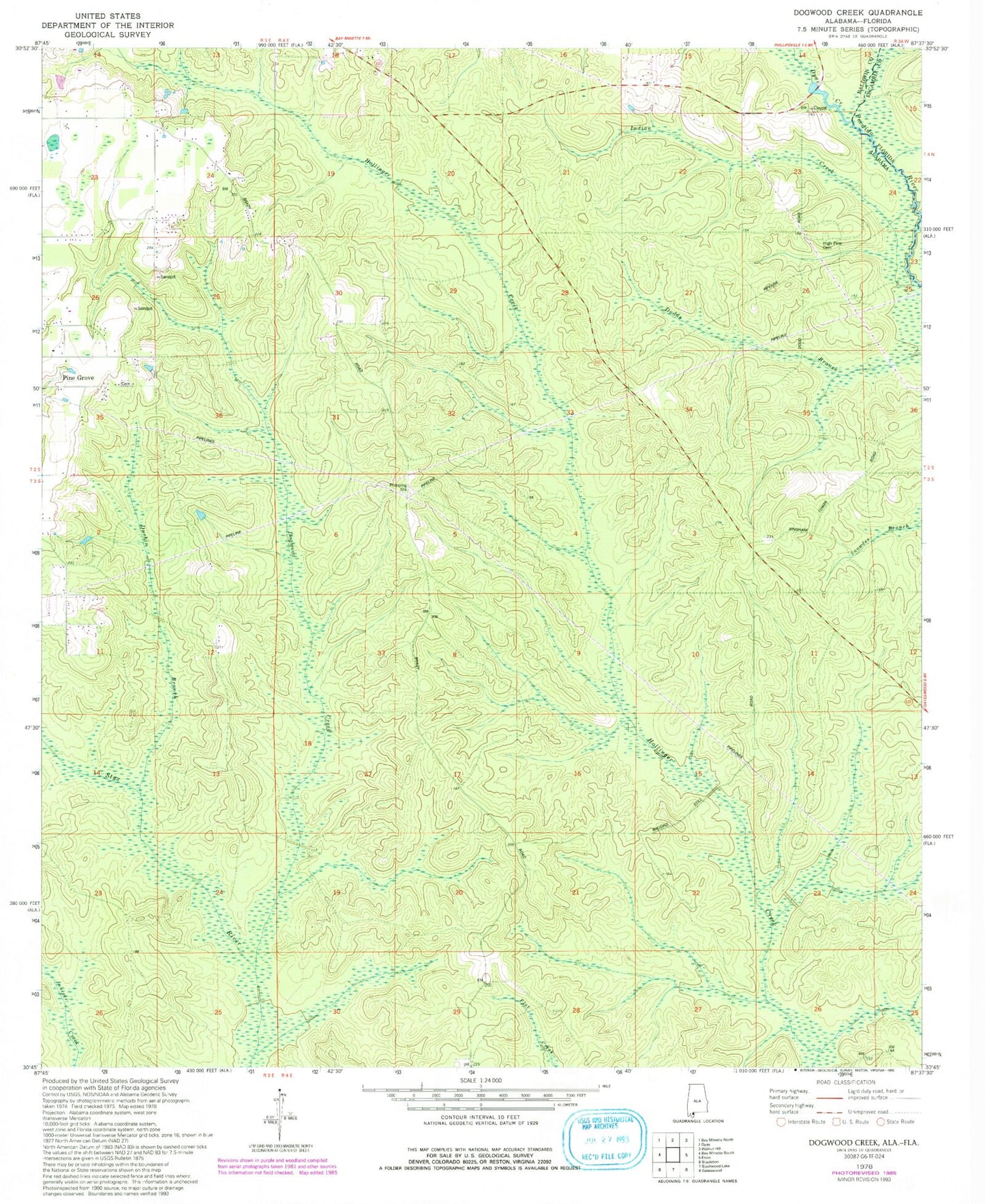
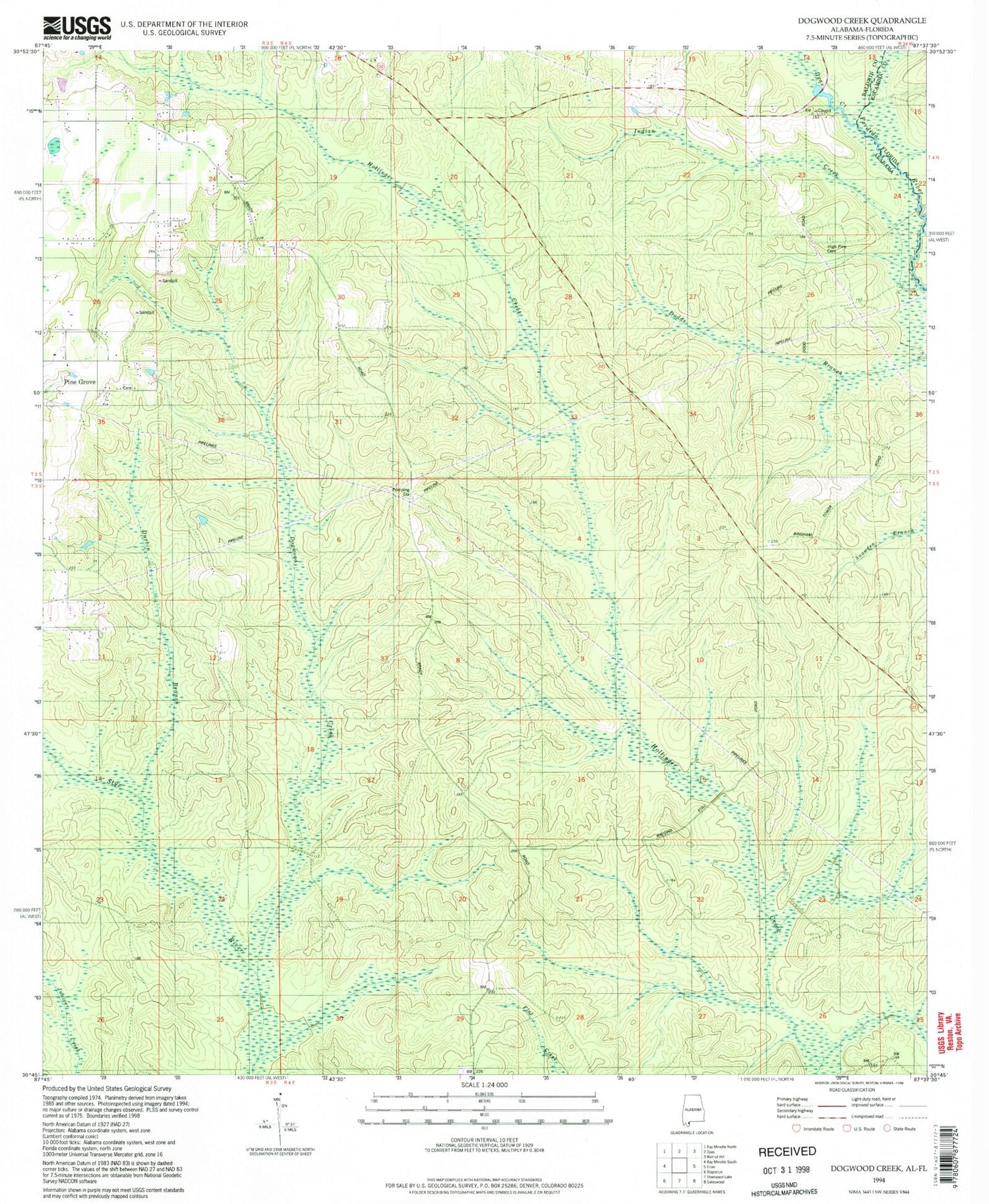
Historical USGS topographic quad map of Dogwood Creek in the state of Alabama. Map scale may vary for some years, but is generally around 1:24,000. Print size is approximately 24" x 27"
This quadrangle is in the following counties: Baldwin, Escambia.
The map contains contour lines, roads, rivers, towns, and lakes. Printed on high-quality waterproof paper with UV fade-resistant inks, and shipped rolled.
Contains the following named places: Bay Minette Division, Bingham Fire Tower, Dogwood Creek, Durbin Branch, Dyas Creek, High Pine Cemetery, Indian Creek, Light of the World Church, Pine Grove, Pine Grove Cemetery, Pine Grove Church, ZIP Code: 36507