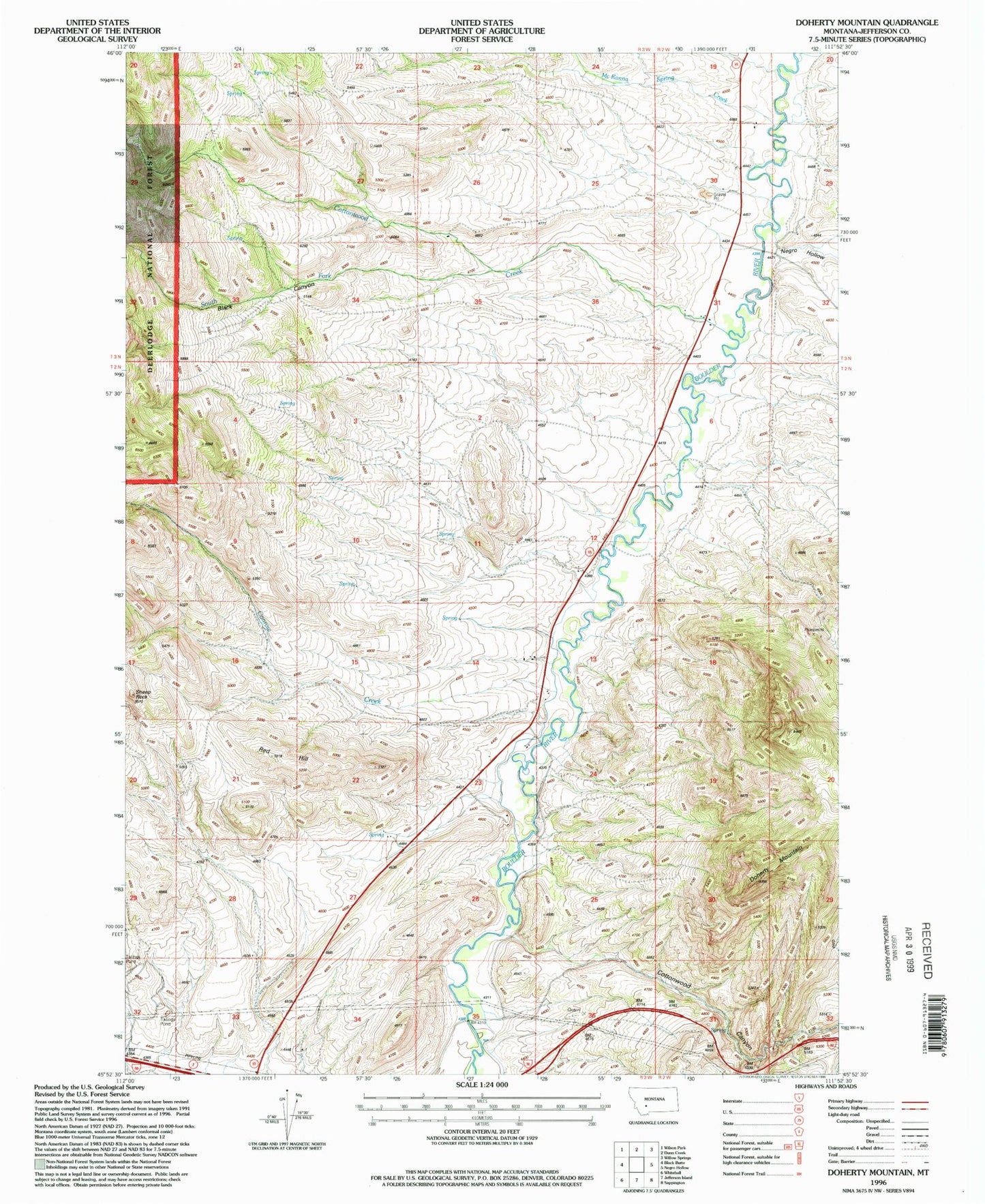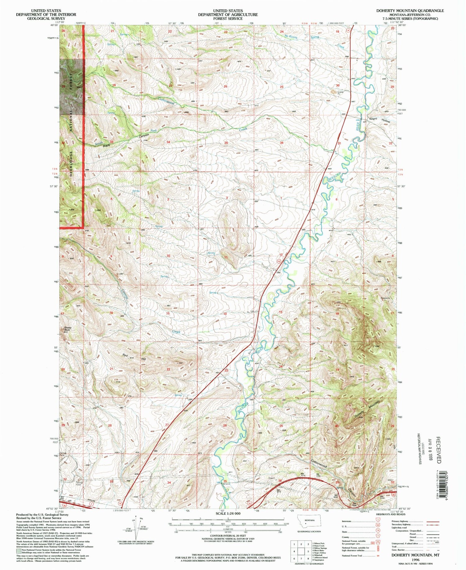
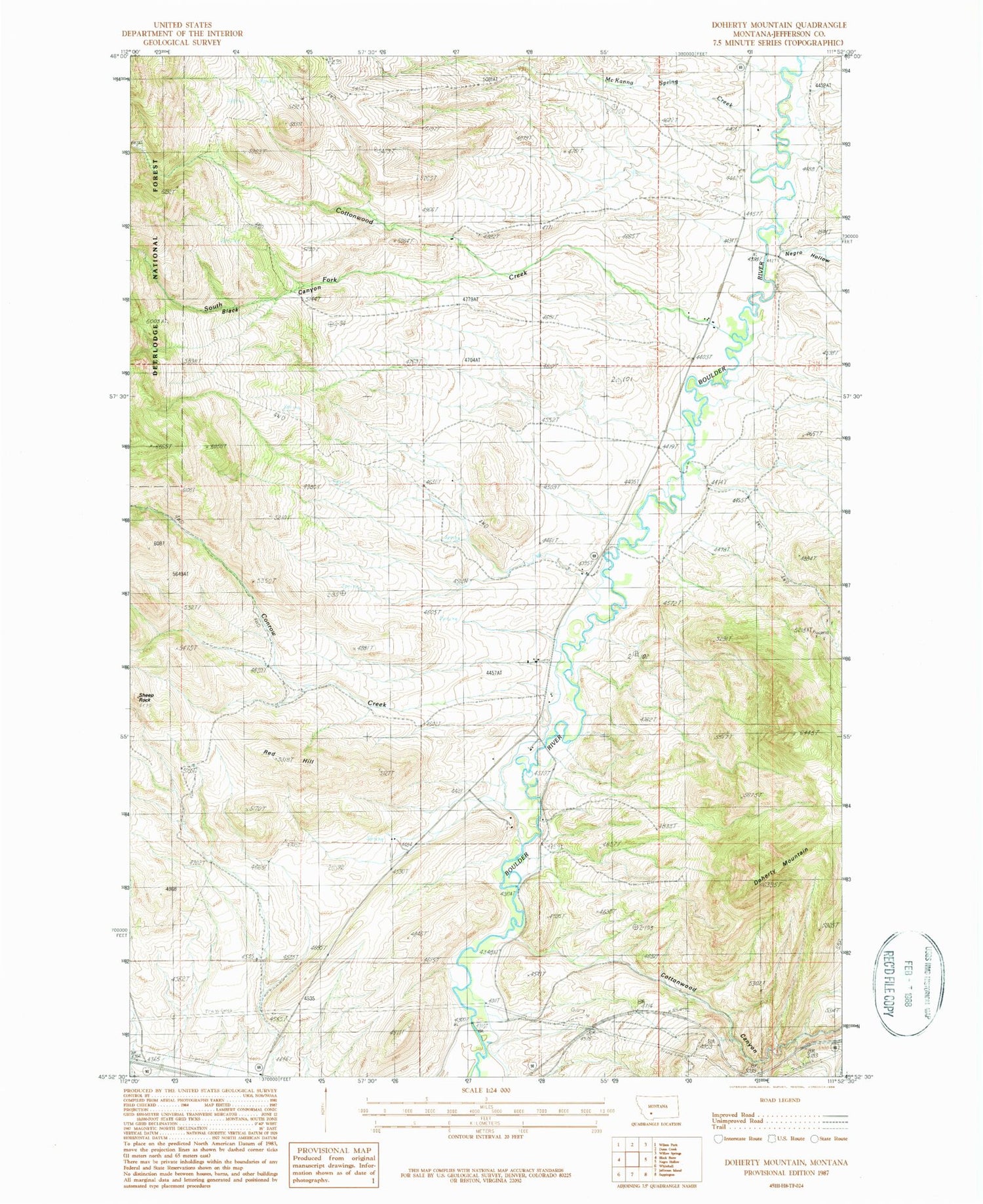
MyTopo
Classic USGS Doherty Mountain Montana 7.5'x7.5' Topo Map
Couldn't load pickup availability
Historical USGS topographic quad map of Doherty Mountain in the state of Montana. Map scale may vary for some years, but is generally around 1:24,000. Print size is approximately 24" x 27"
This quadrangle is in the following counties: Jefferson.
The map contains contour lines, roads, rivers, towns, and lakes. Printed on high-quality waterproof paper with UV fade-resistant inks, and shipped rolled.
Contains the following named places: 02N03W12CACD01 Well, 02N03W12CADC01 Well, 02N03W15CBC_01 Well, 02N03W22DCDD01 Well, 02N03W23DDBD01 Well, 03N02W29CDBC01 Well, Black Canyon, Brenner Ranch, Cold Spring, Cold Spring Post Office, Cold Springs School, Conrow Creek, Cottonwood Canyon, Cottonwood Creek, Dawson Ranch, Doherty Mountain, Elliott Ranch, Frisbe Mine, Mayne Ranch, McKanna Spring Creek, Pryor Ranch, Red Hill, Shafthouse Hill Mine, South Fork Cottonwood Creek