MyTopo
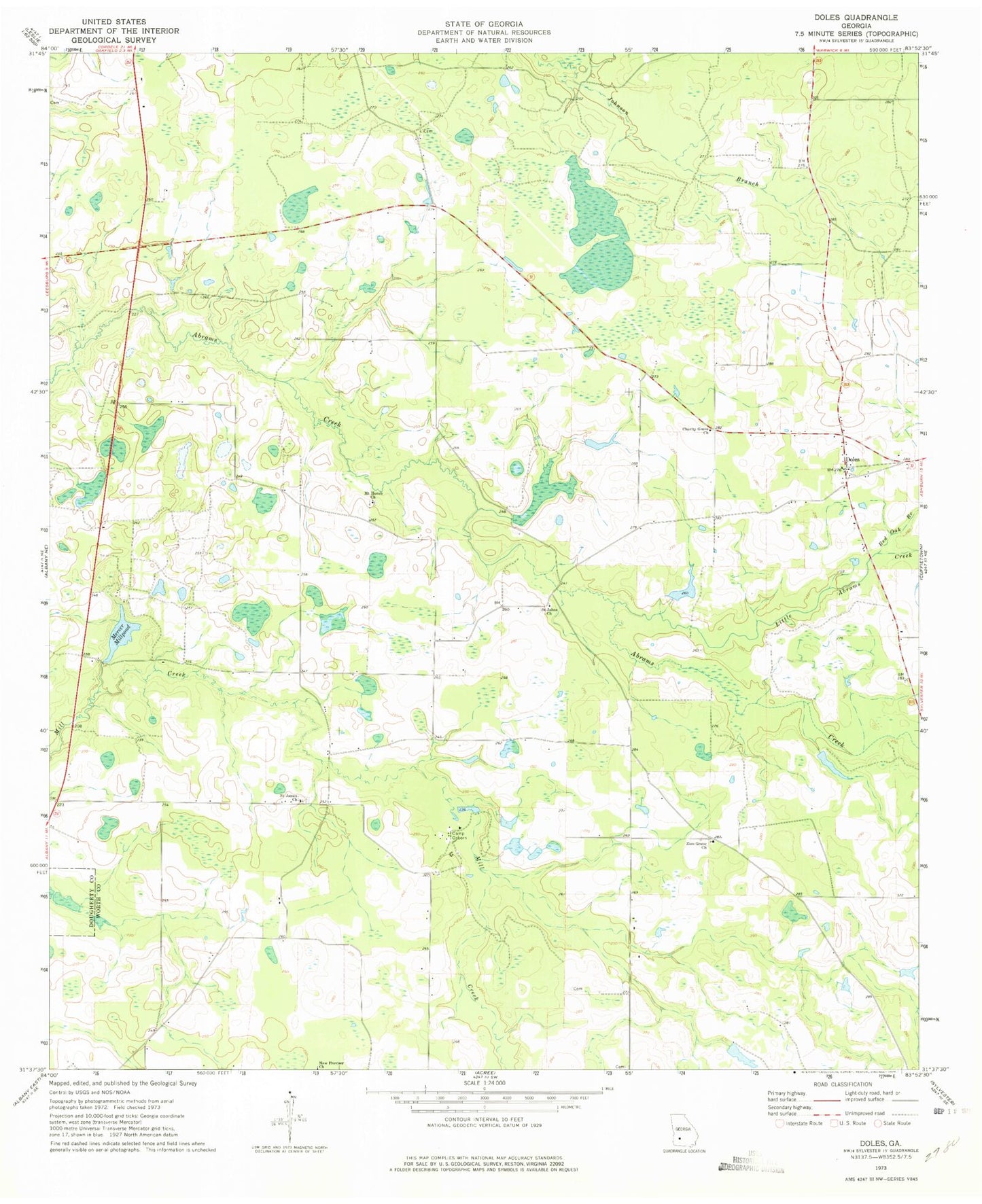
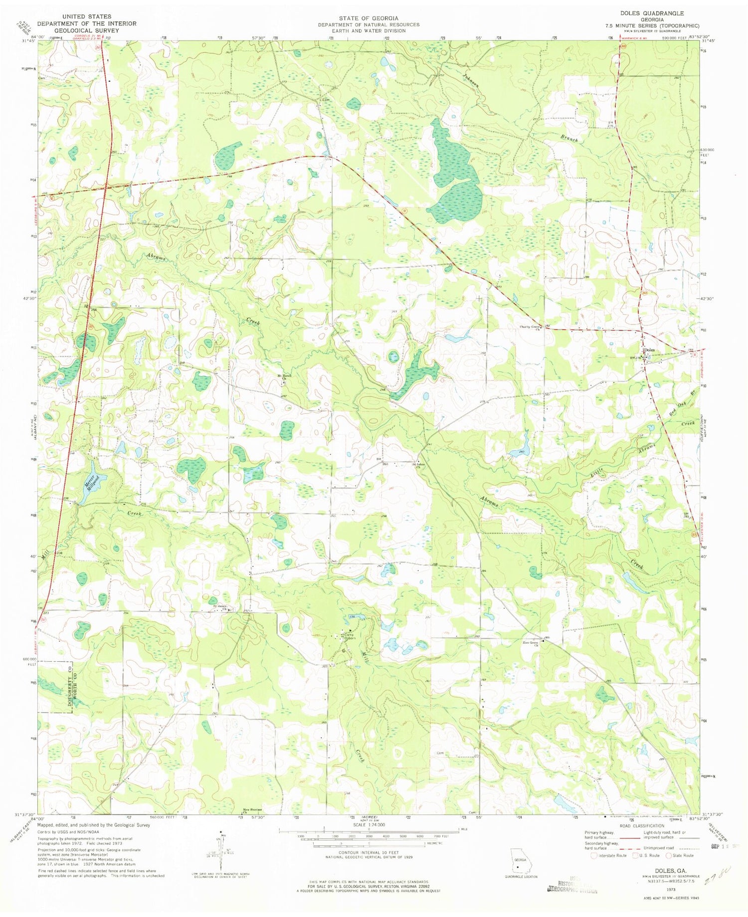
Classic USGS Doles Georgia 7.5'x7.5' Topo Map
Couldn't load pickup availability
Historical USGS topographic quad map of Doles in the state of Georgia. Map scale may vary for some years, but is generally around 1:24,000. Print size is approximately 24" x 27"
This quadrangle is in the following counties: Dougherty, Worth.
The map contains contour lines, roads, rivers, towns, and lakes. Printed on high-quality waterproof paper with UV fade-resistant inks, and shipped rolled.
Contains the following named places: Abrams School, Aultmans, Blue Spring, Buckaloo School, Camp Osborn, Charity Grove Church, Charity Grove School, Davis School, Doles, Doles School, Doles Volunteer Fire Department Station 11, Fords Store, Friendship School, Johnson Branch, Little Abrams Creek, Mercer Mill School, Mercer Millpond, Mercer Millpond Dam, Mount Horeb Cemetery, Mount Horeb Church, New Provisor Church, Pinder Town Cemetery, Red Oak Branch, Rouses Store, Saint James Cemetery, Saint James Church, Saint James School, Saint Johns Church, Salem Cemetery, Tison Lake, Tison Lake Dam, Warwick Division, Zion Grove Church, Zion Grove School, ZIP Code: 31772