MyTopo
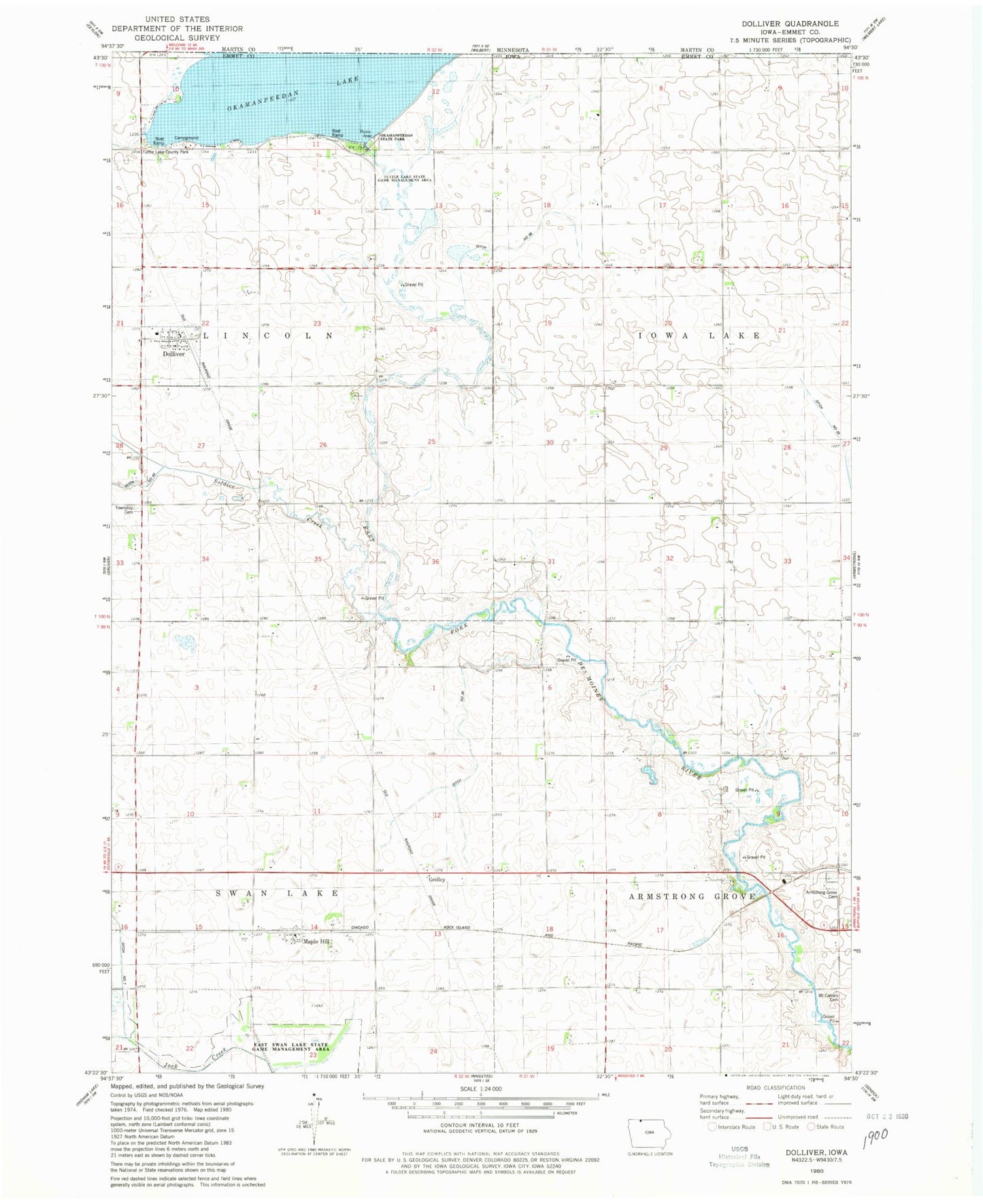
Classic USGS Dolliver Iowa 7.5'x7.5' Topo Map
Couldn't load pickup availability
Historical USGS topographic quad map of Dolliver in the state of Iowa. Map scale may vary for some years, but is generally around 1:24,000. Print size is approximately 24" x 27"
This quadrangle is in the following counties: Emmet.
The map contains contour lines, roads, rivers, towns, and lakes. Printed on high-quality waterproof paper with UV fade-resistant inks, and shipped rolled.
Contains the following named places: Armstrong Grove Cemetery, City of Dolliver, Ditch Number 26, Ditch Number 68, Dolliver, Dolliver Post Office, Ellsworth Ranch Bridge, Gridley, Gridley Post Office, Gruver Fire Department Station 2, Guse Farms, Lincoln Township Cemetery, Maple Hill, Maple Hill Post Office, Mount Calvary Cemetery, Okamanpeedan Lake, Okomanpado Lake Historical Marker, Saint Marys Catholic Cemetery, Township of Armstrong Grove, Township of Iowa Lake, Township of Lincoln, Township of Swan Lake, Tuttle Lake County Park, Tuttle Lake State Game Management Area, ZIP Code: 50531