MyTopo
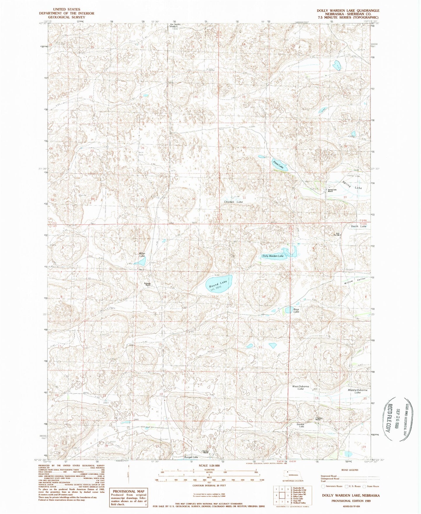
Classic USGS Dolly Warden Lake Nebraska 7.5'x7.5' Topo Map
Couldn't load pickup availability
Historical USGS topographic quad map of Dolly Warden Lake in the state of Nebraska. Map scale may vary for some years, but is generally around 1:24,000. Print size is approximately 24" x 27"
This quadrangle is in the following counties: Sheridan.
The map contains contour lines, roads, rivers, towns, and lakes. Printed on high-quality waterproof paper with UV fade-resistant inks, and shipped rolled.
Contains the following named places: Chicken Lake, Dolly Warden Lake, F Sandoz Ranch, Hill Crest School, J Sandoz Ranch, Keys Lake, Mari Sandoz Museum, Middle Osborne Lake, Miller Lake, Peterson Ranch, Petes Lake, Round Lake, Sandoz Lake, School Number 166, Smith Lake, Spring Lake, Spring Lake Airport, Spring Lake Ranch, West Osborne Lake