MyTopo
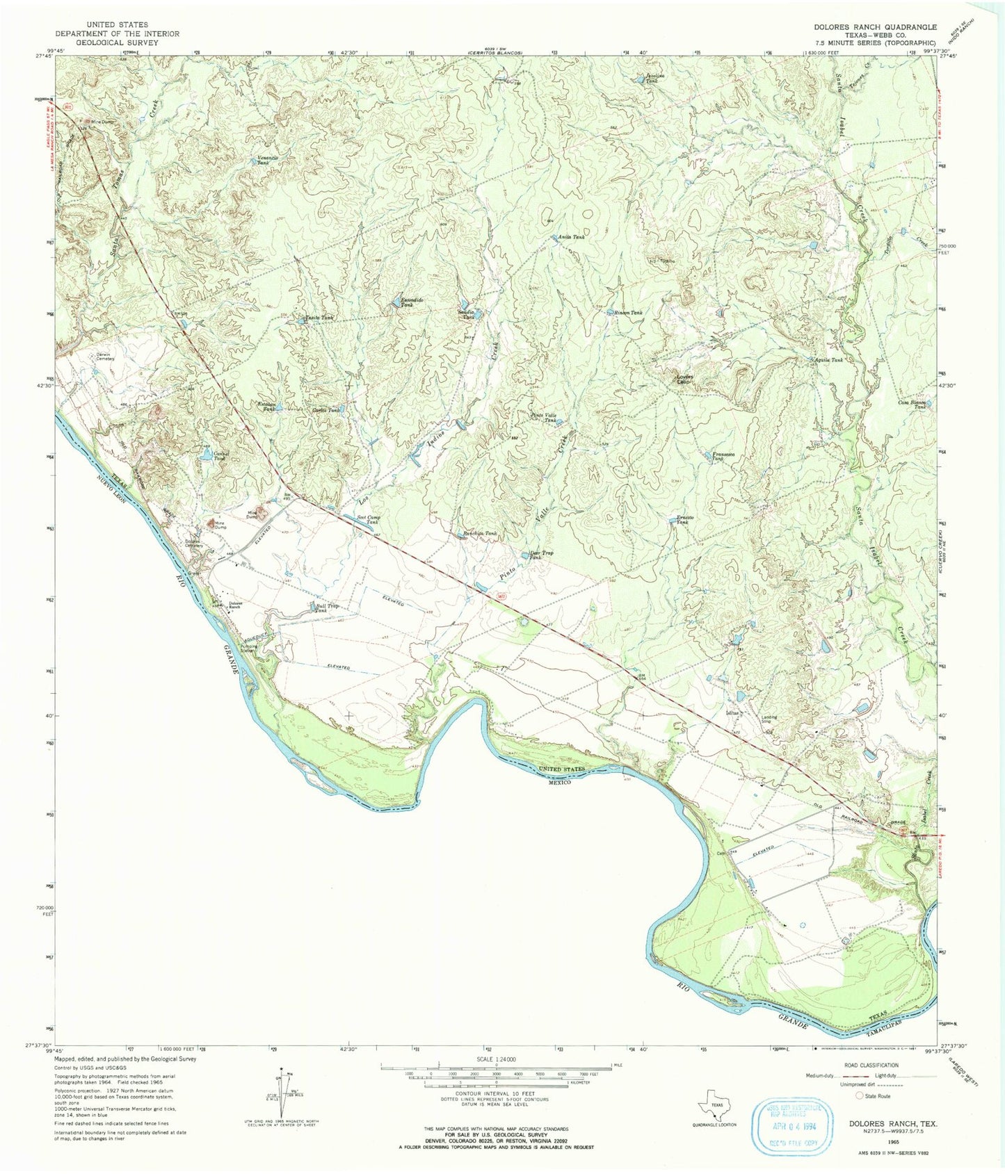
Classic USGS Dolores Ranch Texas 7.5'x7.5' Topo Map
Couldn't load pickup availability
Historical USGS topographic quad map of Dolores Ranch in the state of Texas. Map scale may vary for some years, but is generally around 1:24,000. Print size is approximately 24" x 27"
This quadrangle is in the following counties: Webb.
The map contains contour lines, roads, rivers, towns, and lakes. Printed on high-quality waterproof paper with UV fade-resistant inks, and shipped rolled.
Contains the following named places: Aguila Tank, Anita Tank, Bull Trap Tank, Cannel Tank, Carlos Tank, Casa Blanca Tank, Darwin Cemetery, Deer Trap Tank, Dolores Cemetery, Dolores Ranch, Ernesto Tank, Escondido Tank, Estaban Tank, Fransesca Tank, Islitas, Javelina Tank, KGNS-TV (Laredo), Laredo Fire Department Station 13, Los Indios Creek, Lovers Leap, Pinto Valle Creek, Pinto Valle Tank, Ranchita Tank, Rincon Tank, Sandia Tank, Santa Isabel Creek, Scot Camp Tank, Tasita Tank, Tejones Creek, Tordillo Creek, United States Border Patrol Station, Venancio Tank