MyTopo
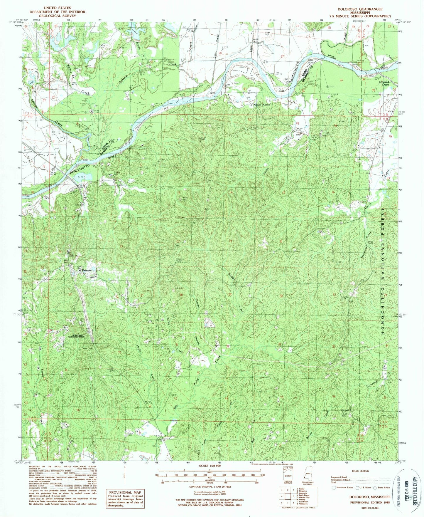
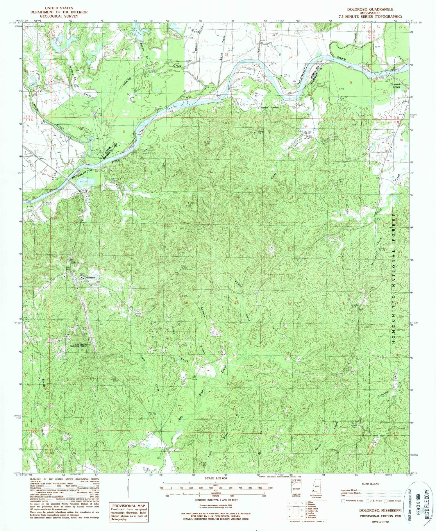
Classic USGS Doloroso Mississippi 7.5'x7.5' Topo Map
Couldn't load pickup availability
Historical USGS topographic quad map of Doloroso in the state of Mississippi. Map scale may vary for some years, but is generally around 1:24,000. Print size is approximately 24" x 27"
This quadrangle is in the following counties: Adams, Wilkinson.
The map contains contour lines, roads, rivers, towns, and lakes. Printed on high-quality waterproof paper with UV fade-resistant inks, and shipped rolled.
Contains the following named places: Armstrong Oil Field, Brown Creek, Bucks Creek, Buena Vista Church, Bunch Cemetery, Chase Bayou, Commencement Oil Field, Crooked Creek, Crosby Post Office, Cypress Branch, Darrington Oil Field, Doloroso, Doloroso Oil Field, East Commencement Oil Field, Folley Creek, Free Spring Church, Geter Cemetery, Hazlit Creek, Hazlit Creek Oil Field, Hurricane Creek, Hyde Park School, Lynn Creek, Mandamus Oil Field, Mars Hill Church, Martin Creek, Oak Grove Church, Phipps Creek, Pine Creek Oil Field, Possum Corner, Possum Corner Oil Field, Rose Hill Church, Sammy Creek, Sandy Creek Oil Field, Second Creek, Second Creek Structure 8 Dam, Second Creek Structure 9 Dam, South Possum Corner Oil Field, South Sammy Creek Oil Field, Southeast Ellislie Oil Field, Town Creek, West Possum Corner Oil Field, Whites Creek