MyTopo
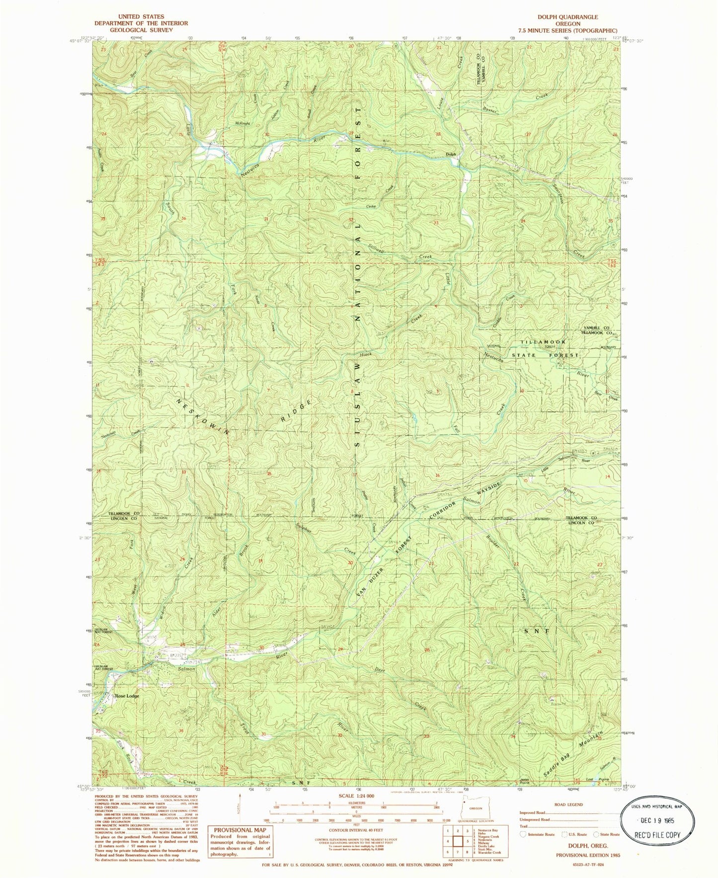
Classic USGS Dolph Oregon 7.5'x7.5' Topo Map
Couldn't load pickup availability
Historical USGS topographic quad map of Dolph in the state of Oregon. Map scale may vary for some years, but is generally around 1:24,000. Print size is approximately 24" x 27"
This quadrangle is in the following counties: Lincoln, Tillamook, Yamhill.
The map contains contour lines, roads, rivers, towns, and lakes. Printed on high-quality waterproof paper with UV fade-resistant inks, and shipped rolled.
Contains the following named places: Alder Brook, Baxter Creek, Bear Creek, Boulder Creek, Boyer Post Office, Cedar Creek, Conklin Creek, Deer Creek, Dolph, Dolph Post Office, Fall Creek, Gunaldo Falls, H B Van Duzer Forest State Scenic Corridor, Hiack Creek, Indian Creek, Jeeter Prairie, Judson Creek, Kautz Creek, Little Creek, Little Nestucca Camp, Little Salmon River, Louie Creek, McAllister Creek, McKnight Creek, Muscott Bridge, Muscott Creek, Neskowin Ridge, Pitner Post Office, Prairie Creek, Salmon River Guard Station, Salmon River State Forest Service Station, Small Creek, Sourgrass Creek, South Fork Little Nestucca River, Stillwell Creek, Sulphur Creek, Swampy Creek, Treat River, Trout Creek, Weed Bridge, West Fork Salmon River, Widow Creek, Yach Bridge