MyTopo
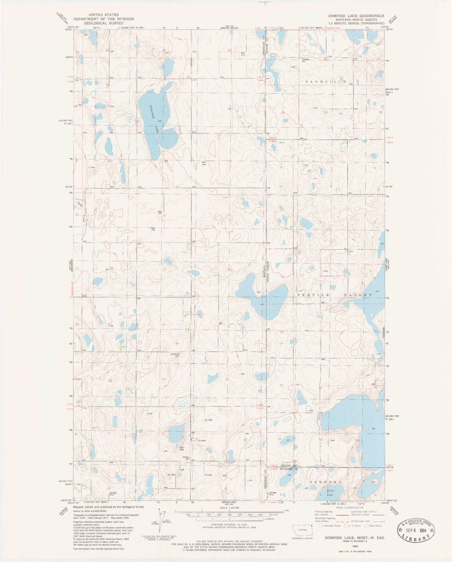
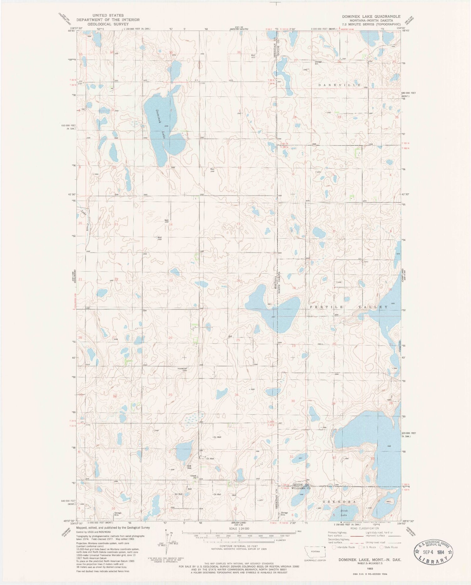
Classic USGS Dominek Lake Montana 7.5'x7.5' Topo Map
Couldn't load pickup availability
Historical USGS topographic quad map of Dominek Lake in the state of Montana. Map scale may vary for some years, but is generally around 1:24,000. Print size is approximately 24" x 27"
This quadrangle is in the following counties: Divide, Sheridan, Williams.
The map contains contour lines, roads, rivers, towns, and lakes. Printed on high-quality waterproof paper with UV fade-resistant inks, and shipped rolled.
Contains the following named places: 33N58E01ABAB01 Well, 34N58E13AAAD01 Well, 34N58E13AAAD02 Well, 34N58E13BBDD01 Well, 34N58E13CDBB01 Well, 34N58E14AAAA01 Well, 34N58E14ACAA01 Well, 34N58E14BDDD01 Well, 34N58E14CBDD01 Well, 34N58E14DBDD01 Well, 34N58E22AACC01 Well, 34N58E23BBBB01 Well, 34N58E26ADAB01 Well, 35N58E36CBBB01 Well, Dominek Lake, Immanuel Cemetery, Monota Post Office, Whittier School