MyTopo
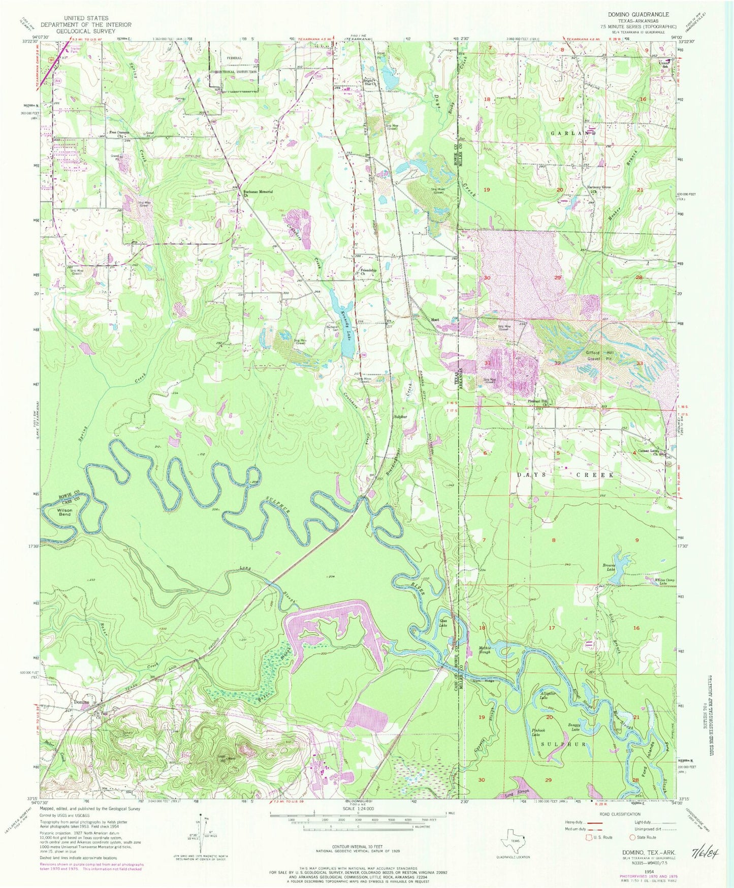
Classic USGS Domino Texas 7.5'x7.5' Topo Map
Couldn't load pickup availability
Historical USGS topographic quad map of Domino in the states of Texas, Arkansas. Map scale may vary for some years, but is generally around 1:24,000. Print size is approximately 24" x 27"
This quadrangle is in the following counties: Bowie, Cass, Miller.
The map contains contour lines, roads, rivers, towns, and lakes. Printed on high-quality waterproof paper with UV fade-resistant inks, and shipped rolled.
Contains the following named places: Alligator Lake, Apostolic Heritage Church, Baker Creek, Baker Slough, Boardinghouse Creek, Bright Star Church, Browns Lake, Buchanan Cemetery, Buchanan First Baptist Church, Buchanan Memorial Church, Canaan Land Church, Crutchers Creek, Cypress Slough, Domino, Domino Cemetery, Elliott Slough, Ford Islands, Ford Slough, Free Oneness Church, Friendship Church, Gifford Hill Dam, Gifford Hill Gravel Pit, Gifford Hill Lake, Goss Lake, Gum Ridge, Harmony Grove Church, Hooker Branch, Hoot, Kennedy Dam, Kennedy Lake, Liberty - Eylau Volunteer Fire Department Station 2, Lick Branch, Line Ferry, Long Slough, Mathis Slough, Moes Slough, Pinhook Lake, Pleasant Hill, Pleasant Hill Church, Pleasant Hill Fire Department, Rocky Creek, Saint Paul Church, Snaggy Lake, Spring Creek, Sulphur, Trinity Volunteer Fire Department, Whites Camp Lake, Wilson Bend