MyTopo
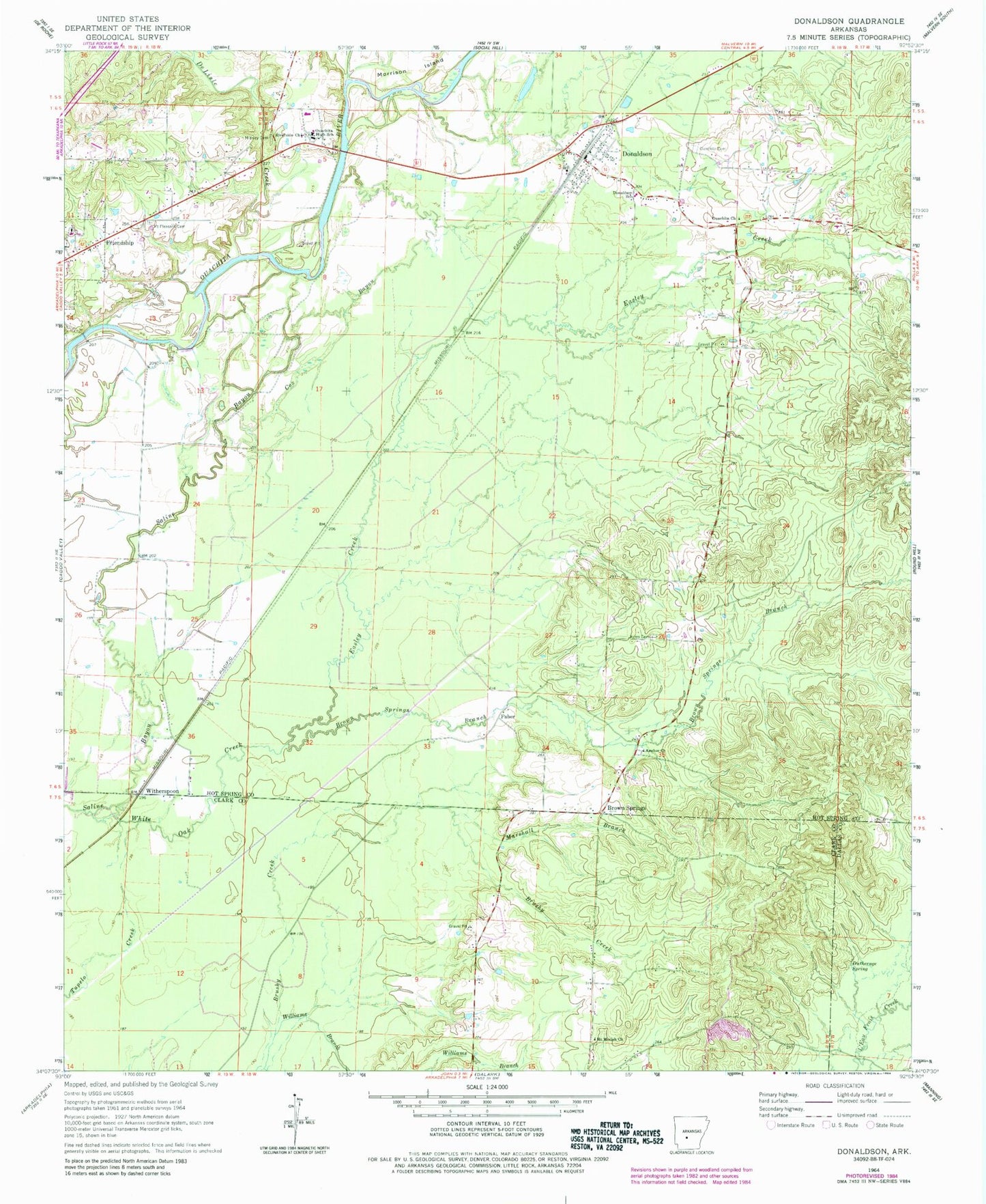
Classic USGS Donaldson Arkansas 7.5'x7.5' Topo Map
Couldn't load pickup availability
Historical USGS topographic quad map of Donaldson in the state of Arkansas. Map scale may vary for some years, but is generally around 1:24,000. Print size is approximately 24" x 27"
This quadrangle is in the following counties: Clark, Dallas, Hot Spring.
The map contains contour lines, roads, rivers, towns, and lakes. Printed on high-quality waterproof paper with UV fade-resistant inks, and shipped rolled.
Contains the following named places: Anchor Baptist Church, Brown Springs, Brown Springs Branch, Cox Bayou, DeLisle Creek, Donaldson, Donaldson City Marshal, Donaldson Post Office, Donaldson School, Dutherage Spring, Easley Creek, Faber, Friendship Post Office, Jones Cemetery, Marshall Branch, Midway Cemetery, Mount Moriah Baptist Church, Mount Pleasant Cemetery, Ouachita Cemetery, Ouachita Church, Ouachita Elementary School, Ouachita Fire Department, Ouachita Fire Department Donaldson Station, Ouachita High School, Riverside Baptist Church, Town of Donaldson, Township of Brown Springs, Township of Ouachita, West Fork DeLisle Creek, White Oak Creek, Williams Branch, Witherspoon, ZIP Code: 71941