MyTopo
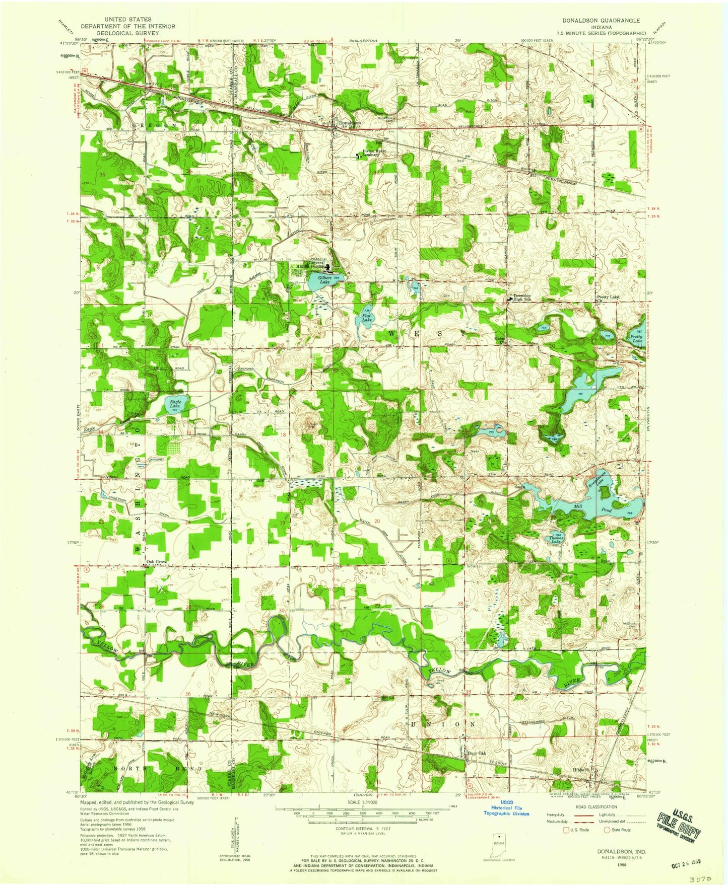
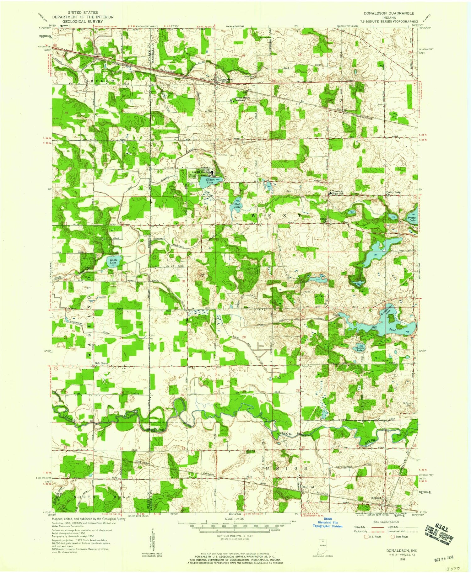
Classic USGS Donaldson Indiana 7.5'x7.5' Topo Map
Couldn't load pickup availability
Historical USGS topographic quad map of Donaldson in the state of Indiana. Map scale may vary for some years, but is generally around 1:24,000. Print size is approximately 24" x 27"
This quadrangle is in the following counties: Marshall, Starke.
The map contains contour lines, roads, rivers, towns, and lakes. Printed on high-quality waterproof paper with UV fade-resistant inks, and shipped rolled.
Contains the following named places: Ancilla Domini College, Anderson Ditch, Bartinger Ditch, Blad Ditch, Burr Oak, Burr Oak Cemetery, Carl Gjemre Ditch, Circle L Ranch, Divine Heart Seminary, Donaldson, Donaldson Cemetery, Donaldson Post Office, Eagle Lake, Flat Lake, Gibson Airport, Gilbert Lake, Gunnard Anderson Ditch, H J Umbaugh Airport, Harry Cool Ditch, I & C Field, J M J Dairy Farm, Kreighbaum Lake, Lake Latonka Dam, Listenberger Ditch, McElrath Cemetery, Mount Carmel Cemetery, Oak Grove, Pretty Lake Church, Schori Lake, Schori Lake Dam, Solomon Ditch, South Arm Ditch, Thomas Lake, Township of West, West Elementary School, Willets Lake, Wolff Livestock Farm, Zehner Millpond, Zehner Millpond Dam