MyTopo
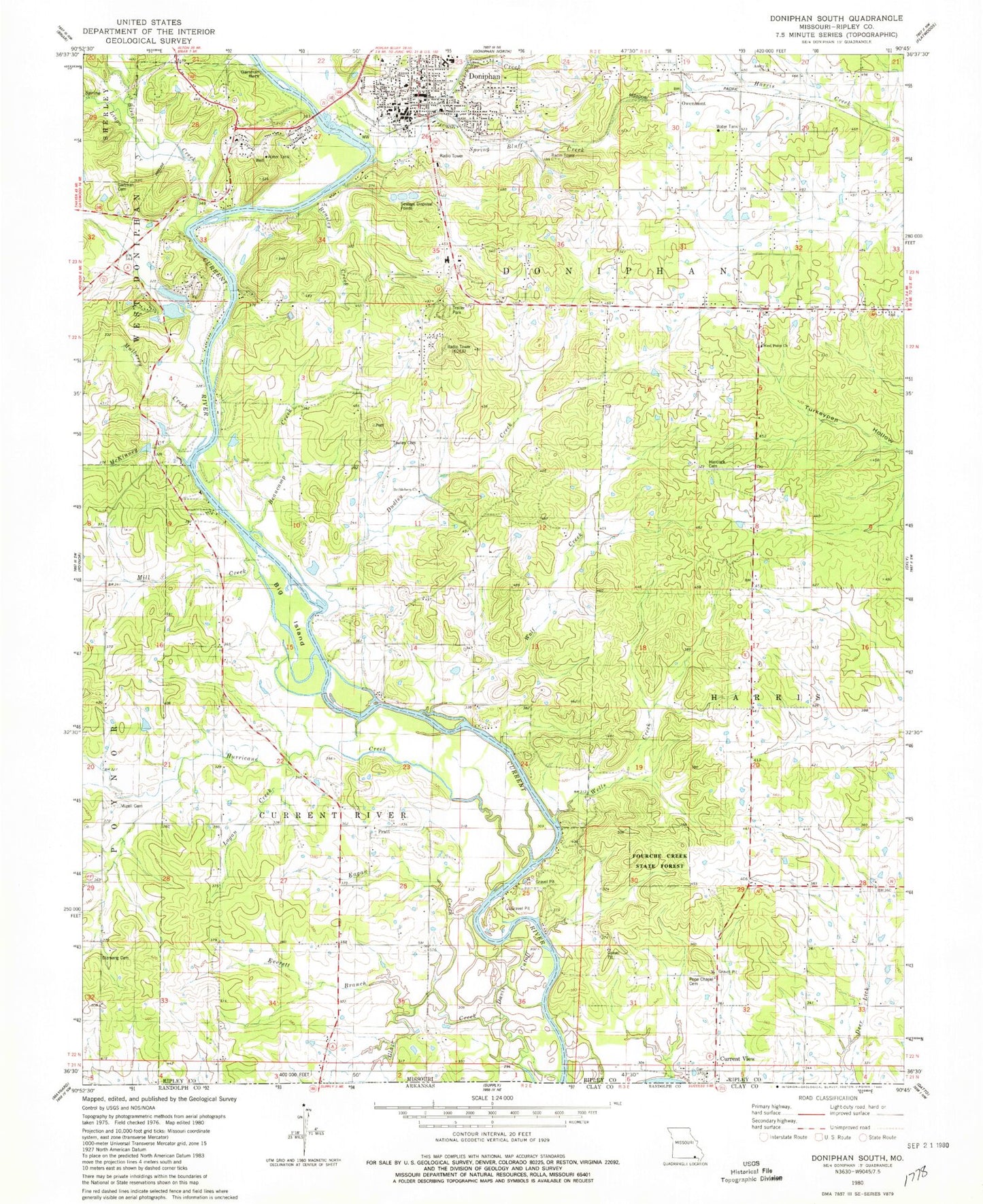
Classic USGS Doniphan South Missouri 7.5'x7.5' Topo Map
Couldn't load pickup availability
Historical USGS topographic quad map of Doniphan South in the state of Missouri. Map scale may vary for some years, but is generally around 1:24,000. Print size is approximately 24" x 27"
This quadrangle is in the following counties: Ripley.
The map contains contour lines, roads, rivers, towns, and lakes. Printed on high-quality waterproof paper with UV fade-resistant inks, and shipped rolled.
Contains the following named places: Amity Church, Barkadare School, Beasley Creek, Beaucamp Creek, Bellview East School, Bethel Church, Bethlehem Church, Big Island, Bluff Cottage, Briar Creek, Cedar Lodge, City of Doniphan, Current River Volunteer Fire Department, Currentview Elementary School, Daltons Mill, Davis Cutoff, Dizmang School, Doniphan, Doniphan Fire Department, Doniphan Police Department, Doniphan Post Office, Dudley Creek, Dudleys Club, Eagan Creek, Everett Branch, Fourche Creek State Forest, Gartman Cemetery, Gartman Rock, Goose Lake, Greenwood School, Hancock Cemetery, Hancock School, Hurricane Creek, KDFN-AM (Doniphan), Klenn Creek, KoeA-FM (Doniphan), Lede, Lingo Creek, Logan Creek, Loreys Cabins, Matthews Cabins, McKinney Creek, Merrell Branch, Mill Creek, Mill Creek School, Mizell Cemetery, Mulberry Creek, Owenmont, Pine Hill Hollow, Pope Chapel, Pope Chapel Cemetery, Pratt, Pratt Church, Pratt School, Purman Community Volunteer Fire Department, Quick Creek, Ripley Chapel, Ripley County Sheriff's Office, Sanky Hall, Sanky Hall Cemetery, Sipes Club, Southeast Health Medical Center Ripley County, Spring Bluff Creek, Towles Cemetery, Towles School, Township of Current River, Township of Harris, Township of West Doniphan, Wells Creek, West Point Church, West Point School, Wolf Creek