MyTopo
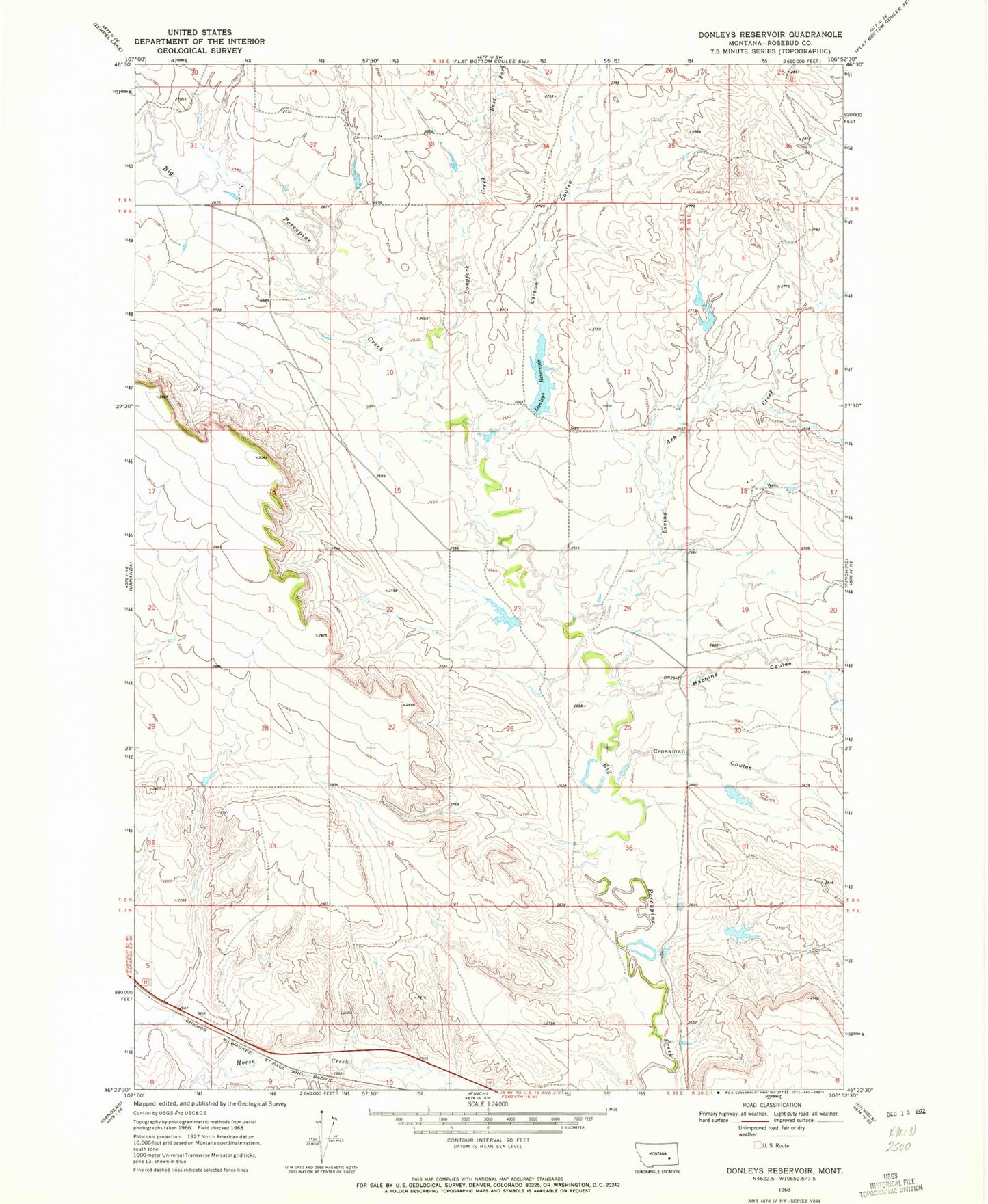
Classic USGS Donleys Reservoir Montana 7.5'x7.5' Topo Map
Couldn't load pickup availability
Historical USGS topographic quad map of Donleys Reservoir in the state of Montana. Map scale may vary for some years, but is generally around 1:24,000. Print size is approximately 24" x 27"
This quadrangle is in the following counties: Rosebud.
The map contains contour lines, roads, rivers, towns, and lakes. Printed on high-quality waterproof paper with UV fade-resistant inks, and shipped rolled.
Contains the following named places: 08N38E20DC__01 Well, 08N38E24C___01 Well, Crossman Coulee, Donleys Reservoir, Donleys Reservoir Dam, East Fork Longfork Creek, Erickson Number 3 Dam, Erickson Number 4 Dam, French Number 10 Dam, French Number 9 Dam, Larson Coulee, Living Ash Creek, Longfork Creek, Machine Coulee, Miller School, Otis Post Office, T L Johnson Number 1 Dam, T L Johnson Number 5 Dam