MyTopo
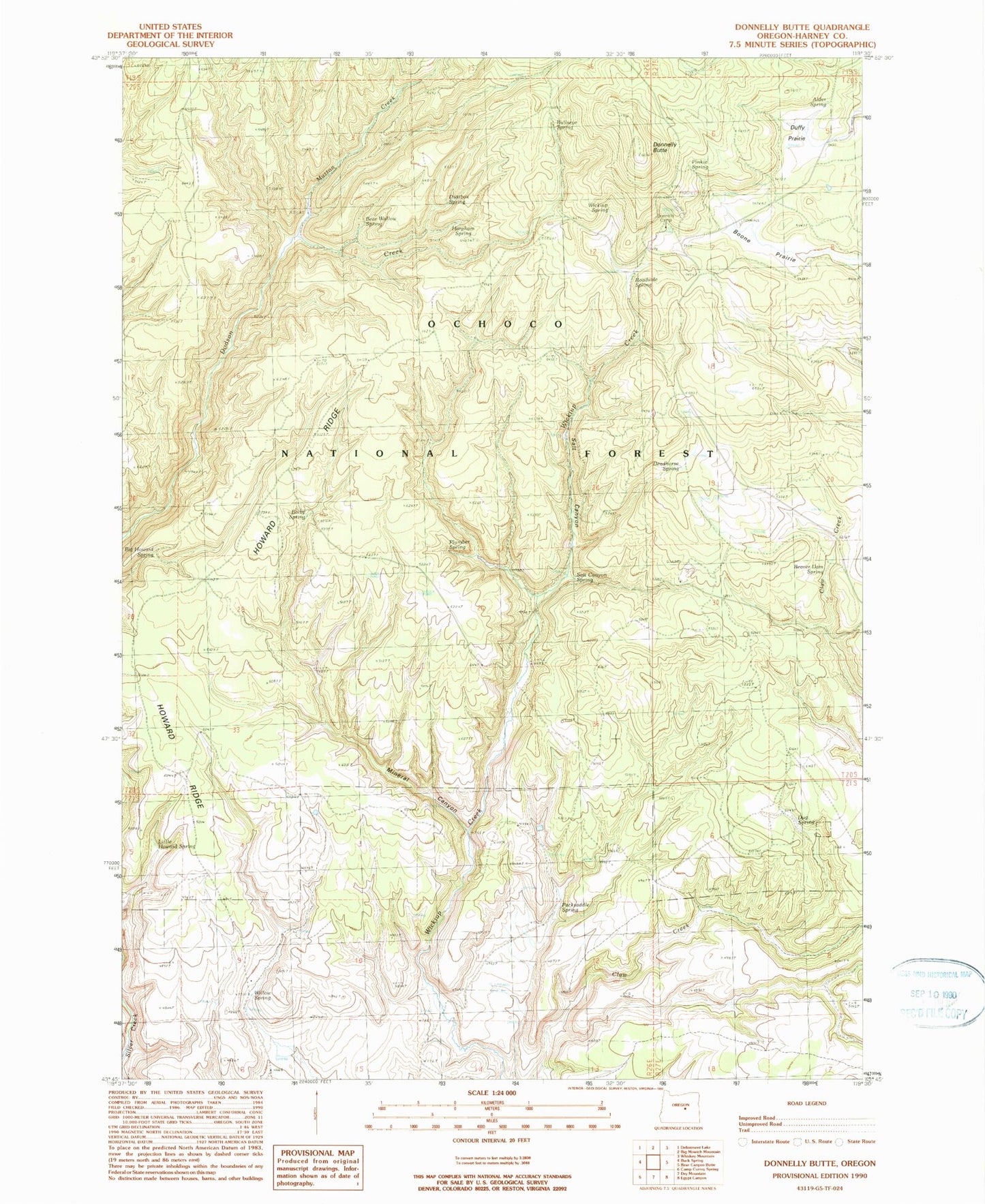
Classic USGS Donnelly Butte Oregon 7.5'x7.5' Topo Map
Couldn't load pickup availability
Historical USGS topographic quad map of Donnelly Butte in the state of Oregon. Map scale may vary for some years, but is generally around 1:24,000. Print size is approximately 24" x 27"
This quadrangle is in the following counties: Harney.
The map contains contour lines, roads, rivers, towns, and lakes. Printed on high-quality waterproof paper with UV fade-resistant inks, and shipped rolled.
Contains the following named places: Alder Spring, Bear Wallow Spring, Beaver Dam Spring, Big Howard Spring, Bixby Spring, Boone Prairie, Bullseye Spring, Deadhorse Spring, Donnelly Butte, Donnelly Camp, Duffy Prairie, Dug Spring, Dustbox Spring, Harpham Spring, Howard Ridge, Little Howard Spring, Mineral Canyon, Mutton Creek, Packsaddle Spring, Pinkie Spring, Plumber Spring, Riverside Spring, Roadside Spring, Salt Canyon, Salt Canyon Spring, Wickiup Spring, Willow Spring