MyTopo
Classic USGS Donnelly Minnesota 7.5'x7.5' Topo Map
Couldn't load pickup availability
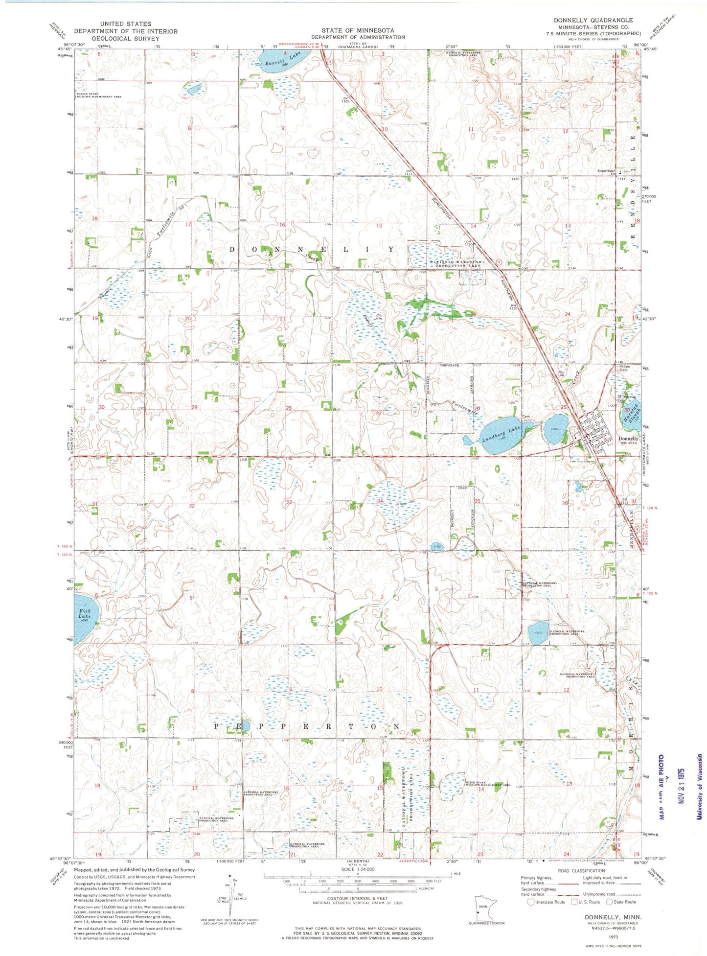
Historical USGS topographic quad map of Donnelly in the state of Minnesota. Map scale may vary for some years, but is generally around 1:24,000. Print size is approximately 24" x 27"
This quadrangle is in the following counties: Stevens.
The map contains contour lines, roads, rivers, towns, and lakes. Printed on high-quality waterproof paper with UV fade-resistant inks, and shipped rolled.
Contains the following named places: Barrett Lake, City of Donnelly, County Ditch Number One, Donnelly, Donnelly Fire Department, Donnelly Post Office, Kline State Wildlife Management Area, Kongsvinger Church, Kongsvinger Lutheran Cemetery, Lundberg Cemetery, Lundberg Lake, Saint John's Lutheran Church, Saint Theresia Cemetery, School Number 15, School Number 42, School Number 44, School Number 56, School Number 63, Township of Donnelly, Township of Pepperton, Vinger Cemetery, ZIP Code: 56235