
MyTopo
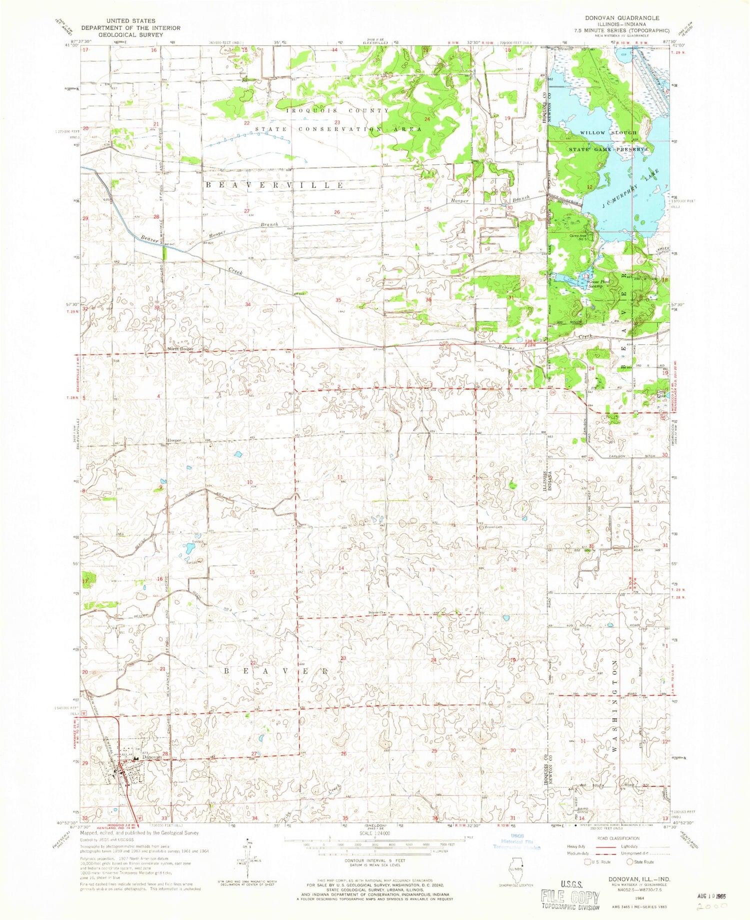
Classic USGS Donovan Illinois 7.5'x7.5' Topo Map
Couldn't load pickup availability
Historical USGS topographic quad map of Donovan in the states of Illinois, Indiana. Map scale may vary for some years, but is generally around 1:24,000. Print size is approximately 24" x 27"
This quadrangle is in the following counties: Iroquois, Newton.
The map contains contour lines, roads, rivers, towns, and lakes. Printed on high-quality waterproof paper with UV fade-resistant inks, and shipped rolled.
Contains the following named places: Beaver Cemetery, Beaver Church, Beaver Ditch Number 1, Beaver Ditch Number 2, Beaver Fire Protection District, College Corner School, Donovan, Donovan Junior High School, Donovan Post Office, Donovan Senior High School, Fairview School, Frigon School, Hooper, Hooper Branch, Independence School, Iroquois County State Conservation Area, J C Murphey Lake, J C Murphy Lake Dam, J H Grant Memorial Cemetery, Loy Airport, Maple Grove School, North Hooper, Pleasant Valley School, Russell Airport, Salem School, Township of Beaver, Township of Beaverville, Village of Donovan, West Grove School, ZIP Codes: 60912, 60931


