MyTopo
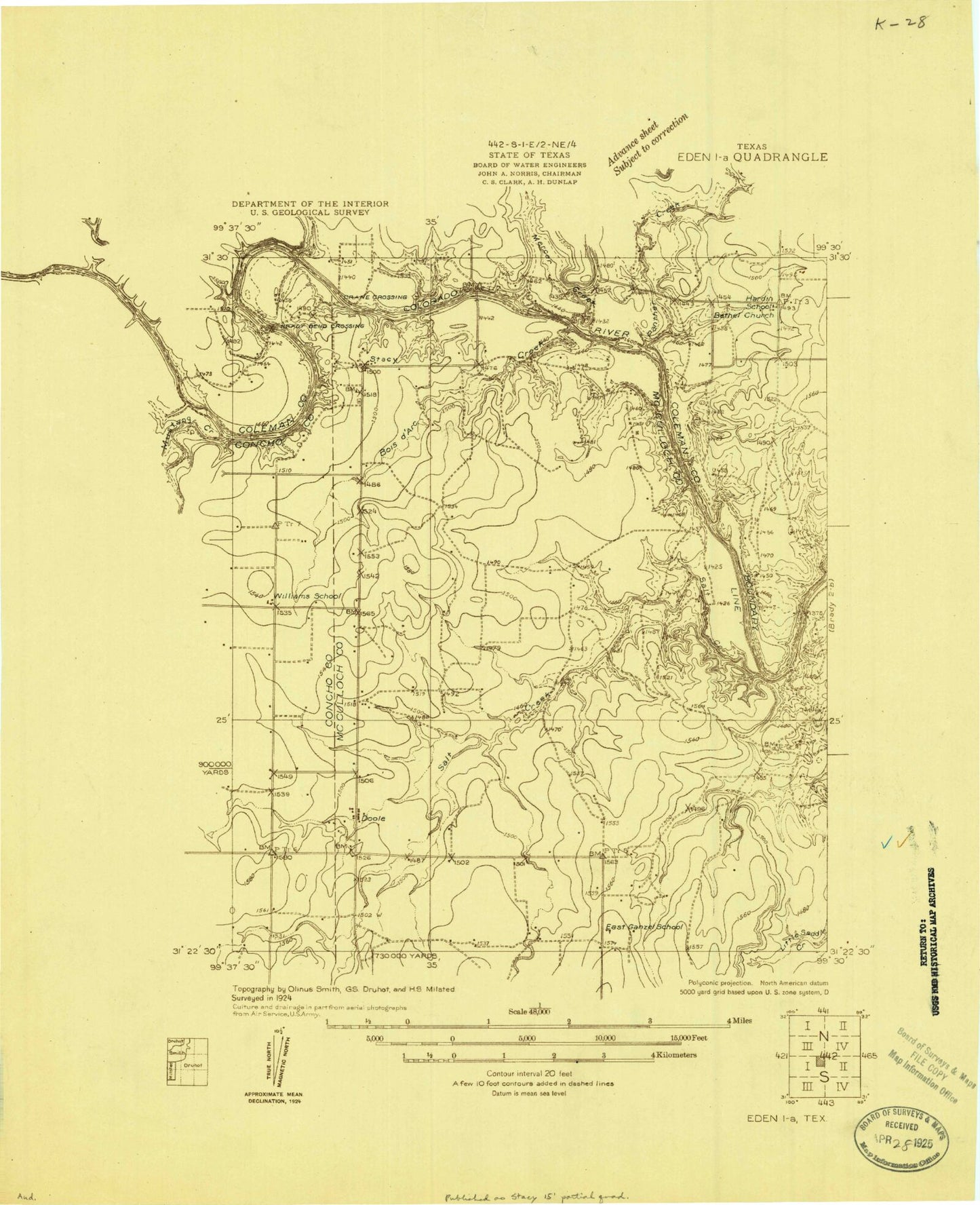
Classic USGS Doole Texas 7.5'x7.5' Topo Map
Regular price
$16.95
Regular price
Sale price
$16.95
Unit price
per
Couldn't load pickup availability
Historical USGS topographic quad map of Doole in the state of Texas. Map scale may vary for some years, but is generally around 1:24,000. Print size is approximately 24" x 27"
This quadrangle is in the following counties: Coleman, Concho, McCulloch.
The map contains contour lines, roads, rivers, towns, and lakes. Printed on high-quality waterproof paper with UV fade-resistant inks, and shipped rolled.
Contains the following named places: Bois d'Arc Creek, Brady Bend, Doole, Doole Post Office, Doole Volunteer Fire Department, J L Cox Estate Lake, J L Cox Estate Lake Dam, Mercer Creek, Panther Creek, Salt Branch, Salt Creek, Stacy, ZIP Code: 76836