MyTopo
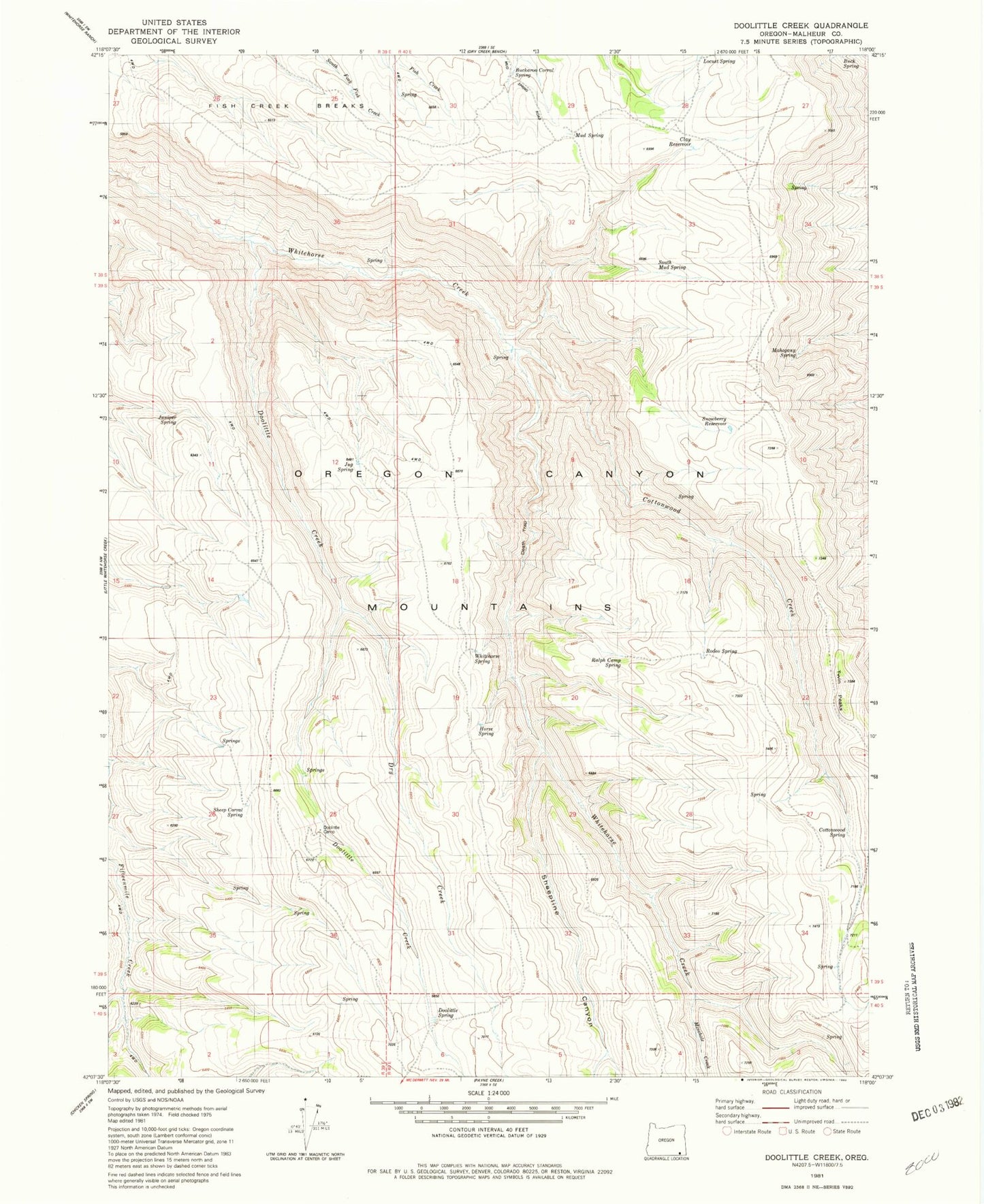
Classic USGS Doolittle Creek Oregon 7.5'x7.5' Topo Map
Couldn't load pickup availability
Historical USGS topographic quad map of Doolittle Creek in the state of Oregon. Typical map scale is 1:24,000, but may vary for certain years, if available. Print size: 24" x 27"
This quadrangle is in the following counties: Malheur.
The map contains contour lines, roads, rivers, towns, and lakes. Printed on high-quality waterproof paper with UV fade-resistant inks, and shipped rolled.
Contains the following named places: Doolittle Creek, Minehole Creek, South Mud Spring, Death Trap, Mahogany Spring, Sheep Corral Spring, Doolittle Spring, Doolittle Camp, Horse Spring, Cottonwood Spring, Twin Peaks, Rodeo Spring, Ralph Camp Spring, Cottonwood Creek, Juniper Spring, Jug Spring, Whitehorse Spring, Snowberry Reservoir, Dry Creek, Buckaroo Corral Spring, Buck Spring, Locust Spring, Mud Spring, Clay Reservoir