MyTopo
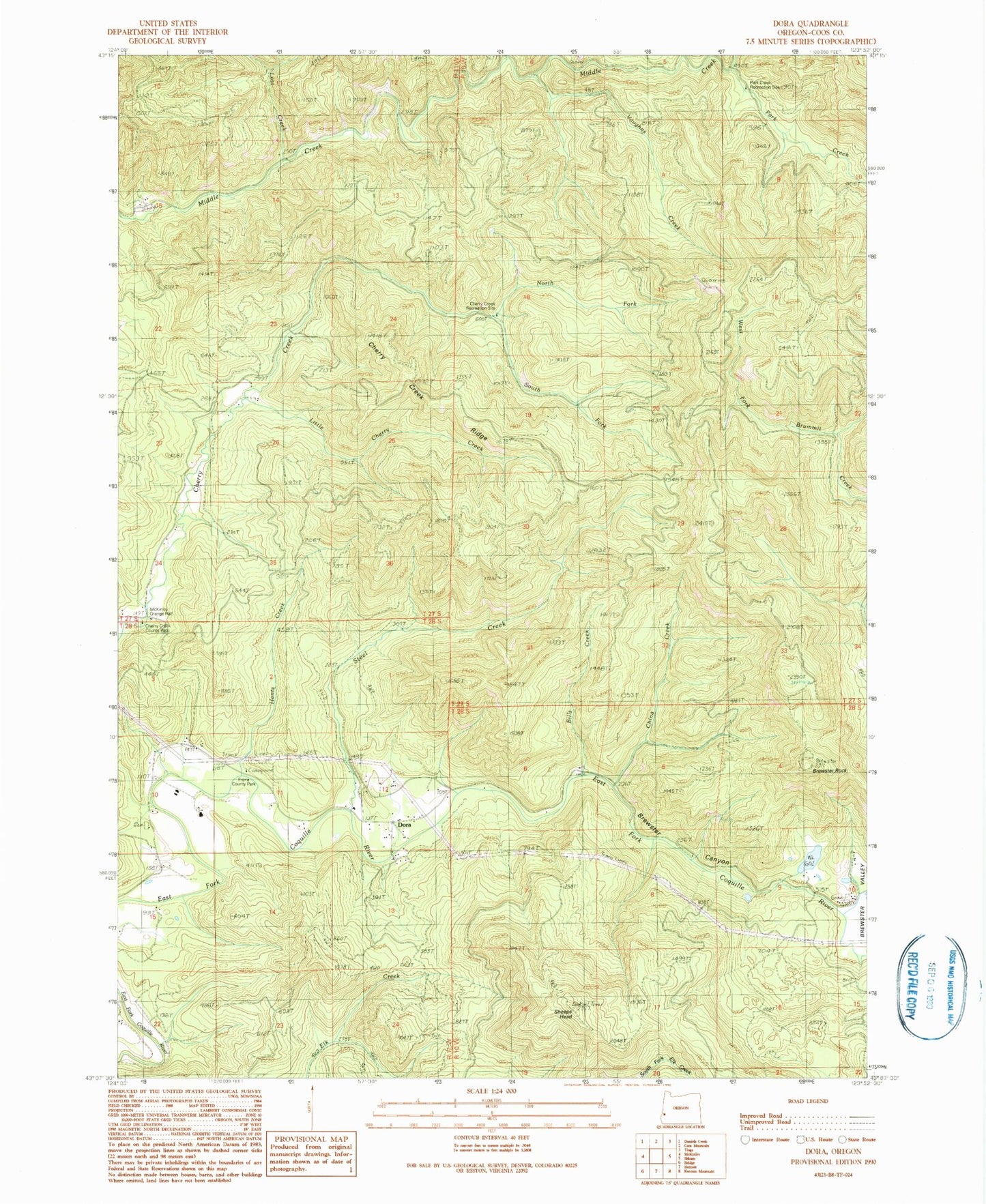
Classic USGS Dora Oregon 7.5'x7.5' Topo Map
Couldn't load pickup availability
Historical USGS topographic quad map of Dora in the state of Oregon. Map scale may vary for some years, but is generally around 1:24,000. Print size is approximately 24" x 27"
This quadrangle is in the following counties: Coos.
The map contains contour lines, roads, rivers, towns, and lakes. Printed on high-quality waterproof paper with UV fade-resistant inks, and shipped rolled.
Contains the following named places: 4H Camp, Abernathy Station, Alder Creek, Bills Creek, Brewster Canyon, Brewster Rock, Brewster Valley, Cherry Creek Myrtle Preserve, Cherry Creek Recreation Site, Cherry Creek Ridge, China Creek, Dora, Dora - Sitkum Rural Fire Protection District, Dora Post Office, Dora Public Library, East Fork China Creek, Frona County Park, Ham Bunch - Cherry Creek County Park, Hantz Creek, Karl Creek, Little Cherry Creek, Lost Creek, Maple Creek, McKinley Cemetery, McKinley Grange Hall, Middle Creek County Park, Nellie Creek, North Fork Cherry Creek, Park Creek, Park Creek Recreation Site, Reeves Creek, Sheeps Head, South Fork Cherry Creek, Steel Creek, Vaughns Creek