
MyTopo
Classic USGS Doran Cove Alabama 7.5'x7.5' Topo Map
Couldn't load pickup availability
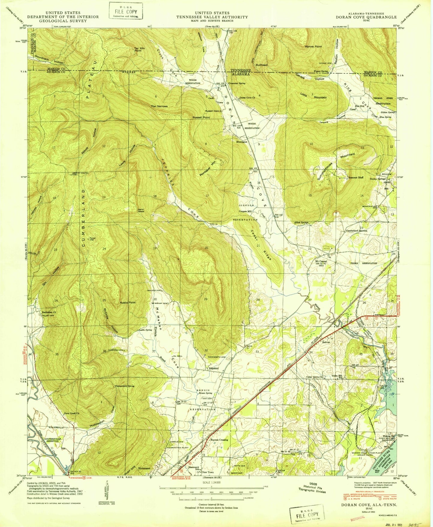
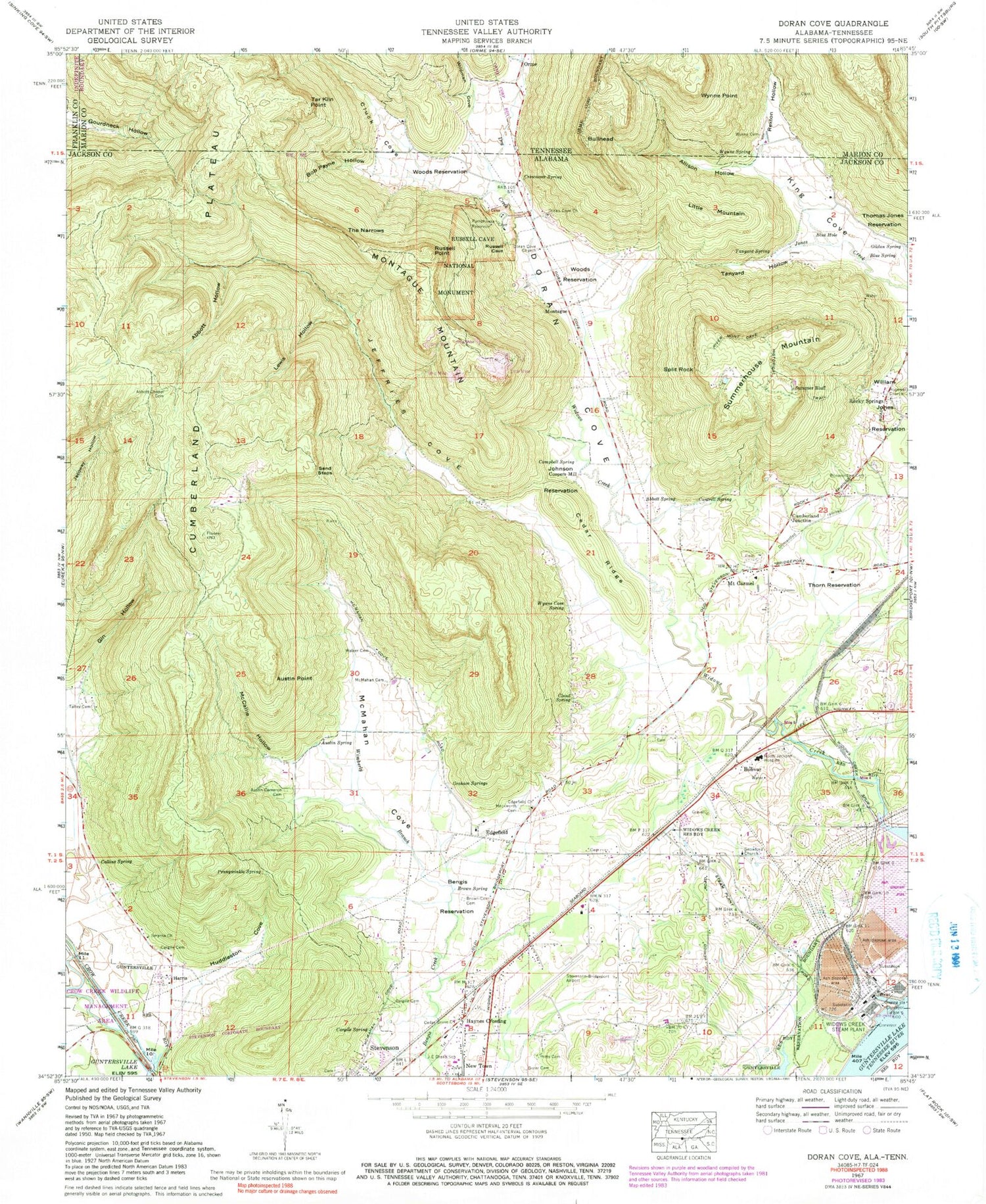
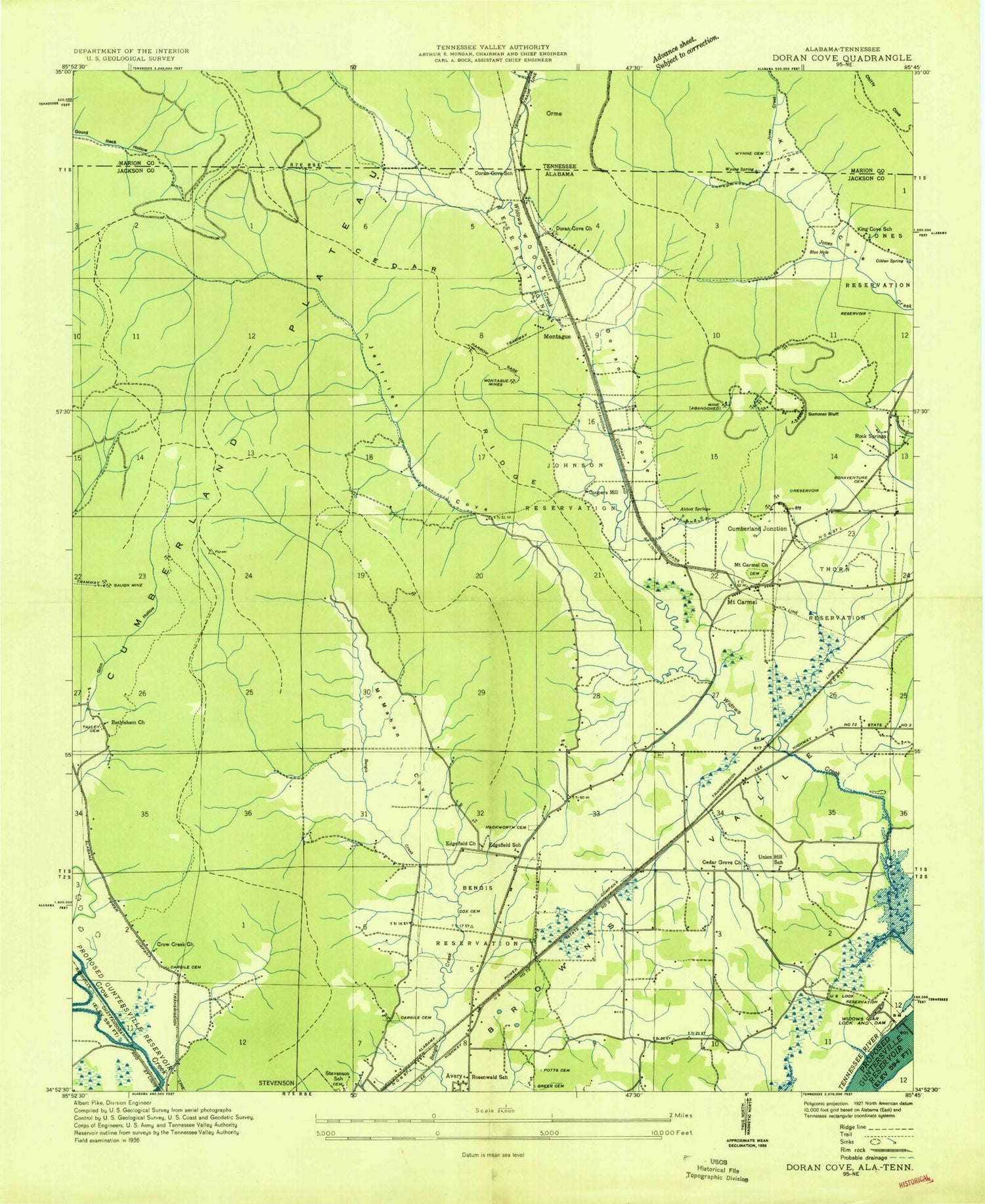
Historical USGS topographic quad map of Doran Cove in the states of Alabama, Tennessee. Map scale may vary for some years, but is generally around 1:24,000. Print size is approximately 24" x 27"
This quadrangle is in the following counties: Franklin, Jackson, Marion.
The map contains contour lines, roads, rivers, towns, and lakes. Printed on high-quality waterproof paper with UV fade-resistant inks, and shipped rolled.
Contains the following named places: Abbott Chapel Cemetery, Abbott Hollow, Abbott Spring, Allison Hollow, Austin - Cameron Cemetery, Austin Point, Austin Spring, Baugh Mine, Bengis Reservation, Bethlehem Church, Blue Hole, Blue Spring, Bob Payne Hollow, Bolivar, Bonaventure Cemetery, Bridgeport Division, Brown - Cox Cemetery, Brown Spring, Browns Valley, Bullhead, Calvary Church, Campbell Spring, Cantrell Spring, Cargile Cemetery, Cargile Spring, Cedar Grove Church, Cedar Ridge, Chuck Cove Branch, City of Stevenson, Cloud Spring, Cluck Cove, Collins Spring, Coopers Mill, Crow Creek Valley, Crownover Spring, Cumberland Junction, Doran Cove, Doran Cove Church, Doran Cove School, Dry Creek, Edgefield, Edgefield Church, Edgefield School, Gildan Spring, Gin Hollow, Graham Springs, Greer Cemetery, Hackworth Cemetery, Harris, Haynes Crossing, Hopewell Church, Huddleston Cove, JE Drake School, Jeffries Cove, Johnson Reservation, King Cove School, Lewis Hollow, Little Mountain, McCallie Hollow, McMahan Cemetery, McMahan Cove, Montague, Montague Mines, Montague Mountain, Mount Carmel, Mount Carmel Church, Mount Carmel School, North Jackson Hospital, Pennywinkle Spring, Potts Cemetery, Rexton Hollow, Rexton Hollow Creek, Ridleys Ferry, River Mont Cave Historical Trail, Rock Springs, Rocky Spring Cemetery, Rocky Springs, Rocky Springs Church of Christ, Rosenwald School, Russel Prong, Russell Cave National Monument, Russell Point, Sand Steps, Smyrna Church, Snowford Church, Split Rock, Stevenson Airport, Stevenson School, Summer Bluff, Summerhouse Mountain, Talley Cemetery, Tanyard Hollow, Tanyard Spring, Tar Kiln Point, Tennessee Valley Mine, The Narrows, Thomas Jones Reservation, Thorn Reservation, Union Hill School, Walker and Leonard Mine, Walker Cemetery, Widows Bar Lock and Dam, Widows Creek Station, Widows Creek Steam Plant, Wildcat Cove Branch, Wildman Cove, William Jones Reservation, Wilson Cemetery, Wimberly Branch, Woods Reservation, Wynne Cave Spring, Wynne Cemetery, Wynne Point, Wynne Spring, ZIP Code: 35740