
MyTopo
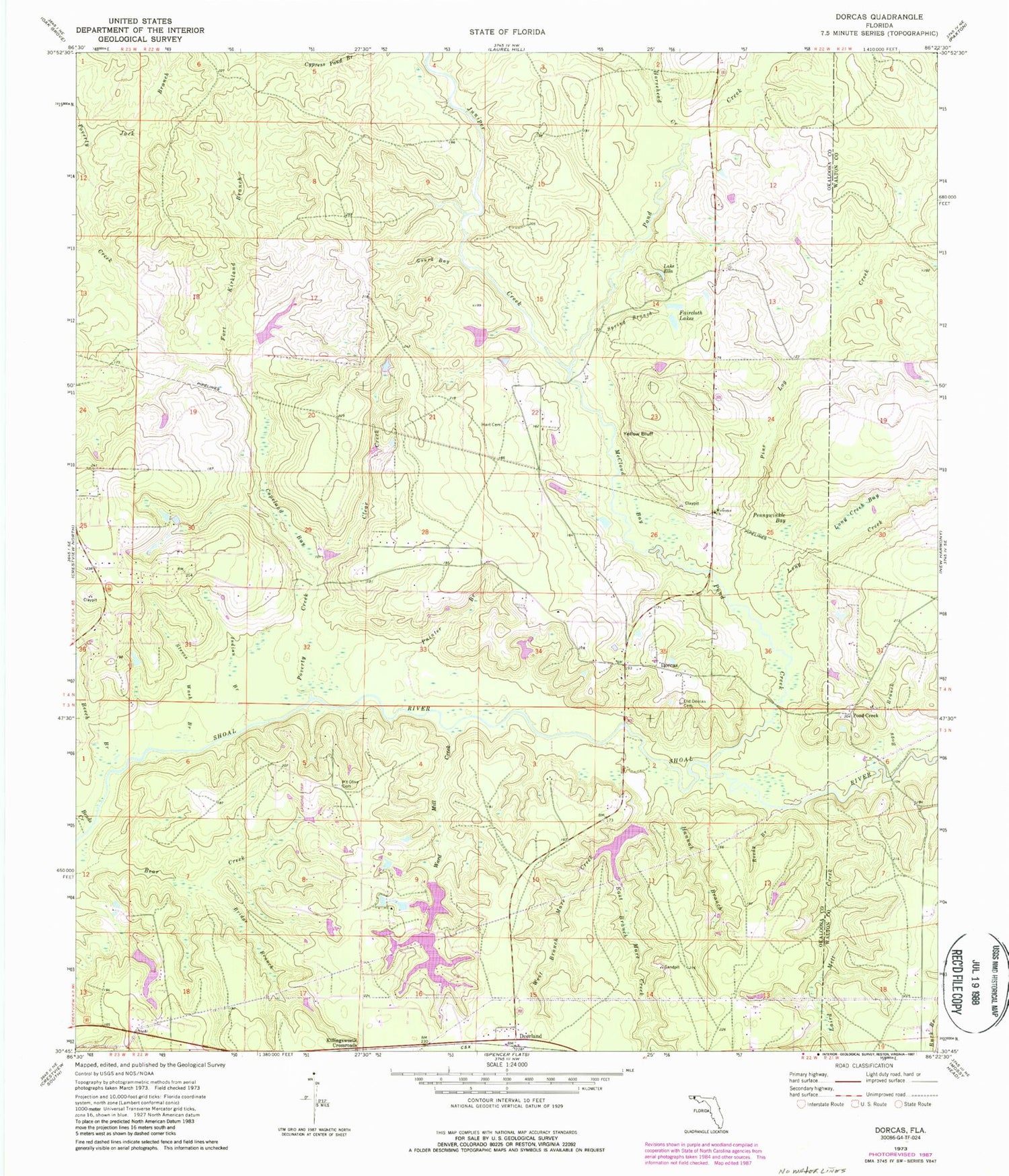
Classic USGS Dorcas Florida 7.5'x7.5' Topo Map
Couldn't load pickup availability
Historical USGS topographic quad map of Dorcas in the state of Florida. Map scale may vary for some years, but is generally around 1:24,000. Print size is approximately 24" x 27"
This quadrangle is in the following counties: Okaloosa, Walton.
The map contains contour lines, roads, rivers, towns, and lakes. Printed on high-quality waterproof paper with UV fade-resistant inks, and shipped rolled.
Contains the following named places: Beech Branch, Bends Creek, Bogy Branch, Bridge Branch, Clear Creek, Copeland Bay, Deerland, Dorcas, Dorcas Fire District Station 41, Dorcas Fire District Station 42, East Branch Mare Creek, Faircloth Lakes, Five Oaks Estate Airport, Fort Kirkland Branch, Gourd Bay, Hannah Branch, Hart Cemetery, Horsehead Creek, Indian Branch, Jack Branch, Juniper Creek, Killingsworth Crossroads, Laird Mill Creek, Lake Ella, Long Creek, Long Creek Bay, McCloud Bay, Mount Olive Cemetery, Old Dorcas Cemetery, Painter Branch, Pennywinkle Bay, Pine Log Creek, Pond Creek, Poverty Creek, Reedy Branch, Rum Still Branch, Spring Branch, Steves Wash Branch, Triple B Airpark, Ward Mill Creek, Welcome Church, West Branch Mare Creek, Yellow Bluff, ZIP Code: 32539


